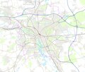
Datei:Hannover - Basiskarte (grell).png

Gress dea Voaschau: 705 × 600 Pixel Weitere Auflésungan: 282 × 240 Pixel | 565 × 480 Pixel | 903 × 768 Pixel | 1.204 × 1.024 Pixel | 2.408 × 2.048 Pixel | 2.847 × 2.421 Pixel.
Version in hechara Auflesung (2.847 × 2.421 Pixel, Dateigress: 3,33 MB, MIME-Typ: image/png)
Dateiversiona
Wensd auf an Zeitpunkt klickst, nacha konst a friaane Version lodn.
| Version vom | Vorschaubuidl | Dimensióna | Nutzer | Kommentar | |
|---|---|---|---|---|---|
| aktuell | 18:53, 15. Jun. 2009 |  | 2.847 × 2.421 (3,33 MB) | Chumwa | {{Information |Description={{en|This map of Hannover was created from OpenStreetMap project data, collected by the community.<br/><small>This map may be incomplete, and may contain errors. Don't rely solely on it for navigation.</small>}} |Source=[[Op |
Dateivawendung
Seitn wo de Datei nutzn:
Globale Dateinutzung
D'noochéfóiganden åndern Wikis vawénden dé Datei:
- Vawendung af de.wikipedia.org
- Vawendung af mk.wikipedia.org
- Vawendung af sk.wikipedia.org


