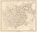
Category:1790s maps of China
Subcategories
This category has the following 3 subcategories, out of 3 total.
- 1790 maps of China (empty)
- 1799 maps of China (3 F)
A
- Atlas Général de la Chine (80 F)
Media in category "1790s maps of China"
The following 17 files are in this category, out of 17 total.
-
1784 D'Anville Wall Map of Asia - Geographicus - Asia-anville-1794.jpg 7,000 × 6,074; 11.94 MB
-
La China (Antonio Zatta 1794, twelve small maps).jpg 556 × 366; 76 KB
-
SeaEst in Koeea18c.jpg 730 × 564; 283 KB
-
A Chart of the Islands to the Southward of Tchu-San on the Eastern Coast of China.jpg 5,051 × 6,791; 7.17 MB
-
A Plan of the City and Harbour of Macao.jpg 1,124 × 1,536; 1.3 MB
-
Jing ban tian wen quan tu LOC gm71005137.jpg 8,980 × 16,687; 23.33 MB
-
Jing ban tian wen quan tu LOC gm71005137.tif 8,980 × 16,687; 428.72 MB
-
Jing ban tian wen quan tu. LOC 92682866.jpg 8,903 × 14,676; 22.77 MB
-
Jing ban tian wen quan tu. LOC 92682866.tif 8,903 × 14,676; 373.82 MB
-
Map China c1798.jpg 940 × 894; 297 KB
-
La-Perouse-Chart-of-Discoveries.jpg 3,216 × 4,144; 1.39 MB
-
Titsingh route 1794-1795.jpg 984 × 1,539; 416 KB


