Category:1790s maps of Portugal
Media in category "1790s maps of Portugal"
The following 19 files are in this category, out of 19 total.
-
"A Map of Spain & Portugal", 1794.jpg 2,096 × 1,700; 5.84 MB
-
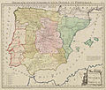
Carte des royaumes d'Espagne et de Portugal - dressée par Hérisson... - btv1b53062160m.jpg 9,949 × 6,869; 11.21 MB
-
Map of Cape St. Vincent (1797).jpg 936 × 488; 276 KB
-
Map of Western Europe in 1791 by Reilly 0006.jpg 1,470 × 952; 591 KB
-
Map of Western Europe in 1791 by Reilly 0006b.jpg 1,346 × 888; 531 KB
-
MAPA DEL NOROESTE DE ESPAÑA EN 1792.jpg 7,737 × 6,326; 10.66 MB
-
Reilly Allgemeiner Postatlas Spanien, Portugal (B Cut out).jpg 5,760 × 4,880; 14.21 MB
-
Reilly Allgemeiner Postatlas Spanien, Portugal (B).jpg 6,880 × 5,312; 17.98 MB
-
Reilly Allgemeiner Postatlas Spanien, Portugal.jpg 7,053 × 5,445; 2.41 MB
-
Reilly Karte von dem Königreiche Portugal.jpg 569 × 526; 87 KB
-
Reilly Karte von dem Königreiche Spanien.jpg 697 × 571; 136 KB
-
Spain and Portugal (4232064806).jpg 2,000 × 1,676; 3.66 MB
-
Spain and Portugal 1791 F. Vivares (detalle noroeste).jpg 1,600 × 1,546; 1.32 MB
-
Spain and Portugal from the best authorities (4586559497).jpg 2,000 × 1,924; 4.09 MB
-
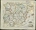
Spanien1790.jpg 727 × 564; 109 KB


