Category:1860 maps
| ← · 1860 · 1861 · 1862 · 1863 · 1864 · 1865 · 1866 · 1867 · 1868 · 1869 · → |
Deutsch: Karten mit Bezug zum Jahr 1860
English: Maps related to the year 1860
Español: Mapas relativos al año 1860
Français : Cartes concernant l’an 1860
Русский: Карты 1860 года
Subcategories
This category has the following 8 subcategories, out of 8 total.
Media in category "1860 maps"
The following 200 files are in this category, out of 217 total.
(previous page) (next page)-
EVEN(1860) p019 Tab.2.jpg 2,974 × 2,550; 4.06 MB
-
(1860) STRAITS OF MALACCA.jpg 3,483 × 3,459; 4.56 MB
-
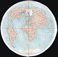
1860 James Polar Projection of the Globe, Arctic - Atlantic Projection.jpg 4,000 × 3,938; 2.3 MB
-
1860 kart Skansen.jpg 443 × 381; 227 KB
-
1860 Senetz-ozero.jpg 2,048 × 1,172; 2.35 MB
-
1860. Изъяснение к плану Москвы.jpg 21,508 × 26,550; 44.98 MB
-
1860. Изъяснение к плану С. Петербурга.jpg 21,358 × 26,433; 39.67 MB
-
1860. Карта губерний Санкт-Петербургской, Новгородской, Псковской, Витебской и Могилевской.jpg 26,750 × 34,000; 65.17 MB
-
1860. Карта губерний Саратовской, Самарской, Астраханской и южной части Оренбургской (этнограф).jpg 34,000 × 26,750; 59.39 MB
-
1860. Карта губерний Саратовской, Самарской, Астраханской и южной части Оренбургской.jpg 34,000 × 26,750; 59.3 MB
-
1860. Карта губерний Харьковской, Орловской, Тамбовской, Воронежской и Земли Войска Донского (этн).jpg 26,750 × 34,000; 60.81 MB
-
1860. Карта губерний Харьковской, Орловской, Тамбовской, Воронежской и Земли Войска Донского.jpg 26,750 × 34,000; 63.34 MB
-
1860. Карта Западной Сибири.jpg 26,750 × 34,000; 50.82 MB
-
1860. Карта Кавказа (cropped 2).jpg 8,560 × 7,661; 5.65 MB
-
1860. Карта Кавказа (cropped).jpg 7,933 × 7,399; 4.34 MB
-
1860. Подробный Атлас Российской Империи. Изъяснение (условные знаки).jpg 18,500 × 26,750; 26.04 MB
-
A plat showing the position of the different townships (4231922420).jpg 2,000 × 1,454; 1.52 MB
-
Admiralty Chart No 1563 Beirut, Published 1860.jpg 11,951 × 8,256; 10.27 MB
-
America map Herakles Lazarides Atlas Athens c1860.jpg 6,054 × 7,798; 13.51 MB
-
Amerikē LOC 2007625794.jpg 6,054 × 7,798; 6.22 MB
-
Amerikē LOC 2007625794.tif 6,054 × 7,798; 135.07 MB
-
AMH-5546-NA Map showing the journeys of Abel Tasman.jpg 2,400 × 1,871; 693 KB
-
Asia (FL32703290 2559288).jpg 10,171 × 8,684; 110.98 MB
-
Auguste Henri Dufour, Asie (FL27961782 2487481).jpg 19,865 × 14,588; 432.05 MB
-
Auguste Henri Dufour, Empire d'Alexandre (FL27961811 2487505).jpg 20,196 × 14,405; 439.53 MB
-
Auguste Henri Dufour, Océanie (FL27963714 2518848).jpg 18,966 × 14,109; 390.17 MB
-
Avenue Kléber 2.jpg 461 × 629; 296 KB
-
Barcelona - planol ciutat vella 1860.jpg 1,536 × 1,024; 841 KB
-
Battle Plan Canton.jpg 1,328 × 591; 149 KB
-
Bird's eye view of Camp Chase near Columbus, Ohio. LOC 73694505.jpg 7,800 × 5,936; 11.73 MB
-
Blatt 250 Herzogenaurach 1860 001.jpg 1,287 × 1,283; 587 KB
-
Blatt 251 Erlangen 1860-61 001.jpg 1,243 × 1,235; 477 KB
-
C. Stier, Palaestina.inde a Maccabaeorum temporibus (FL33141949 3878228).jpg 7,573 × 5,517; 55.59 MB
-
Camp Chase Aerial View.jpg 1,950 × 1,484; 734 KB
-
Camp Dennison - taken from Old Aunt Roady's Hill LOC 89694912.jpg 8,245 × 4,401; 6.25 MB
-
Camp Dennison - taken from Old Aunt Roady's Hill LOC 89694912.tif 8,245 × 4,401; 103.82 MB
-
Canaan in possesion of the Twelve Tribes (FL37119408 3897448).jpg 2,368 × 3,174; 2.4 MB
-
Canton1860.jpg 11,680 × 6,672; 11.72 MB
-
Carte du monde de 1860.JPG 3,643 × 2,994; 4.02 MB
-
Carte routière du département de la Haute-Vienne - 1860.jpg 8,343 × 9,941; 13.92 MB
-
Carte routière et hydrographique du département de la Dordogne - 1860.jpg 9,450 × 7,580; 10.09 MB
-
Chart of the Mediterranean (FL37663328 3370976).jpg 16,859 × 13,304; 303.64 MB
-
Colton's new railroad & county map of the United States and the Canadas etc. LOC 98688329.jpg 12,128 × 9,984; 31.18 MB
-
Colton's new railroad & county map of the United States and the Canadas etc. LOC 98688329.tif 12,128 × 9,984; 346.43 MB
-
Copy of the plot of the city of Beaufort, South Carolina LOC 79690340.jpg 8,360 × 5,473; 5.61 MB
-
Copy of the plot of the city of Beaufort, South Carolina LOC 79690340.tif 8,360 × 5,473; 130.9 MB
-
County map of Georgia and Alabama. NYPL1510809.tiff 5,248 × 6,299; 94.6 MB
-
County map of Kentucky and Tennessee. NYPL1510808.tiff 6,298 × 5,246; 95.19 MB
-
County map of Massachusetts, Connecticut, and Rhode Island. NYPL1510799.tiff 6,298 × 5,246; 94.55 MB
-
County map of Minnesota. NYPL1510819.tiff 5,248 × 6,299; 95.24 MB
-
County map of the State of Maine; Portland Harbor and vicinity (inset). NYPL1510797.tiff 5,246 × 6,298; 95.18 MB
-
County map of the States of Iowa and Missouri. NYPL1510817.tiff 5,248 × 6,299; 95.24 MB
-
County map of Virginia and West Virginia. NYPL1510807.tiff 6,298 × 5,246; 95.19 MB
-
County map of Virginia, and North Carolina. LOC lva0000076.jpg 4,697 × 3,881; 4.08 MB
-
County map of Virginia, and North Carolina. LOC lva0000076.tif 4,697 × 3,881; 52.15 MB
-
Cuzco1860.jpg 1,036 × 1,308; 531 KB
-
Dingolfing Karte 1860 sig KI,77.jpg 3,188 × 2,303; 1.67 MB
-
Dominions of David & Solomon with the adjacent lands (FL35090191 3891886).jpg 7,548 × 5,490; 53.47 MB
-
Duvotenay Thunot, Malte (FL13722910 2471804).jpg 6,862 × 4,403; 39.63 MB
-
Département de la Marne - 1860.jpg 9,375 × 7,254; 9.46 MB
-
Ermete Pierotti, Plan de Jerusalem ancienne et moderne (FL188908540 2368147).jpg 5,225 × 3,446; 22.82 MB
-
Ermete Pierotti, Plan de l'Église de la Résurrection (FL191783186 2400201).jpg 6,356 × 5,176; 31.94 MB
-
Faubourg de Paris-Rennes-1860.PNG 926 × 682; 667 KB
-
Firenze (FL167448446 2369971).jpg 7,483 × 5,465; 51.49 MB
-
FoutaMap.jpg 1,126 × 933; 228 KB
-
France location map-Departements 1860.svg 2,000 × 1,922; 567 KB
-
Gall & Inglis' map of Palestine and Syria (FL46961952 3718374).jpg 7,643 × 12,003; 123.33 MB
-
Gall & Inglis' map of Syria Antiqua et Palæstina (FL46962027 3718375).jpg 7,600 × 11,932; 120 MB
-
Hermann Rheinhard, Aegyptus et Palaestina (FL37128387 3904969).jpg 2,799 × 3,723; 6.19 MB
-
Hill between hill no. 1 & Fort Meigs - (Washington D.C.). LOC 88690820.jpg 9,094 × 6,252; 4.79 MB
-
Hill between hill no. 1 & Fort Meigs - (Washington D.C.). LOC 88690820.tif 9,094 × 6,252; 162.67 MB
-
Hill no. 3 opposite Fort Maha(n) - (Washington D.C.). LOC 88690818.jpg 8,032 × 4,769; 3.09 MB
-
Hill no. 3 opposite Fort Maha(n) - (Washington D.C.). LOC 88690818.tif 8,032 × 4,769; 109.59 MB
-
Historische Ortlerkarte.jpg 1,243 × 2,190; 917 KB
-
Hotel-de-Blossac---1860.svg 311 × 320; 235 KB
-
John Bartholomew, Israel's wanderings in the wilderness (FL35090247 3891914).jpg 6,448 × 8,436; 75.46 MB
-
Joseph Meyer, Westliche Halfte von Paris, 1860 - David Rumsey.jpg 11,330 × 8,349; 35.21 MB
-
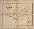
Kaart der gemeente Wisch, met vermelding van huis- en boerderijnamen.jpg 6,332 × 5,308; 9.89 MB
-
Kaart over Kjøbenhavn - no-nb krt 00771.jpg 8,820 × 7,579; 20.66 MB
-
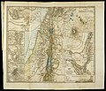
Karl Georg von Raumer, Karte von Palaestina (FL147393078 2370349).jpg 4,282 × 3,678; 15.09 MB
-
Karte zu Hesselbach (1860).jpg 2,220 × 1,805; 1.87 MB
-
Le Alpi Giulie colle loro dipendenze italiane del Friuli orientale ed Istria 1860.jpg 9,996 × 14,105; 15.31 MB
-
Le tour du monde - nouveau journal des voyages (1860) (14793865643).jpg 1,734 × 2,810; 856 KB
-
Maoming Xian yu tu. LOC 80692811.jpg 10,548 × 7,038; 8.22 MB
-
Maoming Xian yu tu. LOC 80692811.tif 10,548 × 7,038; 212.39 MB
-
Map of Louisiana, Mississippi, and Arkansas. NYPL1510811.tiff 5,246 × 6,298; 95.18 MB
-
Map of Oregon, Washington and part of Idaho. NYPL1510821.tiff 6,299 × 5,248; 95.24 MB
-
Map of the Yellowstone and Missouri rivers and their tributaries LOC 96682479.jpg 13,290 × 8,713; 14.7 MB
-
Map of Wayne Co., Pennsylvania LOC 2012592225.jpg 11,899 × 19,972; 33.45 MB
-
Map to illustrate the voyages & travels of St. Paul (FL35090252 3891959).jpg 7,057 × 5,830; 57.43 MB
-
MAP026 L.JPG 2,484 × 2,042; 1.03 MB
-
Mapa antiguo América del Sur (South America old map).jpg 1,500 × 1,780; 2.04 MB
-
Milano - Giovanni Brenna (1860) SanGregorio.jpg 389 × 446; 96 KB
-
Milano - Giovanni Brenna (1860), ritaglio.JPG 1,658 × 1,662; 697 KB
-
Milano - Giovanni Brenna (1860).jpg 2,399 × 1,729; 1.17 MB
-
Military map of Maryland & Virginia (8249621781).jpg 2,000 × 1,168; 2.39 MB
-
Mordecai Yoffe, תחומי ארץ ישראל וגבוליה בסוף פרשת מסעי (FL45611020 3948287).jpg 2,555 × 3,640; 2.16 MB
-
Nan yue quan tu LOC gm71005105.jpg 19,722 × 3,380; 9.93 MB
-
Nan yue quan tu LOC gm71005105.tif 19,722 × 3,380; 190.72 MB
-
Nei wai Mengguo tu. LOC 2006626294.jpg 15,555 × 7,613; 16.14 MB
-
Nei wai Mengguo tu. LOC 2006626294.tif 15,555 × 7,613; 338.8 MB
-
New Hampshire and Vermont. NYPL1510798.tiff 4,276 × 5,598; 68.51 MB
-
Ohio - Newark Earth Works - drawn 1860.jpg 864 × 652; 226 KB
-
Palaestina a Maccabaeorum tempore usque ad eversionem Hierosolymorum (FL32713964 3878159).jpg 5,665 × 6,600; 43.72 MB
-
Palaestina ante exilium (FL33141953 3878244).jpg 6,884 × 5,423; 55.4 MB
-
Palestine (FL36566196 3913038).jpg 12,681 × 15,546; 278.62 MB
-
Palestine (FL65566491 4730089).jpg 3,266 × 3,551; 9.6 MB
-
Palestine. based on the Survey of the Palestine Exploration Fund (FL35090257 3891948).jpg 6,949 × 9,188; 95.11 MB
-
Plan and profile of the Phil. W. & Balt. R.R., A.D. 1860. LOC 98688776.jpg 35,284 × 5,140; 19.55 MB
-
Plan and profile of the Phil. W. & Balt. R.R., A.D. 1860. LOC 98688776.tif 35,284 × 5,140; 518.87 MB
-
Plan der Provinz = Hauptstadt Laibach 1860.jpg 3,548 × 3,321; 2.39 MB
-
Plan der Provinzial Hauptstadt Laibach 1860.jpg 9,131 × 7,544; 17.26 MB
-
Plan général du territoire de la commune de Saint-Quentin - 1860.jpg 9,885 × 7,505; 9.15 MB
-
Plan jacoubert.jpg 1,019 × 731; 458 KB
-
Plan of Foundry site - (Washington D.C.) LOC 88690829.jpg 16,033 × 6,776; 14.31 MB
-
Plan of Foundry site - (Washington D.C.) LOC 88690829.tif 16,033 × 6,776; 310.82 MB
-
R.P. Kelley's map of the territory of Arizona LOC 2008621510.jpg 12,609 × 7,174; 11.44 MB
-
R.P. Kelley's map of the territory of Arizona LOC 2008621510.tif 12,609 × 7,174; 258.8 MB
-
Rivers of the world. NYPL1510866.tiff 5,248 × 6,299; 95.23 MB
-
Royaume de David et de Salomon (FL36012278 3898268).jpg 4,102 × 5,378; 30.24 MB
-
Sketch of the Isthmus of Chiriqui. LOC 2003627008.jpg 6,199 × 5,629; 4.65 MB
-
Sketch of the Isthmus of Chiriqui. LOC 2003627008.tif 6,199 × 5,629; 99.83 MB
-
Sketch plan of Columbiad Battery, Fort Holt, Ky. (opposite Cairo, Ill.). LOC 2008628501.jpg 9,445 × 7,536; 5.58 MB
-
Smith's new map of London. LOC 00556408.jpg 7,868 × 5,156; 8.71 MB
-
Smith's new map of London. LOC 00556408.tif 7,868 × 5,156; 116.06 MB
-
Somerset Co., Penn'a. LOC 2012592212.jpg 12,300 × 12,917; 20.62 MB
-
Square 796 - (Washington D.C.). LOC 88693132.jpg 3,315 × 2,972; 1,015 KB
-
Square 796 - (Washington D.C.). LOC 88693132.tif 3,315 × 2,972; 28.19 MB
-
Syria south part.based on the Survey of the Palestine Exploration Fund (FL35090235 3891952).jpg 7,363 × 5,906; 57.82 MB
-
Table of population, governments, etc NYPL1510863.tiff 5,248 × 6,299; 95.23 MB
-
Territory and military department of Utah LOC 2015591071.jpg 12,806 × 8,733; 15.9 MB
-
Territory and military department of Utah LOC 2015591071.tif 12,806 × 8,733; 319.96 MB
-
The Holy Land in the time of Samuel (FL42861484 3922870).jpg 1,375 × 2,191; 1.96 MB
-
The Negeb or south country of scripture.and the south boudary (FL35090201 3891861).jpg 8,605 × 6,673; 76.38 MB
-
The new war map of Virginia, Maryland & Pennsylvania (5960828689).jpg 1,494 × 2,000; 2.83 MB
-
The new war map of Virginia, Maryland & Pennsylvania. LOC 91686263.jpg 8,361 × 11,424; 10.85 MB
-
The new war map of Virginia, Maryland & Pennsylvania. LOC 91686263.tif 8,361 × 11,424; 273.27 MB
-
The universe after Cosmas, (A.D.) 550. LOC 2011594788.jpg 8,104 × 5,140; 2.52 MB
-
The universe after Cosmas, (A.D.) 550. LOC 2011594788.tif 8,104 × 5,140; 119.17 MB
-
Theodor Fliedner, Kanaan of het heilige land (FL45588625 3929594).jpg 3,964 × 2,678; 2.33 MB
-
Title page. NYPL1510788.tiff 4,720 × 6,299; 85.08 MB
-
Topographic map of the vicinity of Fort Slocum, Washington D.C.. LOC 88690821.jpg 4,153 × 5,568; 3.39 MB
-
Topographic map of the vicinity of Fort Slocum, Washington D.C.. LOC 88690821.tif 4,153 × 5,568; 66.16 MB


