Category:Adobe files with CDATA blocks

Sometimes Adobe Illustrator generates huge blocks of CDATA.
CDATA blocks are completely useless and just bloat the file.
At an example Aichtal in ES.svg, CDATA is 40% of the 884 kilobytes. Worse is e.g. Fxemoji u1F5D5.svg by Ebrahim
It would have been better to remove CDATA before uploading the files.
Subcategories
This category has the following 14 subcategories, out of 14 total.
Media in category "Adobe files with CDATA blocks"
The following 200 files are in this category, out of 351 total.
(previous page) (next page)-
1 Pràctica2 (castellano)-01.svg 1,200 × 620; 1.88 MB
-
1992 Paralympic Games countries.svg 940 × 415; 2.01 MB
-
1998 Paralympic Games countries.svg 940 × 415; 2.01 MB
-
2002 Paralympic Games countries.svg 940 × 415; 2.01 MB
-
2006 Paralympic Games countries.svg 940 × 415; 2.01 MB
-
2020 South Korean election constituency results.svg 512 × 728; 4.34 MB
-
Abkhazia ethnic map 2009 es.svg 1,008 × 786; 3.29 MB
-
ACSC CSAA.svg 621 × 733; 504 KB
-
Activated Sludge diagram fr.svg 449 × 276; 340 KB
-
Agrilus larva Reitter.svg 454 × 81; 40 KB
-
AK-47 Rifle silhouette.svg 681 × 420; 47 KB
-
AK-47-Rifle.svg 512 × 317; 84 KB
-
Amerika'n Sound Logo.svg 512 × 291; 122 KB
-
AML ferrovia Linha Cascais.svg 512 × 362; 13.56 MB
-
AML ferrovia Linha Sintra.svg 512 × 362; 13.56 MB
-
AML ferrovia.svg 512 × 362; 13.56 MB
-
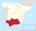
Andalucia in Spain (including Canarias) (special marker).svg 1,184 × 1,016; 1.16 MB
-
Andalucia in Spain (special marker).svg 1,184 × 1,016; 1.11 MB
-
Animal cell cycle-zh-hant.svg 512 × 497; 1.25 MB
-
Arku erdizirkularra - osagaiak - eu.svg 512 × 393; 1.41 MB
-
Arpanet 1974.svg 818 × 515; 246 KB
-
AtoC-RNA.svg 213 × 241; 648 KB
-
Attention IfD.svg 600 × 500; 49 KB
-
Attention MfD audio.svg 600 × 500; 20 KB
-
Austria, administrative divisions - de-.svg 1,256 × 700; 437 KB
-
Austria-Hungary map de.svg 783 × 605; 572 KB
-
BA road sign III-84.1.svg 1,500 × 791; 7 KB
-
Bacillaceae-1.svg 184 × 240; 630 KB
-
Bacterial morphology diagram-el.svg 825 × 762; 527 KB
-
Bacteroides-1-RNA.svg 269 × 170; 646 KB
-
Bahn Retenice-Liberec (Nordboehmische Transversalbahn) (1901).svg 537 × 370; 1.69 MB
-
Balkan 1912.svg 966 × 924; 1.35 MB
-
BART District.svg 621 × 733; 254 KB
-
Battle of Castillon.svg 580 × 443; 252 KB
-
Beige Feather.svg 292 × 110; 4 KB
-
Bizancjum 650.svg 925 × 425; 665 KB
-
Blank Map of France, with Communes.svg 1,000 × 900; 12.03 MB
-
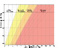
Body mass index chart eu.svg 690 × 575; 230 KB
-
Body mass index chart pl.svg 690 × 575; 225 KB
-
Body mass index chart th.svg 690 × 575; 505 KB
-
Body mass index chart.svg 690 × 575; 219 KB
-
Bolduc House Floor Plan--Ste Genevieve MO.svg 1,591 × 1,365; 2.59 MB
-
Breezeicons-apps-48-kgeography.svg 128 × 128; 227 KB
-
Breezeicons-apps-48-khangman.svg 128 × 128; 102 KB
-
Breezeicons-apps-48-kmplot.svg 128 × 128; 244 KB
-
C4-antisense-RNA-_target-a1b1.svg 184 × 227; 670 KB
-
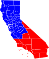
California Central Valley county map.svg 621 × 733; 504 KB
-
California county map (Alameda County highlighted).svg 621 × 733; 503 KB
-
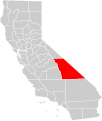
California county map (Alpine County highlighted).svg 621 × 733; 503 KB
-
California county map (Amador County highlighted).svg 621 × 733; 503 KB
-
California county map (Butte County highlighted).svg 621 × 733; 503 KB
-
California county map (Calaveras County highlighted).svg 621 × 733; 503 KB
-
California county map (Colusa County highlighted).svg 621 × 733; 503 KB
-
California county map (Del Norte County highlighted).svg 621 × 733; 503 KB
-
California county map (El Dorado County highlighted).svg 621 × 733; 503 KB
-
California county map (Fresno County highlighted).svg 621 × 733; 503 KB
-
California county map (Glenn County highlighted).svg 621 × 733; 503 KB
-
California county map (Humboldt County highlighted).svg 621 × 733; 503 KB
-
California county map (Imperial County highlighted).svg 621 × 733; 503 KB
-
California county map (Inland Empire highlighted).svg 650 × 800; 258 KB
-
California county map (Inyo County highlighted).svg 621 × 733; 503 KB
-
California county map (Kern County highlighted).svg 621 × 733; 503 KB
-
California county map (Kings County highlighted).svg 621 × 733; 503 KB
-
California county map (Lake County highlighted).svg 621 × 733; 503 KB
-
California county map (Lassen County highlighted).svg 621 × 733; 503 KB
-
California county map (Los Angeles County highlighted).svg 621 × 733; 503 KB
-
California county map (Madera County highlighted).svg 621 × 733; 503 KB
-
California county map (Marin County highlighted).svg 621 × 733; 503 KB
-
California county map (Mariposa County highlighted).svg 621 × 733; 503 KB
-
California county map (Mendocino County highlighted).svg 621 × 733; 503 KB
-
California county map (Merced County highlighted).svg 621 × 733; 503 KB
-
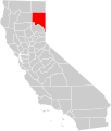
California county map (Modoc County highlighted).svg 621 × 733; 503 KB
-
California county map (Mono County highlighted).svg 621 × 733; 503 KB
-
California county map (Monterey County highlighted).svg 621 × 733; 503 KB
-
California county map (Napa County highlighted).svg 621 × 733; 503 KB
-
California county map (Nevada County highlighted).svg 621 × 733; 503 KB
-
California county map (Orange County highlighted).svg 621 × 733; 503 KB
-
California county map (Placer County highlighted).svg 621 × 733; 503 KB
-
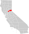
California county map (Plumas County highlighted).svg 621 × 733; 503 KB
-
California county map (Riverside County highlighted).svg 621 × 733; 503 KB
-
California county map (Sacramento County highlighted).svg 621 × 733; 503 KB
-
California county map (San Benito County highlighted).svg 621 × 733; 503 KB
-
California county map (San Bernadino County highlighted).svg 621 × 733; 503 KB
-
California county map (San Diego County highlighted).svg 621 × 733; 503 KB
-
California county map (San Francisco County enlarged).svg 621 × 733; 506 KB
-
California county map (San Francisco County highlighted).svg 621 × 733; 503 KB
-
California county map (San Joaquin County highlighted).svg 621 × 733; 503 KB
-
California county map (San Luis Obispo County highlighted).svg 621 × 733; 503 KB
-
California county map (San Mateo County highlighted).svg 621 × 733; 503 KB
-
California county map (Santa Barbara County highlighted).svg 621 × 733; 503 KB
-
California county map (Santa Clara County highlighted).svg 621 × 733; 503 KB
-
California county map (Santa Cruz County highlighted).svg 621 × 733; 503 KB
-
California county map (Shasta County highlighted).svg 621 × 733; 503 KB
-
California county map (Sierra County highlighted).svg 621 × 733; 503 KB
-
California county map (Siskiyou County highlighted).svg 621 × 733; 503 KB
-
California county map (Solano County highlighted).svg 621 × 733; 503 KB
-
California county map (Sonoma County highlighted).svg 621 × 733; 503 KB
-
California county map (Stanislaus County highlighted).svg 621 × 733; 503 KB
-
California county map (Sutter County highlighted).svg 621 × 733; 503 KB
-
California county map (Tehama County highlighted).svg 621 × 733; 503 KB
-
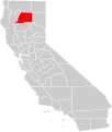
California county map (Trinity County highlighted).svg 621 × 733; 503 KB
-
California county map (Tulare County highlighted).svg 621 × 733; 503 KB
-
California county map (Tuolumne County highlighted).svg 621 × 733; 503 KB
-
California county map (Ventura County highlighted).svg 621 × 733; 503 KB
-
California county map (Yolo County highlighted).svg 621 × 733; 503 KB
-
California county map (Yuba County highlighted).svg 621 × 733; 503 KB
-
CAmn.svg 437 × 313; 107 KB
-
Canal du Midi map-de.svg 1,047 × 689; 551 KB
-
CAP FlightOfficer.svg 70 × 179; 126 KB
-
CAP SeniorFlightOfficer.svg 70 × 179; 126 KB
-
CAP TechFlightOfficer.svg 70 × 179; 126 KB
-
Capsular tension segment (CTS).svg 301 × 288; 249 KB
-
Casimir plates bubbles.svg 500 × 500; 73 KB
-
CCMSgt.svg 438 × 756; 110 KB
-
CCol.svg 181 × 112; 36 KB
-
Cell phone Sagem my202X ubt vectorized.svg 193 × 293; 536 KB
-
Centralny okrug, Omsk, locator map.svg 500 × 400; 288 KB
-
CERA-USGS-labeled.svg 535 × 383; 843 KB
-
Chad (orthographic projection).svg 553 × 553; 213 KB
-
Chlorobi-1-RNA.svg 227 × 213; 688 KB
-
Chlorobi-RRM.svg 184 × 277; 647 KB
-
Chloroflexi-1.svg 283 × 249; 657 KB
-
Cinerama PRJ.svg 982 × 1,079; 234 KB
-
Classical-Definition-of-Kno.svg 1,100 × 750; 1.46 MB
-
Cloud types it.svg 512 × 315; 491 KB
-
CLtC.svg 124 × 112; 5 KB
-
Co-Compost diagram fr.svg 449 × 276; 310 KB
-
CoA of Logroño.svg 316 × 446; 183 KB
-
Coat of arms of Central Java.svg 526 × 564; 905 KB
-
Coat of arms of Don Host Oblast 1878.svg 790 × 911; 656 KB
-
Commons-logo barnstar following category.svg 600 × 600; 84 KB
-
Constantine arch datation en.svg 1,108 × 769; 319 KB
-
Constantinople center.svg 717 × 825; 422 KB
-
Conventional Gravity Sewer diagram fr.svg 492 × 278; 1.06 MB
-
Crimea in Ukraine.svg 1,547 × 1,041; 1.27 MB
-
Croatia road sign E42.svg 329 × 430; 78 KB
-
CrosswordJPN.svg 330 × 330; 231 KB
-
CrosswordUK.svg 546 × 546; 235 KB
-
CrosswordUSA.svg 546 × 546; 317 KB
-
CSSgt.svg 436 × 366; 109 KB
-
CtgShop.com Logo, 2018.svg 512 × 504; 2.58 MB
-
CTSgt.svg 436 × 417; 110 KB
-
Cubitalindex.svg 1,133 × 405; 75 KB
-
D-Helvetolide.svg 608 × 190; 13 KB
-
Democratic Republic of the Congo in its region.svg 819 × 461; 6.89 MB
-
DFS Bild Wortmarke vertikal RGB 720px.svg 512 × 155; 377 KB
-
Diagram human cell nucleus cs.svg 462 × 378; 425 KB
-
Diagram human cell nucleus hu.svg 462 × 378; 425 KB
-
Diagram human cell nucleus id.svg 462 × 378; 425 KB
-
Diagram human cell nucleus tr.svg 462 × 378; 443 KB
-
Discoidalverschiebung.svg 1,133 × 405; 66 KB
-
Dodona location.svg 991 × 784; 517 KB
-
Députés de l'Hérault élus en 2017.svg 512 × 374; 64 KB
-
Düsseldorf Subdivisions grey.svg 924 × 992; 2.48 MB
-
Düsseldorf Subdivisions.svg 924 × 992; 2.52 MB
-
Essertines-sur-Yverdon-coat of arms.svg 603 × 763; 33 KB
-
Estonia Harju locator map.svg 1,668 × 1,393; 628 KB
-
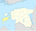
Estonia Hiiu locator map.svg 1,668 × 1,393; 629 KB
-
Estonia Ida-Viru locator map.svg 1,668 × 1,393; 629 KB
-
Estonia Järva locator map.svg 1,668 × 1,393; 629 KB
-
Estonia Jõgeva locator map.svg 1,668 × 1,393; 629 KB
-
Estonia Lääne locator map.svg 1,668 × 1,393; 629 KB
-
Estonia Lääne-Viru locator map.svg 1,668 × 1,393; 629 KB
-
Estonia Pärnu locator map.svg 1,668 × 1,393; 629 KB
-
Estonia Põlva locator map.svg 1,668 × 1,393; 629 KB
-
Estonia Rapla locator map.svg 1,668 × 1,393; 629 KB
-
Estonia Saare locator map.svg 1,668 × 1,393; 629 KB
-
Estonia Tartu locator map.svg 1,668 × 1,393; 629 KB
-
Estonia Valga locator map.svg 1,668 × 1,393; 629 KB
-
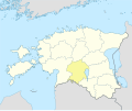
Estonia Viljandi locator map.svg 1,668 × 1,393; 629 KB
-
Estonia Võru locator map.svg 1,668 × 1,393; 629 KB
-
Europa Germanen 50 n Chr.svg 941 × 655; 710 KB
-
Europe biogeography regions de.svg 3,737 × 2,610; 1.31 MB
-
Fifteenth Army SSI.svg 170 × 182; 26 KB
-
Fio banka logo.svg 512 × 95; 43 KB
-
Fission bomb assembly methods de.svg 447 × 543; 208 KB
-
Flag of Austria (state, variant 2).svg 216 × 144; 383 KB
-
Flag of Key West, Florida.svg 512 × 307; 541 KB
-
Flag-kr.svg 48 × 48; 117 KB
-
Fouskarnaki-Arms.svg 480 × 480; 326 KB
-
Galicia in Spain (including Canarias).svg 1,184 × 1,016; 1.16 MB
-
Galicia in Spain.svg 1,184 × 1,016; 1.1 MB
-
Galizien Israeliten 1910.svg 1,075 × 700; 91 KB
-
Gehoerlos.svg 915 × 895; 1 KB
-
Georgian Public Service Development Agency Logo.svg 960 × 960; 42 KB
-
Glasgow City in Scotland.svg 1,128 × 1,483; 1.57 MB
-
GW split.svg 800 × 200; 216 KB
-
Hantelindex.svg 1,133 × 405; 75 KB
-
Heatpump2.svg 715 × 367; 74 KB
-
HIV-SIV-phylogenetic-tree.svg 518 × 446; 304 KB
-
HR road sign E47 (2005).svg 1,440 × 1,440; 76 KB
-
HR- Naziv naseljenog mjesta, prometni znak C79.svg 500 × 250; 87 KB
-
Hugh Charles Boyle Bishop of Pittsburgh COA.svg 576 × 543; 1.62 MB
-
Icon - jeu.svg 45 × 45; 247 KB
-
Inconsistent trinity.svg 367 × 237; 775 KB
-
Independence Hall clip art.svg 358 × 389; 636 KB
-
Indogermaische Ursprache 3500BC.svg 960 × 582; 367 KB
-
Irrigation and Aspiration 3.svg 792 × 612; 259 KB
-
Irrigation and Aspiration.svg 792 × 612; 261 KB


