Category:Argentera Massif
Description
edit- With an elevation of 3,297 metres (10,817 ft), it is the highest peak in the range.
- Located in the upper Valle Gesso in the Parco naturale delle Alpi Marittime, in the province of Cuneo, Piedmont, northwestern Italy.
mountain in Italy | |||||
| Upload media | |||||
| Instance of | |||||
|---|---|---|---|---|---|
| Part of | |||||
| Located in protected area | |||||
| Location | Province of Cuneo, Piedmont, Italy | ||||
| Mountain range | |||||
| Topographic prominence |
| ||||
| Topographic isolation |
| ||||
| Elevation above sea level |
| ||||
| Different from | |||||
 | |||||
Subcategories
This category has the following 3 subcategories, out of 3 total.
Media in category "Argentera Massif"
The following 54 files are in this category, out of 54 total.
-
152B.jpg 3,641 × 1,522; 804 KB
-
152C.jpg 2,432 × 1,824; 636 KB
-
154A.jpg 3,072 × 1,284; 600 KB
-
162A.jpg 3,648 × 1,521; 820 KB
-
165Bs.jpg 3,648 × 1,519; 534 KB
-
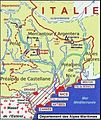
Alpes-Maritimes-06.jpg 673 × 801; 148 KB
-
AlpesMaritimes027A.jpg 1,433 × 1,040; 230 KB
-
AlpesMaritimes027B.jpg 1,433 × 1,040; 240 KB
-
AlpesMaritimes027E.jpg 1,433 × 1,040; 263 KB
-
Argentera - Courpatou - & Gelàs from Siruol - panoramio.jpg 2,032 × 1,354; 883 KB
-
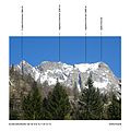
Argentera banner.JPG 3,647 × 521; 793 KB
-
Argentera da Gias delle Mosche.jpg 1,544 × 1,556; 569 KB
-
Argentera060(4).JPG 3,648 × 2,736; 4.52 MB
-
Argentera060ax.JPG 2,872 × 1,824; 575 KB
-
Argentera102.JPG 3,072 × 2,048; 2.08 MB
-
Argentera102xb.JPG 1,264 × 1,059; 138 KB
-
Argentera121Cz.jpg 919 × 910; 122 KB
-
Argentera121DX.jpg 2,469 × 910; 236 KB
-
Argentera121FR.jpg 2,469 × 910; 238 KB
-
Argentera121Fz.jpg 919 × 910; 123 KB
-
Argentera123Ae.jpg 1,537 × 1,013; 200 KB
-
Argentera17Cx.JPG 3,072 × 2,048; 1.55 MB
-
Argentera18Cx.JPG 3,072 × 2,048; 1.55 MB
-
Argentera81bc.jpg 166 × 180; 21 KB
-
ArgenteraWikipédia081.jpg 1,386 × 1,668; 278 KB
-
ArgenteraWikipédia093.jpg 1,386 × 1,668; 275 KB
-
ArgenteraWikipédia131Ax.jpg 1,386 × 1,668; 282 KB
-
ArgenteraWikipédia131Bs.jpg 1,386 × 1,668; 279 KB
-
Cima di Nasta.JPG 1,200 × 900; 415 KB
-
CimaDiNasta-CimaPaganini.jpg 1,374 × 1,024; 260 KB
-
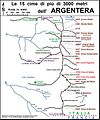
CimeGenova.png 4,000 × 2,250; 11.43 MB
-
From pas de Morgons to SE (F-I border) - panoramio.jpg 2,032 × 1,354; 835 KB
-
GessoValletta205.JPG 2,012 × 1,564; 745 KB
-
IlBastione.jpg 1,374 × 1,024; 293 KB
-
Img112 - Canalone di Lourusa.jpg 1,798 × 1,236; 693 KB
-
LaMadreDiDio.jpg 1,374 × 1,024; 276 KB
-
Massiccio Argentera dal Remondino.jpg 4,618 × 3,464; 3.07 MB
-
MassiccioArgentera.jpg 1,610 × 1,200; 426 KB
-
Mercantour-Argentera100Dx.JPG 3,026 × 1,125; 300 KB
-
Mercantour-Argentera100Dz.JPG 3,026 × 1,125; 304 KB
-
Mercantour-Argentera171Cx.JPG 2,190 × 1,031; 223 KB
-
Mercantour-Argentera99Fz.JPG 3,639 × 1,459; 428 KB
-
Monte Argentera - Sperone Campia.jpg 1,224 × 1,632; 300 KB
-
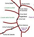
Monte Argentera schema.png 1,338 × 1,691; 126 KB
-
Monte Argentera.jpg 583 × 443; 84 KB
-
MontPelat23.jpg 1,046 × 417; 89 KB
-
Mount Argentera from Moulinet - panoramio.jpg 2,032 × 1,354; 1,003 KB
-
Notte al Bivacco Guiglia; sullo sfondo M.te Argentera.jpg 4,608 × 3,456; 6.71 MB
-
Piccolo di stambecco al passo dei detriti sulla normale al M.te Argentera.jpg 4,608 × 3,456; 7.97 MB
-
RifugioReginaElena-CimaDiNasta.jpg 1,148 × 1,024; 416 KB
-
ValleGessodellaValletta051A.JPG 2,434 × 1,824; 669 KB
-
ValleGessodellaValletta060(2).JPG 3,018 × 2,346; 1.62 MB
-
Vetta della Cima di Nasta.JPG 1,200 × 900; 428 KB


