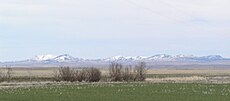
Category:Bears Paw mountains
mountain range in Montana, United States | |||||
| Upload media | |||||
| Instance of | |||||
|---|---|---|---|---|---|
| Location | Montana | ||||
| Elevation above sea level |
| ||||
 | |||||
- The Bear Paw Mountains — a mountain range of the Rocky Mountains in Montana.
Subcategories
This category has only the following subcategory.
G
Media in category "Bears Paw mountains"
The following 24 files are in this category, out of 24 total.
-
Bearpaw Mtns.jpg 1,400 × 820; 610 KB
-
Bearpaws.jp.jpg 360 × 158; 13 KB
-
Cladonia arbuscula - Flickr - pellaea.jpg 3,099 × 2,478; 2.04 MB
-
Coreopsis-like composite - Flickr - pellaea (1).jpg 2,290 × 3,436; 1.23 MB
-
Coreopsis-like composite - Flickr - pellaea.jpg 1,884 × 2,512; 786 KB
-
Eagle Butte, Bearpaw Mountains.jpg 1,400 × 844; 704 KB
-
Fig 12 Map showing preglacial river system of northern Montana.jpg 1,050 × 827; 113 KB
-
Fig 14 Map showing drainage of part of northern Montana at early Wisc stage.jpg 1,057 × 769; 124 KB
-
Fig 15 Map showing post glacial drainage system of part of northern Montana.jpg 1,076 × 844; 158 KB
-
Fig 16 Map showing pre-Glacial river system.jpg 1,438 × 1,085; 171 KB
-
Fig 17 Map showing drainage of no Montana.jpg 1,448 × 1,066; 203 KB
-
Fig 18 May showing drainage of Northern Montana.jpg 1,449 × 998; 175 KB
-
Fig 19 Map showing post-Glacial drainage system.jpg 1,407 × 1,048; 208 KB
-
High conifer forest - Flickr - pellaea.jpg 2,736 × 3,648; 3.79 MB
-
Lichinella nigritella - Flickr - pellaea (1).jpg 3,648 × 2,736; 3.58 MB
-
Lichinella nigritella - Flickr - pellaea.jpg 3,648 × 2,736; 3.36 MB
-
Meadow - Flickr - pellaea (1).jpg 6,194 × 2,597; 2.72 MB
-
Meadow - Flickr - pellaea (2).jpg 8,941 × 2,520; 4.39 MB
-
Meadow - Flickr - pellaea.jpg 3,648 × 2,736; 3.47 MB
-
Moist Valley - Flickr - pellaea.jpg 3,648 × 2,736; 3.09 MB
-
Peltigera extenuata - Flickr - pellaea (1).jpg 3,022 × 2,418; 1.97 MB
-
Williston Basin structure map.jpg 871 × 708; 86 KB
-
Xanthoria sorediata - Flickr - pellaea (3).jpg 2,572 × 1,929; 1.62 MB


