Category:CORINE Land Cover
Deutsch: CORINE Land Cover ist ein Umweltprojekt zur Klassifikation der Landnutzung in den Mitgliedstaaten der Europäischen Union. CORINE steht für „Koordinierung von Informationen über die Umwelt“, „Land Cover“ = Bodenbedeckung.
English: CORINE Land Cover is a project of European Union Member States for Coordination of Information on the Environment (CORINE) by the European Environment Agency.
Español: CORINE Land Cover es un proyecto de los Estados miembros de la Unión Europea para la Coordinación de la Información sobre el Medio Ambiente (CORINE, por sus siglas en Inglés) de la Agencia Europea de Medio Ambiente.
European biophysical land cover database | |||||
| Upload media | |||||
| Pronunciation audio | |||||
|---|---|---|---|---|---|
| Instance of | |||||
| Part of |
| ||||
| Facet of | |||||
| Manufacturer | |||||
| official website | |||||
| |||||
Media in category "CORINE Land Cover"
The following 28 files are in this category, out of 28 total.
-
2018-01-01-00 00 2018-01-01-23 59 CORINE Land Cover Corine Land Cover (5).jpg 1,024 × 528; 129 KB
-
Agglomeration-Geneve.jpg 800 × 488; 154 KB
-
Apance-Amance, hydrographie.png 1,241 × 1,374; 400 KB
-
Bulgaria landcover map.svg 1,620 × 1,080; 10.48 MB
-
Champagne crayeuse map-fr.svg 2,090 × 2,758; 6.98 MB
-
CLC Kosova.jpg 4,679 × 3,308; 5.7 MB
-
Cluse de Chambéry - Carte de l'occupation des sols (CORINE).svg 1,898 × 2,050; 12.71 MB
-
CORINE Land Cover 2006 France.png 1,260 × 528; 512 KB
-
Distribuzione demografica e sfruttamento del territorio in calabria.jpg 563 × 1,000; 371 KB
-
Franche-Comte-Corine.jpg 1,000 × 1,426; 569 KB
-
IdF-Corine.jpg 878 × 518; 322 KB
-
Land cover surfaces over the municipality of Bembibre and El Bierzo.jpg 1,028 × 608; 457 KB
-
Lorraine-Corine.jpg 1,050 × 1,053; 466 KB
-
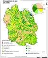
Lozere occupationdusol.png 418 × 500; 223 KB
-
Photo interpretation corine land cover.PNG 902 × 320; 319 KB
-
Scotland land cover map-en.svg 2,090 × 3,015; 1.27 MB
-
Scotland land cover map-fr.svg 2,090 × 3,015; 1.27 MB
-
Scotland land cover map-sco.svg 2,090 × 3,015; 1.27 MB
-
Sols perte relativeUE20 EEAEen1.jpg 1,265 × 610; 130 KB
-
Sols perte UE20 AAE.jpg 1,265 × 610; 116 KB
-
Sources GIS -fr.svg 2,657 × 3,457; 554 KB
-
Sources GIS Coast-fr.svg 4,052 × 2,670; 208 KB
-
The urban morphology of Copenhagen 1800-2006 video Christian Fertner.ogv 26 s, 480 × 480; 388 KB
-
Toulouse-Corine.jpg 674 × 419; 158 KB
-
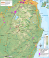
Wicklow Mountains milieux végétaux map-fr.svg 1,049 × 1,232; 3.39 MB
-
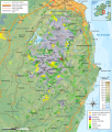
Wicklow Mountains mine map-fr.svg 1,049 × 1,232; 3.17 MB
-
Wicklow Mountains National Park map-fr.svg 1,049 × 1,232; 3.39 MB
-
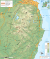
Wicklow Mountains topographic map-fr.svg 1,050 × 1,234; 2.94 MB


