Category:Fault zones in the United States
Subcategories
This category has the following 13 subcategories, out of 13 total.
Media in category "Fault zones in the United States"
The following 14 files are in this category, out of 14 total.
-
122-38HaywardFault.jpg 568 × 549; 88 KB
-
Central VA Quakemap by CMBailey.jpg 1,680 × 2,342; 491 KB
-
Crack in the Ground, Central Oregon - 1.jpg 4,056 × 3,040; 5.4 MB
-
Geofeatures-PacificNW.png 357 × 450; 180 KB
-
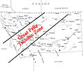
GreatFallstectoniczone.jpg 603 × 511; 163 KB
-
Grouse Creek block location.jpg 1,131 × 1,206; 576 KB
-
Grouse Creek block location1.jpg 1,131 × 1,206; 565 KB
-
Newberry-Yellowstone tracks.png 536 × 326; 19 KB
-
NPS walnut-canyon-geologic-map.gif 3,858 × 2,552; 589 KB
-
Puget Sound faults.png 384 × 640; 612 KB
-
RamapoFaultSystem.png 600 × 855; 822 KB
-
Seismic Hazard Zones in the United States..pdf 1,650 × 1,275; 460 KB
-
Wichita Uplift fault cross section.png 1,212 × 513; 45 KB
-
Williston Basin tectonic map.jpg 635 × 748; 83 KB


