Category:Geography of Philadelphia
Wikimedia category | |||||
| Upload media | |||||
| Instance of | |||||
|---|---|---|---|---|---|
| Category combines topics | |||||
| Philadelphia | |||||
largest city in Pennsylvania, United States | |||||
| Instance of |
| ||||
| Location | Philadelphia County, Pennsylvania | ||||
| Located in or next to body of water | |||||
| School district |
| ||||
| Head of government | |||||
| Founded by | |||||
| Inception |
| ||||
| Population |
| ||||
| Area |
| ||||
| Elevation above sea level |
| ||||
| Different from | |||||
| official website | |||||
 | |||||
| geography | |||||
science that studies the terrestrial surface, the societies that inhabit it and the territories, landscapes, places or regions that form it when interacting with each other | |||||
| Pronunciation audio | |||||
| Instance of |
| ||||
| Different from | |||||
| Partially coincident with | |||||
| |||||
- 100 most populous cities of the United States
- 1–25
- Austin
- Boston
- Charlotte
- Chicago
- Columbus
- Dallas
- Denver
- El Paso
- Houston
- Indianapolis
- Jacksonville
- Los Angeles
- Nashville
- New York City
- Oklahoma City
- Philadelphia
- Portland
- San Diego
- San Francisco
- San Jose
- Seattle
- Washington, D.C.
- 26–50
- Atlanta
- Baltimore
- Colorado Springs
- Detroit
- Fresno
- Kansas City
- Las Vegas
- Louisville
- Memphis
- Miami
- Minneapolis
- Oakland
- Omaha
- Raleigh
- Sacramento
- 51–75
- Cincinnati
- Cleveland
- Corpus Christi
- Durham
- Greensboro
- Lexington
- Lincoln
- Newark
- New Orleans
- Orlando
- Pittsburgh
- Plano
- Saint Paul
- St. Louis
- Tampa
- 76–100
- Baton Rouge
- Buffalo
- Fort Wayne
- Madison
- Norfolk
- Reno
- Richmond
- Santa Clarita
- Spokane
- Toledo
- Winston-Salem
Subcategories
This category has the following 10 subcategories, out of 10 total.
Media in category "Geography of Philadelphia"
The following 7 files are in this category, out of 7 total.
-
Aerial photography (San francisco-philadelphia) 37.jpg 1,712 × 2,560; 1.09 MB
-
Large Philadelphia Landsat (1).jpg 1,000 × 750; 847 KB
-
Large Philadelphia Landsat.jpg 1,000 × 1,000; 319 KB
-
Map of the USA highlighting the Delaware Valley.gif 4,200 × 3,105; 1.59 MB
-
Philadelphia aerial view.jpg 2,816 × 2,112; 4.85 MB
-
Philadelphia map situation 1.png 661 × 658; 123 KB
-
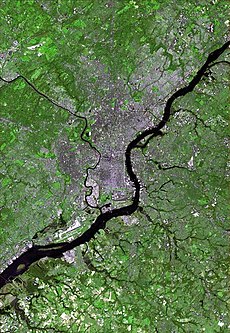
Philadelphia satellite map.jpg 590 × 854; 111 KB


