Category:Geological maps of Australia
Countries of Oceania: Australia · Fiji · Federated States of Micronesia · New Zealand · Papua New Guinea · Samoa · Tonga · Vanuatu
Other areas: French Polynesia · Hawaii · New Caledonia – Partly: Indonesia · French Southern and Antarctic Lands
Other areas: French Polynesia · Hawaii · New Caledonia – Partly: Indonesia · French Southern and Antarctic Lands
Subcategories
This category has the following 4 subcategories, out of 4 total.
*
M
O
Media in category "Geological maps of Australia"
The following 44 files are in this category, out of 44 total.
-
1911 Britannica - Australia - Geology.png 853 × 749; 671 KB
-
30 ma New Zealand Zealandia.png 1,104 × 721; 1.69 MB
-
424 of '(Articles on mining and geology reprinted from periodicals.)' (11210823814).jpg 1,431 × 1,488; 541 KB
-
Ausgeolbasic.jpg 918 × 845; 129 KB
-
Australia cratons EN.svg 5,430 × 4,287; 75 KB
-
Australian cratons NL.svg 5,430 × 4,287; 91 KB
-
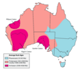
Australian rock ages-MJC.png 800 × 676; 18 KB
-
Basin subdivision of the Adelaide Superbasin.svg 512 × 355; 101 KB
-
DinosaurCove.png 400 × 436; 31 KB
-
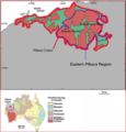
Eastern Pilbara Map.png 447 × 467; 143 KB
-
Elatina.jpg 515 × 599; 138 KB
-
Extent map of the Adelaide Superbasin.svg 512 × 731; 4.8 MB
-
Geological Survey Of Victoria.jpg 7,270 × 5,503; 40.82 MB
-
Geology of Kimberley (Western Australia) Geological Map.png 1,515 × 1,939; 1.05 MB
-
Geology of Kimberley (Western Australia) Overview Map.png 937 × 870; 188 KB
-
Geomap edited.png 1,515 × 1,939; 865 KB
-
Geomap edited1.png 1,515 × 1,939; 865 KB
-
Greenstone belt cross-section EN.svg 661 × 1,209; 308 KB
-
Greenstone belt cross-section NL.svg 661 × 1,209; 308 KB
-
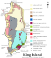
King Island geology.png 707 × 816; 82 KB
-
Lake Bungunnia of the Murray Basin.png 1,224 × 1,000; 2.47 MB
-
Location of Galilee Basin.png 1,721 × 1,417; 138 KB
-
Macquarie Island geology.png 1,182 × 2,267; 276 KB
-
New town map all.jpg 1,368 × 1,557; 333 KB
-
New town map detail - Geilston Bay.jpg 930 × 554; 94 KB
-
Oil shale in Australia.png 1,063 × 956; 106 KB
-
Pilbara Craton Map.pdf 1,275 × 1,650; 1.1 MB
-
Pilbara Craton Region Map.pdf 931 × 666; 1.11 MB
-
Report on the geology and gold fields of Otago (Plate V) BHL43691900.jpg 3,862 × 3,343; 1.12 MB
-
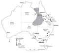
Savannasaurus-fig1-outcrops.png 1,395 × 1,681; 1.05 MB
-
Savannasaurus-fig2-map.png 1,370 × 1,326; 1.2 MB
-
Sistema petrolifero.jpg 2,020 × 2,717; 950 KB
-
Tasmania simple geology map.png 1,005 × 1,122; 103 KB
-
Tasmania undersea minerals.png 673 × 1,357; 1.06 MB
-
Tectonic Map of Grawler Craton.gif 1,084 × 1,415; 70 KB
-
Undara National Park3.jpg 5,184 × 3,888; 5.09 MB
-
Victoria Early Cretaceous Localities.jpg 600 × 446; 66 KB
-
Warrawoona geology 2.JPG 560 × 666; 299 KB
-
Westmusgrave.jpg 1,228 × 776; 267 KB
-
Winton formation.svg 680 × 660; 65 KB


