Category:Geology of California
description of the geology of California | |||||
| Upload media | |||||
| Instance of |
| ||||
|---|---|---|---|---|---|
| Location |
| ||||
| |||||
Subcategories
This category has the following 78 subcategories, out of 78 total.
Media in category "Geology of California"
The following 120 files are in this category, out of 120 total.
-
Amargosa River at Tecopa 3.jpg 2,400 × 1,800; 1.31 MB
-
Bulletin of the Geological Society of America (1903) (20261523760).jpg 2,816 × 2,232; 1.3 MB
-
Bulletin of the Geological Society of America (1903) (20261599858).jpg 3,008 × 2,424; 1.41 MB
-
California - Lavic through Ubehebe Crater - NARA - 23935499.jpg 4,350 × 3,382; 4.45 MB
-
California - Lavic through Ubehebe Crater - NARA - 23935501.jpg 4,350 × 3,382; 3.78 MB
-
California - Lavic through Ubehebe Crater - NARA - 23935503.jpg 4,350 × 3,382; 2.88 MB
-
Cascades and Modoc Plateau Block Diagram.png 1,077 × 620; 464 KB
-
Concretion Point Loma Fm1.jpg 3,072 × 2,048; 4.16 MB
-
Convolute laminations, Cozy Dell Fm.jpg 1,510 × 1,000; 396 KB
-
De-watering dike, Cozy Dell Fm.jpg 1,516 × 1,000; 355 KB
-
CozyDell2.jpg 3,456 × 2,592; 6.17 MB
-
A bibliography relating to the geology, palaeontology, and mineral resources of California (IA cu31924060308826).pdf 777 × 1,291, 142 pages; 3.37 MB
-
DishStructureCalifornia.jpg 1,200 × 798; 158 KB
-
Down into Convict Canyon at creek and cliff from trail.jpg 2,592 × 3,888; 8.36 MB
-
Eastern California from the ISS.jpeg 3,029 × 2,002; 1.66 MB
-
Garlock Fault.jpg 600 × 450; 31 KB
-
Folded Chert - Glen Canyon.jpg 2,112 × 2,816; 2.14 MB
-
Gaviota area (10377779813).jpg 2,048 × 1,536; 793 KB
-
Geologic map of Los Angeles basin (1933).jpg 3,156 × 2,529; 2.28 MB
-
Geological Cross Section of Table Mountain, Tuolumne County, California Meters.jpg 3,152 × 2,256; 1.47 MB
-
Geological Cross Section of Table Mountain, Tuolumne County, California.png 3,152 × 2,261; 613 KB
-
Geological formation in Ed R. Levin County Park, Diablo Range.JPG 4,608 × 3,072; 3.59 MB
-
Geology of California - fktmp13 0125 (3354973766).jpg 1,365 × 2,048; 1.36 MB
-
Geology of California - fktmp5 0084 (3354975260).jpg 2,048 × 1,364; 1.2 MB
-
Geology of California - IM000531 037 (3354985182).jpg 2,048 × 1,536; 917 KB
-
Geology of California - IM000589 101 (3355001350).jpg 2,048 × 1,536; 715 KB
-
Geology of California - Rolling Hills in the Coast Range (3354175633).jpg 2,048 × 1,536; 1.45 MB
-
Geology of California - The Sutter Buttes in the Clouds (3354973966).jpg 1,828 × 1,217; 482 KB
-
Ghost myrmekite.gif 340 × 287; 76 KB
-
Glacial striations and polish near Lambert Dome-750px.jpg 750 × 580; 101 KB
-
Gold from quartz-gold hydrothermal vein (California, USA) 2 (16844358998).jpg 1,824 × 2,573; 3.92 MB
-
Gold-quartz hydrothermal vein (Calaveras County, California, USA) (17032084115).jpg 1,789 × 1,829; 2.71 MB
-
Gold-quartz hydrothermal vein (Cretaceous; Eldorado County, California, USA).jpg 2,133 × 1,038; 2.03 MB
-
Gold-quartz hydrothermal vein (Grass Valley, California, USA) (17182914831).jpg 2,119 × 2,145; 3.2 MB
-
Gold-quartz hydrothermal vein in matrix (Amador County, California, USA) (17161938811).jpg 2,620 × 1,650; 3.65 MB
-
Government Point California.png 1,329 × 747; 2.61 MB
-
Granite at South Lake Tahoe.jpg 4,288 × 2,848; 5.51 MB
-
JalamaFormation1.jpg 3,456 × 2,592; 6.44 MB
-
JalamaSandstoneMember.jpg 3,456 × 2,592; 5.79 MB
-
Jawbone Canyon 2022.jpg 3,000 × 2,250; 6.96 MB
-
Joshua Tree Park 1.jpg 4,136 × 2,043; 695 KB
-
Joshua Tree Park road 1.jpg 4,271 × 2,043; 1.1 MB
-
JuncalFormation1.jpg 3,228 × 2,535; 4.73 MB
-
JuncalShaleWeathered.jpg 3,456 × 2,592; 5.27 MB
-
Kings Canyon National Park - General Grant Grove - roadcut.JPG 3,456 × 1,701; 3.31 MB
-
Kings Canyon National Park - roadcut near Junction View.JPG 3,456 × 1,956; 3.13 MB
-
Lake Berryessa turbidites1.jpg 2,075 × 1,500; 886 KB
-
Lake Berryessa turbidites3.jpg 2,247 × 1,500; 836 KB
-
Landslide San Matteo County.jpg 327 × 439; 48 KB
-
Layers of time - panoramio.jpg 2,500 × 1,667; 683 KB
-
Marin Headlands ribbon chert.jpg 4,500 × 3,004; 7 MB
-
Marine sandstones, Gaviota coast.jpg 3,504 × 2,336; 6.72 MB
-
MatilijaSandstone2.jpg 3,456 × 2,592; 6.12 MB
-
Rip-up clasts, Matilia Fm.jpg 1,512 × 1,000; 339 KB
-
Sticky Phacelia - (Phacelia viscida).jpg 2,742 × 2,190; 5.59 MB
-
Mojave River 031013.JPG 3,872 × 2,592; 7.61 MB
-
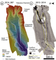
Monterey Cyclic Steps Birds Eye View.png 419 × 449; 270 KB
-
Mother Lode Gold OreHarvard mine quartz-gold vein.jpg 1,105 × 770; 143 KB
-
Mountains and Alluvial Fans in California 2.jpg 2,256 × 1,496; 1.54 MB
-
Mountains and Alluvial Fans in California.jpg 2,256 × 1,496; 1.42 MB
-
Mudflow from Venado Fm at Lake Berryessa.jpg 1,500 × 1,000; 515 KB
-
Myrmekite Temecula.gif 245 × 232; 46 KB
-
Naturally Oil Stained Kern River Field Outcrop.jpg 640 × 480; 55 KB
-
North Star gold ore.jpg 889 × 1,400; 657 KB
-
NRCSCA06012 - California (969)(NRCS Photo Gallery).jpg 2,100 × 1,500; 3.72 MB
-
Oceanic-oceanic convergence-rus.png 301 × 156; 24 KB
-
Orbicular gabbro-1.JPG 944 × 1,258; 245 KB
-
Orbicular gabbro.JPG 1,592 × 1,194; 427 KB
-
Oso Member.jpg 600 × 543; 58 KB
-
Pebble Plains habitat near Big Bear Lake in the San Bernardino Mountains (36609729536).jpg 5,472 × 3,648; 3.93 MB
-
Pillow lava cross section.JPG 2,592 × 3,872; 2.99 MB
-
Pillow lava-Marin.JPG 2,592 × 3,872; 2.11 MB
-
Plagioclase Replacement.jpg 387 × 444; 175 KB
-
Point Conception and Gaviota Coast.jpg 3,504 × 1,728; 5.1 MB
-
Point Loma section.jpg 2,048 × 3,072; 3.72 MB
-
PointArenaMarkGunn.jpg 6,123 × 4,082; 9.64 MB
-
PSM V52 D638 Sierra nevada fault near owens lake.jpg 1,698 × 1,310; 444 KB
-
PSM V58 D243 Tar pool in upper ojai ventura county cal.png 1,673 × 1,057; 424 KB
-
PSM V69 D296 Earthquake rift under the alder creek bridge in mendocino county.png 1,569 × 1,173; 469 KB
-
PSM V88 D206 Natural cannonballs in the soft sandstone.png 1,286 × 726; 369 KB
-
RinconShale1.jpg 2,887 × 2,394; 4.77 MB
-
Rock-veined ridge N of Forester.jpg 3,412 × 2,592; 4.97 MB
-
Rocks in Joshua Tree Park.jpg 4,272 × 1,890; 820 KB
-
RogersCrkNorthHayward.gif 640 × 440; 23 KB
-
Sanc0164 - Flickr - NOAA Photo Library.jpg 3,008 × 2,000; 4.25 MB
-
Sand to Snow NM geology.JPG 3,000 × 2,000; 4.8 MB
-
Santa rosa beach.JPG 3,456 × 2,304; 3.18 MB
-
SespeCA.jpg 2,560 × 1,920; 5.42 MB
-
Sierra Fault Block.gif 1,190 × 408; 103 KB
-
Sierra Fault Block.png 595 × 204; 21 KB
-
Sierra nevada schematic.png 800 × 512; 22 KB
-
SIR-C-X-SAR Death Valley Collage.jpg 2,125 × 1,423; 479 KB
-
SisquocClose.jpg 3,456 × 2,592; 4.31 MB
-
Slickenside in basalt.JPG 1,592 × 2,378; 1.08 MB
-
Slump Fold.jpg 1,024 × 685; 502 KB
-
SoCal Coast.jpg 720 × 1,084; 374 KB
-
Steatite Soapstone Outcropping (32000978036).jpg 4,160 × 2,340; 5.92 MB
-
SynclineCalico.JPG 3,000 × 3,200; 8.65 MB
-
Tar volcano in the Carpinteria Asphalt mine.jpg 1,400 × 1,009; 1.11 MB
-
Tar volcanoes in the Carpinteria Asphalt mine (cropped).jpg 1,248 × 785; 829 KB
-
Tight fold in radiolarian chert, Estero Blufs SP.jpg 2,307 × 2,448; 2.51 MB
-
Turbidite from Pigeon Pt Fm at Pescadero Beach, CA.jpg 1,277 × 1,000; 497 KB
-
Turbidite-2.jpeg 1,944 × 2,592; 1.01 MB
-
Turbidite-3.jpeg 2,592 × 1,944; 941 KB
-
Turbidite-4.jpeg 2,592 × 1,944; 817 KB
-
Turbidite-California.jpeg 1,944 × 2,592; 1.18 MB
-
USA - California - Garrapata Beach - 53007797422.jpg 5,054 × 2,843; 10.75 MB
-
USA - California - Garrapata Beach - 53008773220.jpg 5,472 × 3,078; 10.23 MB
-
View from Joshua Tree Park rocks.jpg 4,272 × 2,333; 1.3 MB
-
Western development (9).jpg 2,064 × 1,129; 448 KB
-
Wfm honey lake.jpg 1,280 × 948; 246 KB
-
Wheeler ridge rivers-01-01.jpg 3,759 × 2,742; 4.92 MB
-
Wheeler ridge rivers-01.jpg 1,884 × 2,742; 575 KB
-
Whipple Wash WikiMediaCommons.jpg 2,048 × 1,536; 1.12 MB
-
YosemiteFromPlane.JPG 2,048 × 1,536; 247 KB


