Category:Langley, British Columbia (township)
district municipality in British Columbia, Canada | |||||
| Upload media | |||||
| Instance of |
| ||||
|---|---|---|---|---|---|
| Location | Metro Vancouver Regional District, British Columbia, Canada | ||||
| Located in or next to body of water |
| ||||
| Inception |
| ||||
| Population |
| ||||
| Area |
| ||||
| Different from | |||||
| official website | |||||
 | |||||
Subcategories
This category has the following 13 subcategories, out of 13 total.
Media in category "Langley, British Columbia (township)"
The following 31 files are in this category, out of 31 total.
-
20146 100a Avenue (34561954790).jpg 4,896 × 3,247; 8.54 MB
-
20146 100a Avenue (34817265211).jpg 4,904 × 3,248; 9.28 MB
-
20146 100a Avenue (34908778486).jpg 4,871 × 3,226; 5.68 MB
-
20146 100a Avenue (34908785896).jpg 4,901 × 2,474; 5.45 MB
-
20146 100a Avenue (34908792186).jpg 4,889 × 3,242; 7.47 MB
-
20146 100a Avenue (34908800716).jpg 4,878 × 3,231; 10.69 MB
-
20146 100a Avenue (34949252315).jpg 4,902 × 2,237; 8.52 MB
-
20175 100a Avenue (34785739532).jpg 4,868 × 3,224; 9.41 MB
-
20175 100a Avenue (34949255585).jpg 4,889 × 3,246; 7.62 MB
-
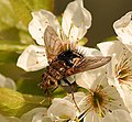
Archytas fly.jpg 797 × 736; 473 KB
-
Brookswood Secondary (school field).jpg 3,264 × 1,832; 2.95 MB
-
Canada Geese.jpg 4,288 × 2,848; 8.06 MB
-
FoggyForest.JPG 2,136 × 3,216; 1.6 MB
-
Greenhouse orange light pollution langley british columbia.jpg 3,648 × 2,736; 3.44 MB
-
GVRD - Langley district.svg 953 × 719; 299 KB
-
GVRD Langley district.svg 953 × 719; 164 KB
-
House boats - panoramio.jpg 4,608 × 3,456; 5.05 MB
-
Langley BC Block Diagram.png 1,880 × 1,800; 73 KB
-
Langley BC Wikivoyage banner.jpg 2,158 × 308; 146 KB
-
Langley City, BC 1959.jpg 768 × 600; 153 KB
-
Langley rural 216 St & 27 Ave Zoomed.jpg 4,000 × 3,000; 3.27 MB
-
Langley rural 216 St & 27 Ave.jpg 4,000 × 3,000; 3.24 MB
-
Langley Township ALR Map (August 2012).png 865 × 1,172; 497 KB
-
Langley walnut grove greenway.jpg 1,500 × 2,000; 1.09 MB
-
LangleySpeedwayStairs.jpg 4,592 × 3,056; 6.41 MB
-
R. E. Mountain Secondary noticeboard (2010).jpg 1,944 × 2,592; 1.84 MB
-
Syrphus sp.jpg 1,012 × 841; 702 KB
-
Topham Road 216th Street.jpg 3,000 × 4,000; 3.37 MB
-
Walnut Grove Langley Satellite Map - 204th St, 93-94th ave.png 1,354 × 851; 2.32 MB
-
WGSSCairn (2).JPG 2,000 × 3,008; 1.92 MB
-
Willowbrook-sign.jpg 1,704 × 2,272; 1.39 MB


