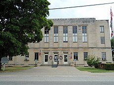
Category:Madison County, Arkansas
Counties of Arkansas: Arkansas · Ashley · Baxter · Benton · Boone · Bradley · Calhoun · Carroll · Chicot · Clark · Clay · Cleburne · Cleveland · Columbia · Conway · Craighead · Crawford · Crittenden · Cross · Dallas · Desha · Drew · Faulkner · Franklin · Fulton · Garland · Grant · Greene · Hempstead · Hot Spring · Howard · Independence · Izard · Jackson · Jefferson · Johnson · Lafayette · Lawrence · Lee · Lincoln · Little River · Logan · Lonoke · Madison · Marion · Miller · Mississippi · Monroe · Montgomery · Nevada · Newton · Ouachita · Perry · Phillips · Pike · Poinsett · Polk · Pope · Prairie · Pulaski · Randolph · Saline · Scott · Searcy · Sebastian · Sevier · Sharp · St. Francis · Stone · Union · Van Buren · Washington · White · Woodruff · Yell
county in Arkansas, United States | |||||
| Upload media | |||||
| Instance of | |||||
|---|---|---|---|---|---|
| Named after | |||||
| Location | Arkansas | ||||
| Capital | |||||
| Inception |
| ||||
| Population |
| ||||
| Area |
| ||||
| Different from | |||||
| official website | |||||
 | |||||
Subcategories
This category has the following 15 subcategories, out of 15 total.
A
- Arkansas Highway 74 (7 F)
- Arkansas Highway 12 (8 F)
- Arkansas Highway 127 (8 F)
- Arkansas Highway 45 (9 F)
C
H
K
M
R
- Daniel Rudd (3 F)
S
- St. Paul, Arkansas (3 F)
W
Media in category "Madison County, Arkansas"
The following 51 files are in this category, out of 51 total.
-
AR 74 east of AR 23 junction south of Huntsville, Arkansas.jpg 3,875 × 2,583; 2.1 MB
-
ARMap-doton-Hindsville.png 300 × 262; 13 KB
-
ARMap-doton-Huntsville.png 300 × 262; 13 KB
-
ARMap-doton-St. Paul.png 300 × 262; 13 KB
-
Assemblage Studio.jpg 2,448 × 2,448; 1.18 MB
-
Bluffside Park in Madison County, AR.jpg 3,888 × 2,592; 2.78 MB
-
Bunch Store.jpg 3,173 × 2,118; 2.74 MB
-
Clifty, Arkansas.jpg 2,219 × 1,483; 645 KB
-
Entrance to Boston, AR.jpg 2,425 × 1,618; 1.39 MB
-
Entrance to Brashears, AR.jpg 2,827 × 1,886; 1.9 MB
-
Highway 16 and 23 turn left in St. Paul, Arkansas.jpg 2,970 × 1,982; 2.07 MB
-
Highway 23 splits from Highway 16 in Madison County, AR.jpg 2,462 × 1,643; 1.44 MB
-
Highway 62 in Alpena, AR 001.jpg 2,961 × 1,972; 2.07 MB
-
Highway 62 in Alpena, AR 002.jpg 2,978 × 1,980; 1.46 MB
-
Highway 74 out of Kingston.jpg 2,152 × 1,436; 1.14 MB
-
Kings River Falls 001.jpg 4,000 × 3,000; 4.91 MB
-
Kings River Falls 002.jpg 4,000 × 3,000; 4.15 MB
-
Looking out into the Ozark forest from the Bluff Shelter.jpg 3,888 × 2,592; 4.45 MB
-
LtGen Martin R Steele USMC.jpg 197 × 247; 59 KB
-
Madison County Road 2175 in Arkansas.jpg 4,000 × 3,000; 3.73 MB
-
Map of Arkansas highlighting Madison County.svg 1,278 × 1,113; 90 KB
-
Natural arch in the Ozark Mountains.jpg 3,888 × 2,592; 6.02 MB
-
Northern terminus of AR 23W at Forum.jpg 3,180 × 1,789; 1.04 MB
-
Top Down Snow Fall (Unsplash).jpg 4,000 × 3,000; 10.63 MB
-
Unnamed creek at the Ozark Natural Science Center.jpg 3,888 × 2,592; 3.82 MB
-
USA Madison County, Arkansas age pyramid.svg 520 × 600; 7 KB
-
White River at Spider Creek 001.jpg 4,128 × 2,322; 3.5 MB


