Category:Maps of Algeria
Countries of Africa: Algeria · Angola · Benin · Botswana · Burkina Faso · Burundi · Cameroon · Cape Verde · Central African Republic · Chad · Comoros · Democratic Republic of the Congo · Republic of the Congo · Djibouti · Egypt‡ · Equatorial Guinea · Eritrea · Eswatini · Ethiopia · Gabon · The Gambia · Ghana · Guinea · Guinea-Bissau · Ivory Coast · Kenya · Lesotho · Liberia · Libya · Madagascar · Malawi · Mali · Mauritania · Mauritius · Morocco · Mozambique · Namibia · Niger · Nigeria · Rwanda · São Tomé and Príncipe · Senegal · Seychelles · Sierra Leone · Somalia · South Africa · South Sudan · Sudan · Tanzania · Togo · Tunisia · Uganda · Zambia · Zimbabwe
Limited recognition: Ambazonia · Azawad · Puntland · Sahrawi Arab Democratic Republic · Somaliland – Other areas: Canary Islands · Ceuta · Madeira · Mayotte · Melilla · Réunion · Saint Helena, Ascension and Tristan da Cunha · Scattered Islands in the Indian Ocean · Western Sahara
‡: partly located in Africa
Wikimedia category | |||||
| Upload media | |||||
| Instance of | |||||
|---|---|---|---|---|---|
| Category combines topics | |||||
 | |||||
Français : Cartes de l'Algérie.
العربية: الجزائر.
Subcategories
This category has the following 17 subcategories, out of 17 total.
Pages in category "Maps of Algeria"
The following 2 pages are in this category, out of 2 total.
Media in category "Maps of Algeria"
The following 113 files are in this category, out of 113 total.
-
00590613 490576349a82b246cf3425eadc202569 arc614x376 w2205 us1.jpg 2,205 × 1,350; 174 KB
-
99531301 o.jpg 1,936 × 995; 1.2 MB
-
Admiralty Chart No 2121 Cap de Fer to Iles Cani, Published 1963.jpg 16,196 × 11,041; 23.91 MB
-
Agence spatiale.png 880 × 447; 99 KB
-
Agglomérations de plus de 150 000 habitants en 2017-2021.jpg 3,507 × 2,480; 153 KB
-
Ahmadi Muslim Persecution Map Algeria.svg 1,287 × 1,278; 962 KB
-
Alge-t10.png 800 × 518; 108 KB
-
Algeria departments 1957-1974.png 1,274 × 1,280; 95 KB
-
Algeria departments 1974-1983 ar.png 1,000 × 1,029; 32 KB
-
Algeria departments 1974-1983.png 1,000 × 1,029; 37 KB
-
Algeria-Mauritania boundary.jpg 4,137 × 3,171; 9.76 MB
-
Algerian wine regions.JPG 682 × 599; 42 KB
-
Algérie durant l'époque ottomane.png 800 × 518; 120 KB
-
Amala de setif.png 2,000 × 1,961; 117 KB
-
Arabic UG recognized by WMF.svg 863 × 443; 1.56 MB
-
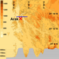
ArakMap.png 3,600 × 3,600; 2.65 MB
-
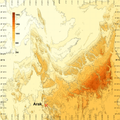
Arakzoom.png 3,000 × 3,000; 672 KB
-
Argentina map-Konkani Vishwakosh.png 345 × 309; 70 KB
-
Barbary coast3.jpg 974 × 582; 151 KB
-
Barrage vert.png 870 × 510; 628 KB
-
Battle of Moulouya - Bataille de la Moulouya (1691 Maroc and Algeria).jpg 1,403 × 879; 219 KB
-
Berber States 1058.png 1,200 × 729; 248 KB
-
Bilan Algérie.svg 863 × 443; 1.2 MB
-
Béjaïa arrière pays.png 434 × 515; 59 KB
-
Béni Amer map ar.png 1,080 × 910; 158 KB
-
Carte Alger Koukou Abbès 1600.svg 8,326 × 4,142; 438 KB
-
Carte B2.jpg 1,169 × 827; 311 KB
-
CARTE DHR ALGERIE.jpg 460 × 542; 54 KB
-
Carte hammadides.png 1,064 × 980; 88 KB
-
Carte krima.jpg 922 × 652; 145 KB
-
Carte oum el bouaghi.png 748 × 439; 93 KB
-
Carte réseauTV Nord.jpg 654 × 393; 72 KB
-
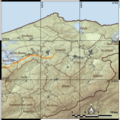
Carte topographique des gorges d'Arak.png 8,640 × 8,640; 77.82 MB
-
Carte topographique du Tassili n'Ajjer et les alentours-jpg.jpg 7,822 × 7,450; 14.38 MB
-
Carte topographique du Tassili n'Ajjer et les alentours.png 7,822 × 7,450; 40.16 MB
-
Carte-des-Pharusiens.png 813 × 577; 80 KB
-
CheffiaTopo.png 4,240 × 4,240; 21.87 MB
-
Chellalat El Adhaoura location.png 429 × 425; 12 KB
-
CommuneMixteBibans.jpg 2,262 × 1,491; 202 KB
-
Dahra occidentale.jpg 1,400 × 1,076; 524 KB
-
Dar Es-Soltan (Français).png 1,920 × 1,080; 178 KB
-
DeltaOuedNamous.png 1,500 × 2,100; 1.97 MB
-
DZ 55 Touggourt Province.png 800 × 787; 65 KB
-
Département de Mostaganem.PNG 200 × 151; 4 KB
-
ECHO Algeria Editable A3 Landscape.png 1,344 × 1,008; 439 KB
-
Emirate of Thaalabah.png 6,040 × 3,320; 515 KB
-
Esquisse du Sahara algérien 1907.jpg 10,768 × 7,776; 10.42 MB
-
Flii algeria.png 1,820 × 683; 340 KB
-
For Boeing B-47E Stratojet 52-534.png 980 × 549; 68 KB
-
GaretDjenoun.jpg 6,480 × 6,480; 38.81 MB
-
GhatTopoMap.png 4,542 × 4,542; 33.02 MB
-
GPRA.png 11,421 × 6,992; 2.43 MB
-
Hammadid Emirate.png 623 × 623; 281 KB
-
Hispanoparlantes en Argelia.png 403 × 295; 21 KB
-
HoggarTopography.png 4,801 × 3,945; 8.42 MB
-
In Ziza Topp.png 4,355 × 4,355; 23.55 MB
-
Karte der Tassili n'Ajjer und Umgebung-jpg.jpg 7,822 × 7,450; 14.37 MB
-
Karte der Tassili n'Ajjer und Umgebung.png 7,822 × 7,450; 79.71 MB
-
Karte des Erg Issaouane.png 4,167 × 3,215; 9.7 MB
-
Karte des Erg Tiffernine.png 3,045 × 2,804; 6.73 MB
-
La mairie de Koléa.jpg 3,072 × 2,304; 2.57 MB
-
Les 6 provinces de la région des Aurès au nord-est de l'Algérie.png 800 × 782; 145 KB
-
Les 7 provinces de la grande Kabylie au nord de l'Algérie.png 800 × 782; 148 KB
-
Localitation des peuplements du Cedre (Afrique du Nord).svg 897 × 511; 141 KB
-
Localitation des peuplements du Cedre (Aures).svg 848 × 616; 55 KB
-
Macaca sylvanus distribution.svg 501 × 430; 115 KB
-
Macaca sylvanus range map.png 582 × 599; 32 KB
-
Map of Algeria 1984.jpg 2,477 × 3,500; 686 KB
-
Map of Beni Amer in Algeria and Morocco.jpg 2,000 × 1,682; 169 KB
-
Map of Erg Issaouane.png 4,167 × 3,215; 9.68 MB
-
Map of Tassili n'Ajjer and surroundings-jpg-en.jpg 7,822 × 7,450; 14.35 MB
-
Map of Tassili n'Ajjer and surroundings.png 7,822 × 7,450; 40.13 MB
-
Mediouna Relizane.jpg 690 × 884; 393 KB
-
Menaceur.jpeg 286 × 176; 4 KB
-
Merça Maghila.jpg 1,069 × 720; 268 KB
-
Nememcha.jpg 2,048 × 1,686; 248 KB
-
Nememchas.jpg 2,048 × 1,686; 243 KB
-
Nemencha roman density.png 6,449 × 4,332; 12.61 MB
-
NemenchaTopoMap.png 3,859 × 3,441; 9.44 MB
-
Nesvrstane zemlje Mediterana-AL.png 1,770 × 798; 38 KB
-
NJ 31 - Series 1302 - U.S. Army Map Service - 1958 - Algiers and Balearic Islands.jpg 4,926 × 5,330; 5.17 MB
-
Oaallen.png 4,789 × 4,789; 37.36 MB
-
Piri Reis - Map of the Algerian Coast around Algiers - Walters W658270B - Full Page.jpg 1,222 × 1,800; 2.66 MB
-
Principales agglomérations du Constantinois.jpg 3,507 × 2,480; 169 KB
-
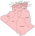
Provinces of Algeria.svg 1,585 × 1,585; 295 KB
-
Régions militaires.jpg 982 × 955; 246 KB
-
Répartition des tribus dans la région des monts des traras.jpg 915 × 989; 212 KB
-
Sahara argelino.png 5,764 × 5,728; 2.64 MB
-
Sahara ecoregion.svg 700 × 500; 181 KB
-
Situation Réseau Autoroutier Algérier - Mai 2015 - V.03.png 3,760 × 1,644; 985 KB
-
Siège d'Oran (1693).jpg 630 × 480; 112 KB
-
Tadmit.png 3,000 × 3,000; 18.64 MB
-
TedefestTopo.png 3,039 × 3,693; 11.82 MB
-
Tekna.PNG 854 × 696; 26 KB
-
Tim Missao.png 6,010 × 6,010; 36.44 MB
-
Tin-bider overview.png 1,600 × 1,600; 1.35 MB
-
Tin-Rehroh.png 2,781 × 6,330; 16.77 MB
-
Tribus de la Commune Mixte des Bibans.jpg 738 × 454; 42 KB
-
Tutorial changer la couleur d'un pays.png 1,679 × 1,007; 151 KB
-
Étendue de la révolte des Mokrani.svg 227 × 129; 86 KB
-
التقسيم الإداري للجزائر.svg 512 × 512; 406 KB
-
الهضاب العليا.svg 1,000 × 1,001; 64 KB
-
خريطة تينار القديمة والجديدة معا.jpg 946 × 1,224; 256 KB
-
خريطة لمملكة تلمسان القديمة.png 1,272 × 571; 93 KB
-
خريطة مدينة تينار.jpg 932 × 751; 228 KB
-
عين الرمان.jpg 228 × 311; 15 KB
-
مناطق إنتشار قبائل الصحراء العربية في الجزائر.jpg 2,048 × 2,042; 485 KB


