Category:Maps of Almoravid dynasty
Wikimedia category | |||||
| Upload media | |||||
| Instance of | |||||
|---|---|---|---|---|---|
| Category combines topics | |||||
| Almoravid dynasty | |||||
Berber dynasty that once ruled over Al-Andalus and Maghreb | |||||
| Instance of | |||||
| Part of | |||||
| Location |
| ||||
| Capital | |||||
| Basic form of government | |||||
| Official language | |||||
| Currency | |||||
| Inception |
| ||||
| Dissolved, abolished or demolished date |
| ||||
| Significant event |
| ||||
| Religion or worldview | |||||
| Followed by | |||||
| Replaces |
| ||||
| Replaced by | |||||
| |||||
Media in category "Maps of Almoravid dynasty"
The following 48 files are in this category, out of 48 total.
-
(Spruner-Menke, map 16) The Iberian peninsula 1086-1257.jpg 3,338 × 2,767; 2.32 MB
-
Almoravid and Almohad Empires.jpg 664 × 457; 110 KB
-
Almoravid Dynasty 1073 - 1147 (AD).PNG 821 × 440; 36 KB
-
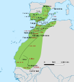
Almoravid dynasty of Morocco-ar.svg 362 × 457; 957 KB
-
Almoravid dynasty of Morocco-en.svg 362 × 457; 943 KB
-
Almoravid Empire-ca.svg 403 × 557; 58 KB
-
Almoravid Empire-en.jpg 1,000 × 1,220; 151 KB
-
Almoravid Empire-pt.svg 403 × 557; 60 KB
-
Almoravid Empire.png 327 × 537; 64 KB
-
Almoravid Greatest Extent.png 821 × 440; 35 KB
-
Almoravid map reconquest loc.jpg 501 × 422; 49 KB
-
Almoravid Map.png 238 × 211; 5 KB
-
Almoravid map.svg 537 × 536; 304 KB
-
AlmoravidEmirate (orthographic projection).svg 550 × 550; 540 KB
-
Almoravides Carte.png 238 × 211; 5 KB
-
Almoravids1120.png 1,116 × 692; 30 KB
-
ALMORÁVIDESJPEG.jpg 546 × 702; 37 KB
-
Empire almoravide-es.svg 362 × 457; 1.01 MB
-
Empire almoravide-HE.PNG 1,000 × 1,220; 71 KB
-
Empire almoravide-pt.svg 362 × 457; 876 KB
-
Empire almoravide.PNG 1,000 × 1,220; 13 KB
-
ExpansiónAlmorávide-pt.svg 2,005 × 2,236; 1.07 MB
-
ExpansiónAlmorávide.svg 1,748 × 2,059; 2.14 MB
-
ExpansiónAlmorávideSimplificado.svg 1,857 × 1,951; 1.44 MB
-
Flag map of Almoravid dynasty.png 823 × 1,126; 69 KB
-
Flag map of the Almoravid Dynasty in Al-Andalus.png 315 × 380; 67 KB
-
Flag-map of Almoravid Kingdom.png 996 × 1,071; 68 KB
-
Magrèb en 1100.png 1,076 × 745; 107 KB
-
Map Almoravid empire-ar.svg 546 × 702; 29 KB
-
Map Almoravid empire-en.svg 546 × 702; 123 KB
-
Map Almoravid empire-es.svg 546 × 702; 40 KB
-
Map Almoravid empire-fr.svg 546 × 702; 28 KB
-
Map Almoravid empire-hu.svg 546 × 702; 32 KB
-
Map Almoravid empire-it.svg 546 × 702; 33 KB
-
Map Almoravid empire-pt.svg 546 × 702; 28 KB
-
Map Almoravid empire-ru.svg 546 × 702; 29 KB
-
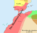
Map of the Murabitun (Almoravid) Empire in 1120.png 1,000 × 911; 77 KB
-
Map of the Murabitun Empire in 1120 in Arabic.png 1,000 × 911; 71 KB
-
Péninsule ibérique en 1115.png 2,000 × 1,500; 1.1 MB
-
Péninsule ibérique en 1144.png 2,000 × 1,500; 990 KB
-
Péninsule ibérique en 1148.png 2,000 × 1,500; 1.03 MB
-
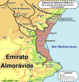
Señorío de Valencia 1099.png 1,793 × 1,853; 740 KB
-
Spruner-Menke Handatlas 1880 Karte 16.jpg 10,306 × 8,593; 22.62 MB
-
الأندلس في عهد علي بن يوسف.png 1,406 × 720; 639 KB
-
الأندلس في عهد يوسف بن تاشفين.png 1,406 × 720; 642 KB
-
ملوك الطوائف 2.png 1,406 × 720; 600 KB
-
ⵜⴰⵎⴷⴷⵓⵍⵜ ⵜⵉⵖⵔⵎⵜ ⵉⵏⵖⵓⴱⴰⵏ.png 6,791 × 8,192; 3.29 MB


