Category:Maps of Bashkortostan
Federal subjects of the Russian Federation:
Republics: Adygea · Altai · Bashkortostan · Buryatia · Chechnya · Chuvashia · (Crimea) · Dagestan · Ingushetia · Kabardino-Balkaria · Kalmykia · Karachay–Cherkessia · Karelia · Khakassia · Komi · Mari El · Mordovia · North Ossetia — Alania · Sakha (Yakutia) · Tatarstan · Tyva · UdmurtiaKrais: Altai · Kamchatka · Khabarovsk · Krasnodar · Krasnoyarsk · Perm · Primorsky · Stavropol · Zabaykalsky
Oblasts: Amur · Arkhangelsk · Astrakhan · Belgorod · Bryansk · Chelyabinsk · Irkutsk · Ivanovo · Kaliningrad · Kaluga · Kemerovo · Kirov · Kostroma · Kurgan · Kursk · Leningrad · Lipetsk · Magadan · Moscow · Murmansk · Nizhny Novgorod · Novgorod · Novosibirsk · Omsk · Orenburg · Oryol · Penza · Pskov · Rostov · Ryazan · Sakhalin · Samara · Saratov · Smolensk · Sverdlovsk · Tambov · Tomsk · Tula · Tver · Tyumen · Ulyanovsk · Vladimir · Volgograd · Vologda · Voronezh · Yaroslavl
Federal cities: Moscow · Saint Petersburg · (Sevastopol)
Autonomous oblast: Jewish
Autonomous okrugs: Chukotka · Khantia-Mansia · Nenetsia · Yamalo-Nenets
Wikimedia category | |||||
| Upload media | |||||
| Instance of | |||||
|---|---|---|---|---|---|
| Category combines topics | |||||
| Bashkortostan | |||||
federal subject of Russia | |||||
| Instance of | |||||
| Part of | |||||
| Named after | |||||
| Location |
| ||||
| Capital | |||||
| Legislative body | |||||
| Executive body | |||||
| Official language | |||||
| Anthem |
| ||||
| Currency | |||||
| Head of government |
| ||||
| Inception |
| ||||
| Highest point | |||||
| Population |
| ||||
| Area |
| ||||
| Elevation above sea level |
| ||||
| Follows | |||||
| Replaces |
| ||||
| Different from | |||||
| official website | |||||
 | |||||
Subcategories
This category has the following 34 subcategories, out of 34 total.
Pages in category "Maps of Bashkortostan"
This category contains only the following page.
Media in category "Maps of Bashkortostan"
The following 38 files are in this category, out of 38 total.
-
499785 original.png 668 × 852; 286 KB
-
Admin-map-Bashkiria-region.gif 410 × 520; 24 KB
-
Bashkir-geo-stub.svg 198 × 255; 15 KB
-
Bashkir03.png 657 × 820; 48 KB
-
Basjkortostan af.png 657 × 820; 44 KB
-
Baszkiria stub.png 285 × 373; 8 KB
-
Bashkirskaya Assr Map 6 - DPLA - a303ac2f6c399b7f15b261cef04ab373.jpg 7,240 × 11,908; 11.67 MB
-
BashkortFlora.jpg 900 × 1,205; 313 KB
-
Bashkortostan crh.png 657 × 820; 54 KB
-
Bashkortostan Ilishevskiy rayon.png 1,036 × 1,315; 75 KB
-
Bashkortostan relief map.png 1,004 × 787; 345 KB
-
Bashkortostan(independence)-Flagmap.svg 569 × 720; 325 KB
-
Bashkortostan.png 1,036 × 1,315; 71 KB
-
Bashrepublic 1919.svg 879 × 787; 1.65 MB
-
Baškortostán.png 657 × 820; 92 KB
-
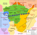
Big Bashkiriya - ru.svg 2,764 × 2,604; 605 KB
-
Districts of Bashkortostan with cities.png 1,035 × 1,317; 1.01 MB
-
Districts of Bashkortostan.png 1,035 × 1,317; 886 KB
-
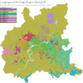
EthnicVolga.png 4,042 × 4,045; 1.29 MB
-
Flag-map of Bashkortostan.svg 488 × 600; 1.05 MB
-
Outline map of Ufimsky district (with position on the map of Bashkortostan).svg 1,000 × 1,000; 711 KB
-
Ru-ba suurkaart.gif 557 × 450; 35 KB
-
Russia - Republic of Bashkortostan (2008-01).svg 1,650 × 1,000; 140 KB
-
RussiaBashkortostan2005.png 300 × 178; 34 KB
-
RussiaBashkortostan2007-07.png 300 × 178; 40 KB
-
Silhouette of Bashkortostan.svg 900 × 1,108; 51 KB
-
SovietUnionBashkir.png 250 × 171; 22 KB
-
Башкирия.png 2,400 × 3,000; 8.01 MB
-
Башкортостанская митрополия.png 850 × 1,024; 199 KB
-
Башҡортостандың физик картаһы.png 2,774 × 4,107; 5.02 MB
-
Белорусы Иглинского района по городским и сельским поселениям, %.png 400 × 400; 15 KB
-
Карта Башкортостанской митрополии РПЦ.jpg 1,668 × 2,060; 1.06 MB
-
Карта геопарка.jpg 4,750 × 3,328; 6.98 MB
-
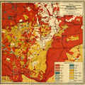
Национальный состав Башкортостана.png 1,100 × 1,098; 3.19 MB
-
Пошкырт Эл 03.png 657 × 820; 53 KB
-
Физическая карта Республики Башкортостан.png 5,371 × 8,197; 11.35 MB
-
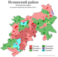
Этническая карта Иглинского района.png 876 × 859; 145 KB


