Category:Maps of Chaco Province
- Provinces of Argentina
- Buenos Aires
- Catamarca
- Chaco
- Chubut
- Córdoba
- Corrientes
- Entre Ríos
- Formosa
- Jujuy
- La Pampa
- La Rioja
- Mendoza
- Misiones
- Neuquén
- Río Negro
- Salta
- San Juan
- San Luis
- Santa Cruz
- Santa Fe
- Santiago del Estero
- Tierra del Fuego
- Tucumán
- Autonomous city
- Buenos Aires
Subcategories
This category has the following 4 subcategories, out of 4 total.
E
L
S
Media in category "Maps of Chaco Province"
The following 32 files are in this category, out of 32 total.
-
Campodelcielo south of Gancedo.jpg 800 × 567; 31 KB
-
Campodelcielo.svg 1,508 × 1,068; 35 KB
-
Provincia del Chaco - localización en Argentina.svg 908 × 1,581; 545 KB
-
Chaco (Argentina), departments and capital.png 708 × 525; 31 KB
-
Chaco (Argentina).png 708 × 525; 26 KB
-
Chaco Köppen.svg 512 × 587; 104 KB
-
Chaco Province.png 2,000 × 4,280; 161 KB
-
CHACO.svg 605 × 442; 65 KB
-
Map of Concepción del bermejo.png 855 × 528; 56 KB
-
Estancia La fidelidad.png 790 × 734; 78 KB
-
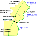
Gran Resistencia.svg 637 × 691; 874 KB
-
HUMEDAL CHACO 1.svg 755 × 616; 26 KB
-
HUMEDAL CHACO 2.svg 752 × 614; 26 KB
-
HUMEDAL CHACO.svg 728 × 717; 77 KB
-
Logo NEPAR Chaco.PNG 922 × 784; 99 KB
-
Map of Chaco Province.svg 906 × 700; 699 KB
-
Map of Santa Rosa island.png 550 × 549; 20 KB
-
Mapa del Chaco Argentino, 1883.jpg 588 × 960; 171 KB
-
Mapa del Gran Chaco y provincias adyacentes.jpg 852 × 960; 206 KB
-
Mapa Riacho Arazá.svg 384 × 586; 17 KB
-
Municipio Resistencia in San Fernando department.png 1,359 × 1,850; 173 KB
-
Municipios Chaco.svg 529 × 478; 455 KB
-
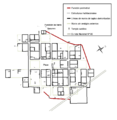
Plano Ruinas del km 75.png 1,072 × 1,104; 27 KB
-
Province Chaco départements numérotés.PNG 708 × 525; 34 KB
-
Provincia de Chaco, Argentina.png 520 × 1,004; 13 KB
-
Regnatur1.jpg 512 × 412; 80 KB
-
Ruinas del km 75 map.png 714 × 715; 38 KB
-
Tipos de clima del Chaco (Köppen).svg 512 × 587; 106 KB


