Category:Maps of Ireland
Wikimedia category | |||||
| Upload media | |||||
| Instance of | |||||
|---|---|---|---|---|---|
| Category combines topics | |||||
| Ireland | |||||
island in the North Atlantic Ocean | |||||
| Pronunciation audio | |||||
| Instance of | |||||
| Part of | |||||
| Location | British Isles, Europe, Northern hemisphere | ||||
| Located in or next to body of water | |||||
| Width |
| ||||
| Length |
| ||||
| Highest point |
| ||||
| Population |
| ||||
| Area |
| ||||
| Different from | |||||
 | |||||
日本語: アイルランドの地図に関するカテゴリ。
Subcategories
This category has the following 30 subcategories, out of 30 total.
!
*
A
- Maps of the Aran Islands (16 F)
C
- Maps of caves in Ireland (1 F)
D
E
G
H
- HDI maps of Ireland (2 F)
I
L
M
P
R
S
T
W
Pages in category "Maps of Ireland"
The following 2 pages are in this category, out of 2 total.
Media in category "Maps of Ireland"
The following 200 files are in this category, out of 250 total.
(previous page) (next page)-
1815 Survey of Kilmagar Sir John Coghill Baronet.jpg 4,160 × 3,120; 1.48 MB
-
2023 All-Ireland Senior Football Championship Results Map.png 874 × 844; 174 KB
-
3isles.jpg 902 × 1,898; 532 KB
-
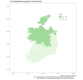
Armutsgefährdung IE 2011 EUSILC.svg 512 × 493; 81 KB
-
Artigarvan relief map (with Burndennett).jpg 1,063 × 505; 173 KB
-
Artigarvan relief map.jpg 1,063 × 505; 123 KB
-
Ascall mac Ragnaill (map).png 1,018 × 1,513; 233 KB
-
AtlanticCorridor Dec09.png 390 × 593; 20 KB
-
AtlanticCorridor Oct17.png 389 × 593; 19 KB
-
Ballycroy-NP-Map.png 910 × 822; 108 KB
-
Bantry.svg 594 × 391; 7 KB
-
Bantrybay.PNG 431 × 549; 42 KB
-
Barony of Clankelly.png 807 × 433; 56 KB
-
Belcarra.PNG 264 × 234; 7 KB
-
Bere Island within Ireland.png 1,450 × 1,806; 814 KB
-
BIThumbMap NI edit3.png 663 × 1,069; 79 KB
-
BIThumbMap ROI.png 663 × 1,069; 82 KB
-
Blank Ireland.png 908 × 1,159; 77 KB
-
Blank Map of Ireland (Kells marked).svg 2,000 × 2,555; 397 KB
-
Blank Map of Ireland (Location of Kells & Nobber).svg 2,000 × 2,555; 419 KB
-
BorrisTownlandBorrisleighParishNorthTipperary.jpg 600 × 758; 141 KB
-
BoundariesOfElectoralDivisionsInNorthTipperary.jpg 1,600 × 1,664; 609 KB
-
BoundariesOfElectoralDivisionsInNorthTipperaryIn2011.jpg 1,600 × 1,664; 608 KB
-
BoundariesOfElectoralDivisionsInTipperary.jpg 702 × 1,001; 327 KB
-
British and Irish Isles.svg 2,263 × 2,186; 409 KB
-
British Isles map.svg 512 × 641; 870 KB
-
British Isles terms.gif 463 × 655; 46 KB
-
Cavan Plantation Map.png 3,976 × 2,984; 1.07 MB
-
CDRmap.png 4,167 × 2,375; 681 KB
-
Celtic countries.svg 547 × 979; 242 KB
-
Chwe Chenedl Geltaidd syml gyda Baneri.svg 360 × 711; 210 KB
-
Chwe Chenedl Geltaidd syml.png 360 × 711; 12 KB
-
Chwe Chenedl Geltaidd.png 430 × 711; 12 KB
-
ClanMahonRebellion1430.png 1,377 × 859; 101 KB
-
Cle OSI.jpg 400 × 480; 96 KB
-
Clipped Irish Counties with Lakes (Less Detail).svg 820 × 1,060; 997 KB
-
Clipped Irish Counties with Lakes.svg 820 × 1,060; 7.31 MB
-
Coastal Counties of Ireland.png 5,840 × 5,280; 3.74 MB
-
ComparisonOfCatholicAndCivilParishesNearThurlesAndMoycarkey.jpg 519 × 214; 59 KB
-
ComparisonOfCatholicAndCivilParishesNearThurlesAndMoycarkey2.jpg 519 × 214; 59 KB
-
Cooley Peninsula in Ireland.png 800 × 1,021; 111 KB
-
Coubty Sligo tuath map.jpg 382 × 334; 52 KB
-
Counties of Ireland.svg 1,450 × 1,807; 697 KB
-
DHI IE 2016 EUSILC.svg 512 × 493; 49 KB
-
Dingle Peninsula.png 908 × 1,159; 77 KB
-
Donegal - 2.png 611 × 521; 24 KB
-
Dublin (European Parliament constituency).svg 333 × 414; 63 KB
-
Early Scandinavian Dublin - North-East.png 4,767 × 2,621; 343 KB
-
East Antrim constituency 1918.png 728 × 912; 57 KB
-
EastMeathMap.png 900 × 733; 48 KB
-
ECDM 20150109 NorthernEurope SevereWeather.pdf 1,625 × 1,125; 742 KB
-
ECDM 20151113 NorthernEurope SevereWeather.pdf 1,625 × 1,125; 807 KB
-
ECDM 20160105 World SevereWeather.pdf 1,625 × 1,125; 870 KB
-
ECDM 20160201 NorthernEurope SevereWeather.pdf 1,625 × 1,125; 572 KB
-
ECDM 20160202 World SevereWeather.pdf 1,625 × 1,125; 567 KB
-
ECDM 20160209 Central WesternEurope SevereWeather final.pdf 1,625 × 1,125; 7.7 MB
-
ECDM 20160412 World SevereWeather.pdf 1,625 × 1,125; 598 KB
-
ECDM 20171016 Post-TC OPHELIA.pdf 2,479 × 1,754; 573 KB
-
Ei-map-recolour-smaller.png 330 × 355; 21 KB
-
Éire-Ireland counties 06.png 2,752 × 3,415; 1.21 MB
-
ElectoralDivisionsInNorthTipperary.jpg 3,000 × 1,664; 1.5 MB
-
ElectoralDivisionsInNorthTipperary2.jpg 2,180 × 1,664; 1.79 MB
-
ElectoralDivisionsInNorthTipperary3.jpg 2,180 × 1,664; 1.49 MB
-
ElectoralDivisionsInSouthTipperary.jpg 1,058 × 659; 297 KB
-
Electrical Power Grid - Ireland.png 2,921 × 3,528; 1 MB
-
Ely-O'Carroll map.png 466 × 670; 404 KB
-
English Dialects in Ulster 3.png 1,000 × 833; 243 KB
-
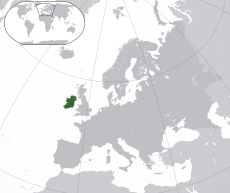
EU location IRL.png 1,600 × 1,200; 470 KB
-
European Highways UK-EI tp.png 2,148 × 2,868; 53 KB
-
European Highways UK-EI.png 1,587 × 2,696; 144 KB
-
Eóin Mac Suibhne (map).png 1,080 × 690; 185 KB
-
Finding Carrowmore Easy.jpg 3,088 × 2,090; 1.12 MB
-
Finding Carrowmore Grey1.jpg 3,088 × 2,090; 1.22 MB
-
FLII Ireland.png 937 × 895; 265 KB
-
Gaeilig in Uladh.jpg 330 × 364; 25 KB
-
GalwayBayMap.png 544 × 342; 11 KB
-
Gemeinden Irland 2020.png 2,500 × 2,916; 918 KB
-
Glenconkeyne.png 598 × 448; 33 KB
-
Grille OSI.jpg 500 × 600; 47 KB
-
High Crosses of Ireland (map).png 1,000 × 1,273; 286 KB
-
Icone irlande.png 97 × 124; 20 KB
-
Iland-dios.png 1,500 × 1,967; 1.3 MB
-
ImprovedOutlineMapOfThurlesTownparksTownlandShowingBuiltUpAreaIn1840s.jpg 1,042 × 699; 188 KB
-
InishtrahullRevised.png 4,967 × 4,900; 1.15 MB
-
Ire Port Span.jpg 448 × 578; 22 KB
-
Ireland 1173.jpg 850 × 1,080; 180 KB
-
Ireland circa 900.png 621 × 806; 142 KB
-
Ireland complete wt.png 800 × 1,000; 220 KB
-
Ireland complete-mk.svg 800 × 1,000; 645 KB
-
Ireland complete.png 1,333 × 1,667; 334 KB
-
Ireland complete.svg 800 × 1,000; 581 KB
-
Ireland counties recoloured.jpg 1,792 × 2,258; 1 MB
-
Ireland counties.PNG 332 × 417; 22 KB
-
Ireland electoral areas.png 1,632 × 2,112; 52 KB
-
Ireland electoral divisions.png 1,632 × 2,112; 123 KB
-
Ireland geographical map.png 150 × 190; 50 KB
-
Ireland green orange.PNG 200 × 250; 26 KB
-
Ireland income distribution chart.gif 272 × 273; 23 KB
-
Ireland map blank.png 2,000 × 2,000; 230 KB
-
Ireland map Cork City Magnified copy.jpg 188 × 244; 58 KB
-
Ireland Map County Louth magnified.png 185 × 240; 28 KB
-
Ireland map modern.png 2,000 × 2,000; 582 KB
-
Ireland physical large.png 592 × 706; 70 KB
-
Ireland physical medium.png 373 × 463; 48 KB
-
Ireland physical small.png 218 × 234; 17 KB
-
Ireland regions map.png 795 × 999; 178 KB
-
Ireland regions map.svg 744 × 1,052; 792 KB
-
Ireland regions.svg 2,450 × 3,000; 3.68 MB
-
Ireland smaller orange.png 21 × 26; 3 KB
-
Ireland smaller.png 21 × 26; 298 bytes
-
Ireland Spanish map.gif 340 × 411; 16 KB
-
Ireland transport map.svg 1,450 × 1,807; 720 KB
-
Ireland-Capitals-ko.png 1,630 × 2,078; 169 KB
-
Ireland-Capitals.png 415 × 541; 5 KB
-
Ireland-outline-detailed.svg 1,213 × 1,507; 118 KB
-
Ireland.svg 2,200 × 2,800; 204 KB
-
IrelandBaronies1846Map.png 3,001 × 3,558; 2.46 MB
-
IrelandBaronies1899Map (Carlow).png 349 × 413; 69 KB
-
IrelandBaronies1899Map (Dublin cropped).png 311 × 419; 70 KB
-
IrelandBaronies1899Map (Louth).jpg 517 × 611; 60 KB
-
IrelandBaronies1899Map.png 3,001 × 3,559; 2.3 MB
-
IrelandBMW.png 200 × 249; 26 KB
-
IrelandProvincesNumbered.png 279 × 348; 18 KB
-
IrelandProvincesNumberedv2.png 279 × 348; 43 KB
-
IrelandSER.png 200 × 249; 24 KB
-
IrelandShape.gif 200 × 249; 2 KB
-
Irish car reg.svg 744 × 1,052; 137 KB
-
Irish Grid.svg 485 × 485; 51 KB
-
Irish Internatioanl Exhibtion map, 1907.png 1,263 × 843; 658 KB
-
IrishConservationBoxOverviewMap.png 220 × 280; 3 KB
-
Irishwiki.png 401 × 506; 5 KB
-
IRL Regions.png 400 × 499; 29 KB
-
Irlanda.png 279 × 348; 43 KB
-
Irlande-capitales-fr.PNG 415 × 541; 15 KB
-
Island-of-Ireland.PNG 416 × 543; 11 KB
-
ITM map of Ireland.svg 548 × 684; 162 KB
-
IveaghOld.png 727 × 599; 109 KB
-
Kaart Ierland.png 330 × 355; 13 KB
-
Kerry North-West Limerick (Dáil Éireann constituency).svg 576 × 733; 671 KB
-
Kinsale Gas Field Map.png 196 × 184; 12 KB
-
Leitrim-Roscommon North Dáil constituency 1921-1923.png 728 × 928; 49 KB
-
Letters from England, Ireland.jpg 1,893 × 2,184; 1,004 KB
-
Limerick City-Limerick East Dáil constituency 1921-1923.png 728 × 928; 49 KB
-
LismakeeveTownlandInGlenkeenCivilParishInNorthTipperary.jpg 4,000 × 2,328; 1.89 MB
-
LittletonElectoralDivision2011.jpg 1,600 × 1,664; 611 KB
-
Location map Ireland County Carlow.png 565 × 686; 242 KB
-
Location map Ireland County Cavan.png 1,095 × 794; 631 KB
-
Location map Ireland County Clare.png 1,368 × 845; 749 KB
-
Location map Ireland County Cork.jpg 1,202 × 764; 167 KB
-
Location map Ireland County Cork.png 1,202 × 764; 920 KB
-
Location map Ireland County Donegal.png 870 × 758; 499 KB
-
Location map Ireland County Dublin.png 622 × 843; 541 KB
-
Location map Ireland County Galway.png 1,273 × 770; 621 KB
-
Location map Ireland County Kerry.png 845 × 832; 462 KB
-
Location map Ireland County Kildare.png 615 × 780; 351 KB
-
Lough Sheelin map.JPG 3,648 × 2,736; 2.48 MB
-
Lough Sheelin.png 908 × 1,159; 77 KB
-
LoughFoyleCloseup.png 544 × 393; 9 KB
-
Map ireland.png 466 × 582; 25 KB
-
Map of Celtic Nations.svg 675 × 1,300; 97 KB
-
Map of Ireland and Cenel nEogain.gif 434 × 542; 14 KB
-
Map of Ireland's capitals.png 1,630 × 2,078; 136 KB
-
Map of ireland.jpg 466 × 350; 49 KB
-
Map of the Laois-Offaly Plantation.jpg 388 × 636; 104 KB
-
Mapa da Irlanda (OCHA).svg 254 × 254; 965 KB
-
Mapa irských hlavních měst.png 1,630 × 2,078; 429 KB
-
Mappa an Mor Keltek.png 431 × 719; 24 KB
-
Mayo North and West Dáil constituency 1921-1923.png 728 × 928; 49 KB
-
Mayo South-Roscommon South Dáil constituency 1921-1923.png 728 × 928; 49 KB
-
McGlinchey's Ireland.png 719 × 891; 249 KB
-
Meath-Westmeath Map, Ireland.png 1,449 × 1,807; 322 KB
-
Mid-West Region Map Ireland 2018.png 800 × 998; 193 KB
-
Midlands Gateway Mullingar Tullamore Athlone.JPG 300 × 400; 19 KB
-
MoycarkeyElectorDivision2011InTipperary.jpg 1,600 × 1,664; 611 KB
-
MoycarkyTownlandWithinMoycarkyCivilParishCountyTipperary.jpg 2,000 × 3,108; 586 KB
-
Mumhan.PNG 279 × 348; 45 KB
-
National Football League 2024 map.png 2,523 × 2,806; 743 KB
-
National Parks in the Republic of Ireland.jpg 786 × 993; 108 KB
-
Newborderregionboundary.png 798 × 1,000; 148 KB
-
NI McGlinchey map.png 1,077 × 927; 231 KB
-
Nine Years War January1600.png 794 × 1,035; 355 KB
-
NoardTownlandInBorrisleighCivilParish.jpg 220 × 278; 36 KB
-
Northern and Southern Ireland.png 415 × 541; 14 KB
-
Northern Ireland (United Kingdom) - DPLA - 596b86de7934c339ac9f70146aace10b.jpg 3,270 × 2,558; 1.24 MB
-
Northern Ireland C. 1500.png 1,494 × 1,018; 468 KB
-
Northern Ireland C1500.png 1,359 × 860; 449 KB
-
ParkstownWIthinBallymurreenCivilParishCountyTipperary.jpg 349 × 599; 68 KB
-
PevsnerIreland.gif 1,450 × 1,807; 161 KB
-
Plebiscite on the Constitution of Ireland, 1937 map.png 980 × 900; 55 KB
-
Population density of Ireland counties.png 2,599 × 3,243; 555 KB
-
Provinces of Ireland (light colors) simple.svg 280 × 361; 58 KB
-
Príomhchathracha na hÉireann.png 1,630 × 2,078; 275 KB
-
PSNImap.PNG 384 × 489; 6 KB
-
RaheltyElectoralDivision2011.jpg 1,600 × 1,664; 612 KB
-
Repartition of Ireland.png 977 × 628; 24 KB
-
Repoblek Iwerdhon Mappa.png 250 × 312; 20 KB
-
Republic of Ireland+Northern Ireland.png 1,000 × 696; 61 KB
