Category:Maps of Netherlands New Guinea
Wikimedia category | |||||
| Upload media | |||||
| Instance of | |||||
|---|---|---|---|---|---|
| Category combines topics | |||||
| Netherlands New Guinea | |||||
1949–1962 Dutch possession in Southeast Asia | |||||
| Instance of | |||||
| Capital | |||||
| Basic form of government | |||||
| Anthem | |||||
| Currency | |||||
| Inception |
| ||||
| Dissolved, abolished or demolished date |
| ||||
| Area |
| ||||
| Religion or worldview | |||||
| Replaces |
| ||||
| Replaced by | |||||
 | |||||
Media in category "Maps of Netherlands New Guinea"
The following 22 files are in this category, out of 22 total.
-
(1881) CARTE DE LA NOUVELLE-GUINEE OCCIDENTALE.jpg 3,681 × 2,833; 4.41 MB
-
Japanese Hollandia Operation.jpg 800 × 575; 121 KB
-
Kaart-Geelvink-Baai.jpg 3,000 × 2,158; 1.08 MB
-
Modern travel, a record of exploration, travel (1921) (14777572154).jpg 2,254 × 3,644; 1.06 MB
-
NetherlandsNewGuinea-1916.jpg 3,000 × 1,895; 6.3 MB
-
New Guinea 1884-1919 w contested boundary.png 618 × 319; 26 KB
-
New Guinea and New Caledonia 1884 (Papua New Guinea).jpg 1,600 × 1,083; 347 KB
-
NNG afd Centraal Nieuw Guinea.png 397 × 330; 32 KB
-
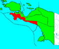
NNG afd FakFak.png 397 × 330; 32 KB
-
NNG afd Geelvinkbaai.png 397 × 330; 32 KB
-
NNG afd Hollandia.png 397 × 330; 33 KB
-
NNG afd West Nieuw Guinea.png 397 × 330; 32 KB
-
NNG afd Zuid Nieuw Guinea.png 397 × 330; 33 KB
-
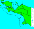
NNG afdelingen blanco.png 397 × 330; 33 KB
-
NNG afdelingen.png 397 × 330; 34 KB
-
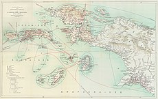
Nova Guinea - Vol 3 - Map (cropped).jpg 2,098 × 1,338; 723 KB
-
Nova Guinea - Vol 3 - Map.jpg 3,272 × 2,177; 3.41 MB
-
USAMS New Guinea Map Series T401 SA 53-5 Geelvink Bay.jpg 4,308 × 4,757; 3.8 MB
-
West Papua - Grasberg Mine loc map.jpg 550 × 362; 68 KB
-
West Papua linguistic map.png 3,848 × 3,100; 3.39 MB


