Category:Maps of Qatar
Wikimedia category | |||||
| Upload media | |||||
| Instance of | |||||
|---|---|---|---|---|---|
| Category combines topics | |||||
 | |||||
See also:
Subcategories
This category has the following 22 subcategories, out of 22 total.
- Blank maps of Qatar (3 F)
C
D
- Maps of Doha (6 F)
F
H
L
- Location maps of Qatar (4 F)
M
O
- Old maps of Qatar (47 F)
P
R
S
T
Media in category "Maps of Qatar"
The following 44 files are in this category, out of 44 total.
-
20220121 DM Overview2021 repatriation v2.pdf 1,754 × 1,239; 757 KB
-
Al Daayen localities.png 87 × 150; 6 KB
-
Al Khor localities.png 451 × 299; 17 KB
-
Al Shamal localities.png 353 × 248; 9 KB
-
Al Wakrah localities.png 369 × 520; 21 KB
-
Caliph Abu Bakr's empire at its peak2-mohammad adil rais.PNG 1,196 × 580; 44 KB
-
CIAIranKarteOelGas.jpg 687 × 705; 51 KB
-
ECHO Qatar Editable A4 Portrait.pdf 1,239 × 1,754; 218 KB
-
ECHO Qatar Editable A4 Portrait.png 794 × 1,123; 235 KB
-
Electrical Power Grid - UAE + Qatar.png 5,233 × 3,528; 1.09 MB
-
Fasht Al Dibal 1909.jpg 732 × 1,200; 156 KB
-
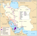
Iran key Petroleum Sector facilities 2004-es.svg 1,034 × 998; 1.65 MB
-
Iran key Petroleum Sector facilities 2004.svg 1,034 × 998; 554 KB
-
Iranian borders in Omans and Persian Gulf (Cro).PNG 1,410 × 770; 1.65 MB
-
Katāras wālsts.png 466 × 637; 26 KB
-
Katārs.png 466 × 637; 26 KB
-
Map Praying Mantis.png 517 × 378; 152 KB
-
Mapa do Catar (OCHA).svg 254 × 254; 705 KB
-
Mapa Katar.jpg 351 × 753; 37 KB
-
Municipalities of Qatar 2014.png 2,000 × 1,900; 244 KB
-
Municipalities of Qatar mk.svg 1,044 × 2,005; 30 KB
-
Municipalities of Qatar.svg 1,044 × 2,005; 36 KB
-
Population density of Qatar municipalities.png 2,034 × 2,121; 204 KB
-
Qatar - DPLA - 76ee80690920b183c48aa6a978249580.jpg 2,548 × 3,272; 6.04 MB
-
Qatar Base Map.png 753 × 1,001; 205 KB
-
Qatar be.png 631 × 599; 55 KB
-
Qatar Flights.png 1,048 × 380; 183 KB
-
Qatar governorates english.png 500 × 1,032; 21 KB
-
Qatar governorates numbered english.png 200 × 413; 8 KB
-
Qatar Mineral map.gif 652 × 813; 64 KB
-
Qatar municipalities map after 2004 reorganization english.svg 459 × 800; 134 KB
-
Qatar Population Density, 2000 (5457018047).jpg 2,550 × 3,265; 658 KB
-
Qatar Population Density, 2000 (6171917057).jpg 2,322 × 3,160; 572 KB
-
Qatar Rail1.jpg 1,856 × 1,754; 222 KB
-
Qatar Rail2.jpg 1,856 × 1,754; 271 KB
-
Qatar, administrative divisions - mk - monochrome.svg 1,039 × 987; 149 KB
-
QatarOMCmap-ar.png 497 × 721; 42 KB
-
QatarOMCmap.png 497 × 721; 23 KB
-
Salwa-canal-Saudi-ar-Qatar-en.jpg 631 × 599; 38 KB
-
Salwa-canal-Saudi-ar-Qatar-fr.jpg 631 × 599; 38 KB
-
Umm Salal localities.png 145 × 139; 3 KB
-
Un-qatar.png 1,905 × 2,859; 806 KB
-
Visa requirements for Qatari citizens 2017.png 1,425 × 625; 37 KB
-
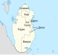
Општини во Катар.svg 459 × 800; 166 KB


