Category:Maps of Veneto
- Regions of Italy: Abruzzo · Aosta Valley · Apulia · Basilicata · Calabria · Campania · Emilia-Romagna · Friuli-Venezia Giulia · Lazio · Liguria · Lombardy · Marche · Molise · Piedmont · Sardinia · Sicily · Trentino-South Tyrol · Tuscany · Umbria · Veneto
Wikimedia category | |||||
| Upload media | |||||
| Instance of | |||||
|---|---|---|---|---|---|
| Category combines topics | |||||
| Veneto | |||||
region in Italy | |||||
| Spoken text audio | |||||
| Instance of | |||||
| Part of |
| ||||
| Patron saint | |||||
| Location | Italy | ||||
| Located in or next to body of water | |||||
| Located on street |
| ||||
| Transport network | |||||
| Capital | |||||
| Legislative body | |||||
| Executive body |
| ||||
| Head of government |
| ||||
| Airline hub |
| ||||
| Inception |
| ||||
| Significant event |
| ||||
| Population |
| ||||
| Area |
| ||||
| Elevation above sea level |
| ||||
| Connecting line |
| ||||
| official website | |||||
 | |||||
Use the appropriate category for maps showing all or a large part of Veneto. See subcategories for smaller areas:
| If the map shows | Category to use |
|---|---|
| Veneto on a recently created map | Category:Maps of Veneto or its subcategories |
| Veneto on a map created more than 70 years ago | Category:Old maps of Veneto or its subcategories |
| the history of Veneto on a recently created map | Category:Maps of the history of Veneto or its subcategories |
| the history of Veneto on a map created more than 70 years ago | Category:Old maps of the history of Veneto or its subcategories |
Subcategories
This category has the following 12 subcategories, out of 12 total.
Media in category "Maps of Veneto"
The following 62 files are in this category, out of 62 total.
-
Italy Regions Veneto Map.png 220 × 257; 18 KB
-
ItalyVeneto.png 269 × 314; 5 KB
-
Regione-Veneto-Posizione.png 200 × 233; 22 KB
-
VEN-Mappa.png 300 × 349; 9 KB
-
12 Venezia.png 2,847 × 1,808; 266 KB
-
15 Vittorio Veneto.png 3,200 × 2,356; 581 KB
-
Carta Veneto Soverzene.jpg 720 × 480; 77 KB
-
Chioggia - Mappa.svg 1,000 × 1,088; 4.57 MB
-
Circoscrizione Veneto 1 (Camera dei Deputati).png 1,632 × 2,112; 122 KB
-
Circoscrizione Veneto 2 (Camera dei Deputati).png 1,632 × 2,112; 122 KB
-
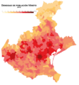
Densidad Véneto.png 2,000 × 2,141; 506 KB
-
Densita Veneto.png 2,000 × 2,141; 505 KB
-
Fasce altimetriche Conselve.jpg 4,677 × 3,307; 982 KB
-
Fiumi medio veneto.svg 1,050 × 600; 964 KB
-
Foto dell'aviazione inglese su Cesuna.jpg 2,012 × 2,596; 1.25 MB
-
Friulano & Co..JPG 847 × 623; 70 KB
-
Idioma véneto.PNG 1,001 × 767; 204 KB
-
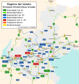
Infrastrutture Veneto 2030.svg 950 × 1,000; 1.56 MB
-
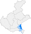
Kaart Italie Verona.png 329 × 353; 19 KB
-
Ladinia towns.gif 1,028 × 686; 32 KB
-
Lusiana-Conco territorio2.png 1,000 × 977; 142 KB
-
Map Cultural heritage and environment II 1992 - Touring Club Italiano CART-TEM-113.jpg 5,000 × 3,419; 12.42 MB
-
Mappa lidar zona Monte Castello Arquà Petrarca.png 703 × 661; 640 KB
-
Mappa regioni con movimenti indipendentisti.png 480 × 600; 75 KB
-
MappaCiclabilePeschieraMantova.jpg 502 × 604; 56 KB
-
MappaCiclabileValsugana.jpg 1,220 × 752; 125 KB
-
MappaPistaCiclabileDolomiti.jpg 770 × 760; 72 KB
-
MappaValpolicella.jpg 945 × 891; 108 KB
-
Ordinary statute regions of Italy.svg 735 × 867; 74 KB
-
Parco-Dolomiti Bellunesi-Posizione.png 269 × 313; 36 KB
-
PatreveES.jpg 2,000 × 2,141; 428 KB
-
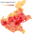
Población Veneto.png 2,000 × 2,141; 555 KB
-
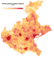
Popolazione Veneto.png 2,000 × 2,141; 553 KB
-
Positionofbassanodelgrappa.png 450 × 432; 196 KB
-
ProduzioneValpolicella.jpg 1,417 × 1,602; 252 KB
-
Provinciapro.JPG 229 × 287; 19 KB
-
Quartiere Operaio di Schio.jpg 3,058 × 1,987; 1.71 MB
-
Regione thumb Veneto.svg 224 × 248; 474 KB
-
RossoTreviso - Mappa.svg 1,000 × 1,088; 4.57 MB
-
Scaligerburgen.jpg 1,500 × 926; 136 KB
-
Serraglio.jpg 1,137 × 487; 142 KB
-
Tracciato pedemontana veneta.svg 1,050 × 660; 687 KB
-
Tracciato SR203.jpg 673 × 1,663; 215 KB
-
Tredici Comuni.svg 3,815 × 4,599; 185 KB
-
Triveneto-fr.svg 720 × 643; 102 KB
-
Triveneto.svg 720 × 643; 86 KB
-
Urban-Rural Population and Land Area Estimates, v2, 2010 Northeast Italy (13873744025).jpg 3,200 × 2,417; 1.07 MB
-
Variación población Véneto.png 2,000 × 2,141; 729 KB
-
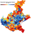
Variazione Veneto.png 2,000 × 2,141; 729 KB
-
VariegatoCastello - Mappa.svg 1,000 × 1,088; 4.57 MB
-
Venetian Dialects Map.png 1,769 × 1,467; 385 KB
-
VenetianRepublic 1790 EN 75dpi.png 3,172 × 1,784; 1.96 MB
-
Veneto in Italy.svg 1,034 × 1,299; 1.67 MB
-
Veneto map wikivoyage.png 6,414 × 6,488; 1.79 MB
-
Veneto provinces.png 795 × 810; 18 KB
-
Venezia Euganea (1935-1947).png 350 × 424; 10 KB
-
Venezia Euganea (1947-1954).png 350 × 424; 10 KB
-
Venezia Euganea (1954-1963).png 350 × 424; 10 KB
-
Venezie.PNG 1,169 × 826; 1.45 MB
-
Wikipedia svg logo-vec.svg 135 × 155; 153 KB
-
WikiVeneto.png 125 × 144; 12 KB


