Category:Maps of Vienna
States of Austria:  Burgenland ·
  Carinthia ·
  Lower Austria ·
  Salzburg ·
  Styria ·
  Tyrol ·
  Upper Austria ·
  Vienna ·
  Vorarlberg
Wikimedia category | |||||
| Upload media | |||||
| Instance of | |||||
|---|---|---|---|---|---|
| Category combines topics | |||||
| Vienna | |||||
capital of and state in Austria | |||||
| Spoken text audio | |||||
| Instance of |
| ||||
| Named after | |||||
| Location |
| ||||
| Located in or next to body of water | |||||
| Legislative body | |||||
| Head of government |
| ||||
| Present in work |
| ||||
| Founded by | |||||
| Inception |
| ||||
| Highest point | |||||
| Population |
| ||||
| Area |
| ||||
| Elevation above sea level |
| ||||
| Replaces | |||||
| Different from | |||||
| official website | |||||
 | |||||
Use the appropriate category for maps showing all or a large part of Vienna. See subcategories for smaller areas:
| If the map shows | Category to use |
|---|---|
| Vienna on a recently created map | Category:Maps of Vienna or its subcategories |
| Vienna on a map created more than 70 years ago | Category:Old maps of Vienna or its subcategories |
| the history of Vienna on a recently created map | Category:Maps of the history of Vienna or its subcategories |
| the history of Vienna on a map created more than 70 years ago | Category:Old maps of the history of Vienna or its subcategories |
Deutsch: Karten von Wien
English: Maps of Vienna
Subcategories
This category has the following 15 subcategories, out of 15 total.
!
1
- 1891 maps of Vienna (1 F)
- 1893 maps of Vienna (1 F)
- 1938 maps of Vienna (2 F)
D
- District maps of Vienna (48 F)
E
- Election maps of Vienna (11 F)
F
M
- Maps of the Danube in Vienna (29 F)
O
- OpenStreetMap maps of Vienna (36 F)
P
S
V
Media in category "Maps of Vienna"
The following 83 files are in this category, out of 83 total.
-
Austria Vienna relief location map.jpg 1,669 × 1,312; 411 KB
-
Allied occupation sectors in Vienna (1945-1955).png 1,400 × 712; 78 KB
-
AuslaenderanteileWien1997.png 650 × 969; 148 KB
-
Austria Vienna location map.svg 1,669 × 1,312; 158 KB
-
Besatzungszonen Wien.png 300 × 234; 40 KB
-
Bezirksteile Landstraße.png 2,495 × 1,936; 120 KB
-
Bistum Wien Geschichte.png 179 × 350; 11 KB
-
Brauereibahn Liesing westlich.jpg 2,700 × 1,490; 2.75 MB
-
Das roemische Wien.png 971 × 803; 532 KB
-
Exkurze wikipedistů v Vědecké knihovně Olomouc 11.jpg 2,560 × 1,440; 1.24 MB
-
Exkurze wikipedistů v Vědecké knihovně Olomouc 13.jpg 2,560 × 1,440; 1.59 MB
-
FestungWien1704.gif 770 × 463; 64 KB
-
Fundstellen ZS Vindobona.png 896 × 793; 1.16 MB
-
Gemeindebezirke Wiens.svg 273 × 173; 24 KB
-
GIP Detailansicht Wien, Kreuzung Schottenring-Börsegasse.png 1,500 × 911; 715 KB
-
Graben ele 2.jpg 610 × 464; 204 KB
-
GuentherZ 2011-01-01 0004 Wien Stadtwanderweg3 Tafel.jpg 1,800 × 1,205; 1.41 MB
-
HQL Plan 3C.jpg 1,772 × 1,064; 381 KB
-
HQL Plan 4C.svg 1,140 × 655; 289 KB
-
Ineos-159-challenge-strecke-de.png 712 × 723; 467 KB
-
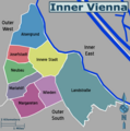
Inner Vienna map.png 3,000 × 3,021; 622 KB
-
Josefsdorfer Waldfriedhof Plan.jpg 6,300 × 8,400; 773 KB
-
Karte Alliierte Besatzungszonen in Österreich von 1945 bis 1955.png 2,624 × 1,408; 335 KB
-
Karte ehemaliger Vorstädte von Wien.png 980 × 820; 870 KB
-
Karte Terroranschlag in Wien 2020.png 1,242 × 1,200; 1.39 MB
-
Kunstwerke im öffentlichen Raum - plan.jpg 2,968 × 4,440; 4.43 MB
-
Land use in Vienna.png 1,312 × 768; 503 KB
-
Landstraße bezirksteil.png 2,495 × 1,936; 125 KB
-
Landstraße bezirksteile.pdf 879 × 912; 369 KB
-
Map at Meidling.png 674 × 575; 27 KB
-
Map GetreidemarktNaschmarkt.jpeg 3,024 × 4,032; 3.55 MB
-
NPDA 2019.jpg 3,742 × 2,214; 1,024 KB
-
OPEC Siege.pdf 1,275 × 1,650; 415 KB
-
Parish area of Breitenfeld-Vienna.png 1,293 × 2,009; 1.16 MB
-
Pfarrwiese 1912-1978 in Wien Hütteldorf.jpg 3,162 × 2,221; 342 KB
-
Schleppbahn Liesing anfangs Wagenmann-Seybel.jpg 1,466 × 490; 1.08 MB
-
Schleppbahn Liesing Gleise Anbindung Bhf.jpg 1,921 × 3,841; 2.97 MB
-
Schleppbahn Liesing Gleise mitte-südlich.jpg 4,619 × 3,904; 7.19 MB
-
Schleppbahn Liesing Gleise westlich.jpg 4,705 × 2,151; 5.01 MB
-
Schleppbahn Liesing Gleise östlich.jpg 3,439 × 2,759; 4 MB
-
Schleppbahn Liesing Industriegebiet.jpg 7,520 × 2,507; 5.52 MB
-
Schleppbahntrasse Parschegasse.jpg 1,918 × 1,268; 1.13 MB
-
Schwarzplan Wien.png 2,923 × 2,066; 7.75 MB
-
Setagayapark, Vienna, Austria-basemap.at - map.png 879 × 1,212; 326 KB
-
SprungschanzenWienKarte kl.jpg 1,394 × 1,068; 840 KB
-
Stadtpark map satellite.png 835 × 993; 1.78 MB
-
T C Lotter Wien Vorstädte.jpg 3,717 × 4,243; 1.85 MB
-
Terroranschlag Wien 2020 – Karte.png 756 × 460; 328 KB
-
V12p428001 Vienna.jpg 330 × 337; 40 KB
-
Vienna Allied sectors (1945-1955) hu.png 1,642 × 835; 294 KB
-
Vienna Allied sectors (1945-1955).png 1,280 × 651; 172 KB
-
Vienna city map.svg 1,113 × 875; 1.98 MB
-
Vienna map.svg 1,000 × 783; 2.61 MB
-
Vienna urban growth.jpg 5,955 × 22,060; 18.33 MB
-
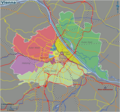
Vienna Wikivoyage Map.png 3,000 × 2,812; 2.08 MB
-
Vienna Wikivoyage Map.svg 2,822 × 2,645; 335 KB
-
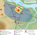
Vindobona 250-300 FR.svg 1,116 × 1,068; 755 KB
-
Vindobona 250-300 no.svg 1,116 × 1,068; 268 KB
-
Vindobona 250-300.es.svg 1,116 × 1,068; 265 KB
-
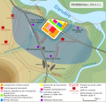
Vindobona 250-300.svg 1,116 × 1,068; 268 KB
-
Wenen Kaart (wp).png 1,440 × 818; 166 KB
-
Wien 01 Paradeplatz a.jpg 1,001 × 1,001; 643 KB
-
Wien 09 Neu-Wien a.jpg 1,725 × 970; 825 KB
-
Wien 10 Altes Landgut f.jpg 3,000 × 1,688; 1.96 MB
-
Wien Besatzungszonen-he.png 1,280 × 651; 218 KB
-
Wien Besatzungszonen.png 1,400 × 712; 92 KB
-
Wien Energie Stromnetz 380kV.svg 829 × 649; 47 KB
-
Wien Goldenes U.jpg 2,512 × 1,887; 1.36 MB
-
Wien map.png 2,057 × 1,455; 620 KB
-
Wien-Albern-Friedhof-für-Ertrunkene-(1873).jpg 2,817 × 2,113; 4.06 MB
-
Wien-Döbling-Leopoldsberg-Drahtseilbahn-Lageplan-(1876).jpg 1,356 × 2,337; 1.23 MB
-
WienStrom Versorgungsgebiet W NÖ B.jpg 640 × 734; 259 KB


