Category:Maps of Wallonia
Wikimedia category | |||||
| Upload media | |||||
| Instance of | |||||
|---|---|---|---|---|---|
| Category combines topics | |||||
| Walloon Region | |||||
region of Belgium | |||||
| Pronunciation audio | |||||
| Instance of | |||||
| Part of | |||||
| Named after | |||||
| Location | Belgium | ||||
| Capital | |||||
| Legislative body | |||||
| Official language | |||||
| Anthem |
| ||||
| Head of government |
| ||||
| Inception |
| ||||
| Highest point | |||||
| Population |
| ||||
| Area |
| ||||
| Elevation above sea level |
| ||||
| Different from | |||||
| official website | |||||
 | |||||
Use the appropriate category for maps showing all or a large part of Walloon Region. See subcategories for smaller areas:
| If the map shows | Category to use |
|---|---|
| Walloon Region on a recently created map | Category:Maps of Wallonia or its subcategories |
| Walloon Region on a map created more than 70 years ago | Category:Old maps of Wallonia or its subcategories |
| the history of Walloon Region on a recently created map | Category:Maps of the history of Wallonia or its subcategories |
| the history of Walloon Region on a map created more than 70 years ago | Category:Old maps of the history of Wallonia or its subcategories |
Subcategories
This category has the following 12 subcategories, out of 12 total.
Pages in category "Maps of Wallonia"
This category contains only the following page.
Media in category "Maps of Wallonia"
The following 41 files are in this category, out of 41 total.
-
Ardennen03.png 1,095 × 917; 150 KB
-
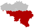
Belgium region Wallonia black.svg 307 × 251; 98 KB
-
Belgiumlux.png 1,118 × 895; 135 KB
-
Capuchins.png 1,544 × 1,080; 1.11 MB
-
Carte des corps de volontaires de 1830.jpg 1,290 × 882; 213 KB
-
Condroz decoupage.jpg 856 × 451; 83 KB
-
Condroz map.png 507 × 315; 16 KB
-
Dalhem-comte.jpg 1,677 × 1,537; 478 KB
-
Die Niederland Nach denen XVII Provincien Eingetheilet (11170024).jpg 8,211 × 4,777; 18.75 MB
-
Die Niederland Nach denen XVII Provincien Eingetheilet (11170024).png 8,211 × 4,777; 56.91 MB
-
Fagne.jpg 280 × 200; 12 KB
-
France Wallonia Brussels map.svg 723 × 708; 1.12 MB
-
France Wallonia map.svg 723 × 708; 1.12 MB
-
France-et-Wallonie.gif 473 × 256; 5 KB
-
France-Wallonie-avec Bruxelles.svg 678 × 663; 1.14 MB
-
France-Wallonie-Bruxelles in red.svg 678 × 663; 1.14 MB
-
France-Wallonie-sans Bruxelles.svg 678 × 663; 1.13 MB
-
Map of Wallonia.png 398 × 335; 6 KB
-
Mape Alphonse Maréchal 1926.jpg 700 × 453; 306 KB
-
Occupation sol wallonie.jpg 1,078 × 829; 441 KB
-
Proposed Wallonia in 1905.svg 1,650 × 1,344; 226 KB
-
Province wallonne des Capucins au XVIIe siècle.png 394 × 480; 333 KB
-
Provinces of Wallonia (he).svg 938 × 544; 19 KB
-
Provinces of Wallonia.svg 938 × 544; 19 KB
-
Provincia2.png 242 × 295; 61 KB
-
Region Wallonien 2019.png 1,136 × 990; 334 KB
-
Reichsgau Wallonien.svg 450 × 456; 509 KB
-
Wa-mape veyes do do Marok al Walonreye.jpg 1,496 × 2,256; 458 KB
-
Wallonia (Belgium) location.svg 1,136 × 945; 133 KB
-
Wallonia (Belgium).png 270 × 270; 972 bytes
-
Wallonia (Belgium).svg 307 × 251; 68 KB
-
Wallonia stub.png 137 × 82; 11 KB
-
Wallonia travel map.png 3,000 × 1,738; 755 KB
-
Wallonia-blank.svg 872 × 567; 166 KB
-
Wallonia.png 270 × 270; 3 KB
-
Wallonie-map.jpg 321 × 340; 18 KB
-
WalloniëProvincies.png 810 × 477; 47 KB
-
Walloon Region in Belgium and Europe.svg 680 × 520; 2.36 MB
-
Walonreye Mouze.jpg 1,983 × 1,603; 491 KB
-
Wax-Belgium location Walloon Region.svg 510 × 407; 104 KB


