Category:Maps of conflicts
Ongoing armed conflicts ( Countries Maps )
|
|---|
|
National or regional Maps of ongoing insurgencies, armed conflicts, disputes of territories, military conflicts, and also current civil or international wars : Overview Maps:
National-wide Maps:
National-wide Maps of areas of activity:
Note: Comments "areas of activity" means that this is not territorial control is shown. Sub-national-wide Maps:
See also:
Category:Conflicts in 2024 (with list of countries in ongoing armed conflicts) Template:City maps of ongoing civil wars (Local maps) |
Ongoing armed conflicts ( Local & City Maps )
|
|---|
|
Local or city Maps of ongoing insurgencies, armed conflicts, disputes of territories, military conflicts, and also current civil or international wars :
|
Subcategories
This category has the following 11 subcategories, out of 11 total.
2
- Maps of conflicts in 2016 (52 F)
B
C
- Conflict maps of the world (59 F)
D
G
M
- Maps of the Mexican Drug War (19 F)
W
Media in category "Maps of conflicts"
The following 35 files are in this category, out of 35 total.
-
Map of terror of the Islamic State (ad-Daula al-islāmiyya).png 2,753 × 1,400; 127 KB
-
Approximate map of the Bakassi Conflict.png 1,053 × 961; 243 KB
-
Attacks on U.S. bases in Iraq and Syria (2023–present).svg 2,431 × 1,966; 845 KB
-
Carter-lake-map.png 575 × 425; 37 KB
-
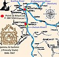
Conflict Kashmir.jpg 613 × 593; 168 KB
-
Cy-map.svg 1,487 × 784; 295 KB
-
Czechoslovakia Poland Border adjustments 1919-1945 ES.svg 1,000 × 404; 52 KB
-
Czechoslovakia Poland Border adjustments 1919-1945 hu.svg 1,000 × 404; 122 KB
-
Czechoslovakia Poland Border adjustments 1919-1945-pt.svg 1,000 × 404; 52 KB
-
Czechoslovakia Poland Border adjustments 1919-1945.svg 1,000 × 404; 121 KB
-
Detailed map of the Afghan tribal revolts of 1944–1947 (No text).png 5,000 × 5,145; 992 KB
-
Detailed map of the Afghan tribal revolts of 1944–1947.png 5,000 × 5,145; 1.41 MB
-
ECDM 20221103 DM Disasters20212022Overview CLIMA.pdf 1,754 × 1,239; 1.06 MB
-
ECDM 20230629 DM Disasters2021-2022Overview CLIMA(2).pdf 1,754 × 1,239; 734 KB
-
Sinai insurgency.svg 499 × 796; 246 KB
-
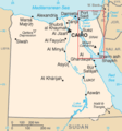
Sinai map.PNG 327 × 350; 30 KB
-
Fourth Fitna.svg 1,000 × 599; 285 KB
-
Gyunnyut Operation.png 798 × 401; 628 KB
-
Map of Gunnut Operation.jpg 653 × 711; 111 KB
-
Map of military operations in Slovakia (1919).png 3,684 × 1,517; 396 KB
-
Map of the Afghan tribal revolts of 1944–1947.png 2,078 × 2,425; 132 KB
-
Mapa Países donde ha intervenido el Grupo Wagner.png 4,404 × 3,049; 1.02 MB
-
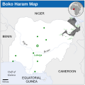
Boko Haram insurgency map.svg 954 × 734; 399 KB
-
Islamist insurgency in Nigeria.svg 254 × 254; 412 KB
-
Pakistan-Waziristan-Map.png 700 × 692; 96 KB
-
Situation of the Civil War of Suriname.png 2,942 × 2,994; 247 KB
-
Slovakia borderPoland uk.png 1,252 × 847; 140 KB
-
Slovakia borderPoland.png 1,000 × 404; 46 KB
-
Terror-attack-brussels-03-2016-map-GER.svg 977 × 746; 5.25 MB
-
The Third World – Cockpit of Conflict, Africa.png 758 × 673; 103 KB
-
Villages destroyed in the Darfur Sudan 2AUG2004.jpg 1,500 × 1,500; 878 KB
-
Zones registering Sendero Luminoso (Shining Path) activity.svg 820 × 1,000; 1.44 MB
-
Zypernkonflikt.svg 836 × 528; 73 KB


