Category:Maps of rivers in Nebraska
States of the United States: Alabama · Alaska · Arizona · Arkansas · California · Colorado · Connecticut · Delaware · Florida · Georgia · Idaho · Illinois · Indiana · Iowa · Kansas · Kentucky · Louisiana · Maine · Maryland · Massachusetts · Michigan · Minnesota · Mississippi · Missouri · Montana · Nebraska · Nevada · New Hampshire · New Jersey · New Mexico · New York · North Carolina · North Dakota · Ohio · Oklahoma · Oregon · Pennsylvania · Rhode Island · South Carolina · South Dakota · Tennessee · Texas · Utah · Vermont · Virginia · Washington · West Virginia · Wisconsin · Wyoming – Washington, D.C.
Subcategories
This category has the following 3 subcategories, out of 3 total.
S
- South Platte River maps (4 F)
Media in category "Maps of rivers in Nebraska"
The following 17 files are in this category, out of 17 total.
-
Elkhorn river basin map.png 1,500 × 913; 2.26 MB
-
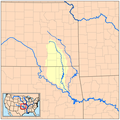
Kansasrivermap.png 654 × 500; 308 KB
-
Loup River basin map.png 1,500 × 913; 2.28 MB
-
Platte basin map.png 1,500 × 913; 2.27 MB
-
Wpdms nasa topo platte river.jpg 300 × 250; 45 KB
-
Platterivermap.jpg 1,382 × 919; 2.29 MB
-
Platterivermap.png 716 × 500; 485 KB
-
Real time gages ne.jpg 1,056 × 816; 293 KB
-
Republican River with Beecher Island highlighted.png 2,047 × 835; 760 KB
-
Southplatterivermap.png 1,106 × 613; 1.23 MB
-
Verdigrisrivermap.png 500 × 500; 126 KB
-
Washington County, Nebraska.svg 512 × 391; 92 KB
-
Wpdms nasa topo elkhorn river nebraska.jpg 300 × 250; 45 KB
-
Wpdms nasa topo keya paha river.jpg 300 × 250; 45 KB
-
Wpdms nasa topo republican river.jpg 300 × 250; 45 KB
-
Wpdms nasa topo south platte river.jpg 300 × 250; 45 KB


