Category:Maps of the history of Switzerland
| NO WIKIDATA ID FOUND! Search for Maps of the history of Switzerland on Wikidata | |
| Upload media |
Subcategories
This category has the following 22 subcategories, out of 22 total.
Media in category "Maps of the history of Switzerland"
The following 153 files are in this category, out of 153 total.
-
Napoleonic Central Europe.jpg 3,937 × 2,855; 2.85 MB
-
35 of 'Histoire de la Nation suisse' (11238732276).jpg 2,144 × 1,785; 934 KB
-
377 of 'Geschichte der schweizerischen Neutralität' (11303460445).jpg 1,502 × 1,432; 382 KB
-
Aare bei Klingnau 1741.jpg 1,024 × 627; 179 KB
-
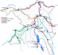
Aargau Eisenbahn1900.png 640 × 600; 32 KB
-
Alamannien es.svg 704 × 626; 824 KB
-
Alamannien Hochburgund ca 1000.png 2,500 × 2,107; 1.11 MB
-
Alamannien IT.svg 704 × 626; 129 KB
-
Alamannien-hu.svg 397 × 350; 627 KB
-
Alamannien.svg 397 × 350; 734 KB
-
Alte Konstanzerstrasse Map1.jpg 1,766 × 2,616; 1.12 MB
-
Amt Pfarrei Gericht Muri.png 600 × 880; 28 KB
-
Archives des sciences physiques et naturelles" (1846-1947.) (19727435576).jpg 3,490 × 2,388; 2.33 MB
-
Atlas Suisse Jungfrau Finsteraarhorn.tiff 1,407 × 1,004; 4.44 MB
-
AtlasTyrolensisDetailFinstermuenzColored.png 746 × 618; 630 KB
-
Bailliage d'Aarwangen.png 472 × 370; 87 KB
-
Bailliage de Bipp.png 306 × 246; 47 KB
-
Bailliage de Flumenthal.png 204 × 185; 18 KB
-
Bailliage de Schenkenberg.png 383 × 354; 76 KB
-
Bailliage Trachselwald.png 656 × 760; 255 KB
-
Baliaggi-transalpini rev.png 1,500 × 1,516; 572 KB
-
Burgunderkriege.png 2,500 × 2,527; 1.13 MB
-
Bündner Wirren Phase 2.jpg 2,500 × 2,250; 3.34 MB
-
Bündner-Wirren Phase1.jpg 2,500 × 2,250; 3.34 MB
-
Bündner-Wirren-Phase-3.jpg 2,500 × 2,250; 2.15 MB
-
C. 1798 Switzerland (1291-1798).jpg 3,879 × 3,031; 5.05 MB
-
Carte Compesieres-1816-1851.png 237 × 235; 39 KB
-
Churraetien.png 2,500 × 2,160; 1.06 MB
-
Circuit de validation du traité de Fribourg.jpg 1,433 × 1,032; 165 KB
-
Confederacion dei VIII Cantons.png 1,146 × 720; 190 KB
-
Drei Bünde Karte 1768.jpg 5,184 × 3,888; 5.95 MB
-
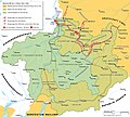
Droysens-255.jpg 2,623 × 1,396; 3.79 MB
-
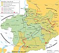
Droysens-25c.jpg 2,610 × 1,403; 4.4 MB
-
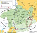
Droysens-25d.jpg 2,626 × 1,390; 3.89 MB
-
Duchy of Swabia locator map (1004).svg 4,431 × 3,875; 4.7 MB
-
Eingemeindung Zuerich.png 1,500 × 1,407; 179 KB
-
Empire carolingien.png 371 × 428; 44 KB
-
File-H1N1 Switzerland Map.svg 1,052 × 744; 360 KB
-
FMIB 39522 Map of Glacial Movements in France and Switzerland.jpeg 1,660 × 1,369; 498 KB
-
Freiamt 1712.png 215 × 360; 9 KB
-
Freiburg territoriale Entwicklung.jpg 1,500 × 1,091; 830 KB
-
Gerichtsherrschaft-Bubikon.svg 570 × 724; 262 KB
-
Gerichtsherrschaften Landvogtei Thurgau.png 2,500 × 1,662; 985 KB
-
Geschichte Graubuenden.png 3,873 × 3,624; 1.84 MB
-
Gingins.png 884 × 661; 292 KB
-
Gliederung Stadtstaat Basel 1798.png 1,500 × 1,266; 285 KB
-
Grafschaft Baden.png 1,084 × 1,594; 148 KB
-
Grafschaft Toggenburg.png 2,000 × 1,599; 328 KB
-
H1N1 Switzerland Map.svg 1,052 × 744; 276 KB
-
H1N1swissmap.png 800 × 566; 72 KB
-
Herrschaft Wädenswil.jpg 667 × 791; 239 KB
-
Herrschaften Graubuenden.png 2,500 × 2,312; 1.05 MB
-
Herrschaftsbereich Lenzburger eng.png 1,000 × 926; 251 KB
-
Herrschaftsbereich Lenzburger.png 1,000 × 926; 139 KB
-
Hist kirchl Einteilung CH.png 2,500 × 1,585; 975 KB
-
Historische Karte CH 18 Jh English.PNG 3,000 × 1,884; 894 KB
-
Historische Karte CH Fokus Vitudurum.png 1,165 × 485; 152 KB
-
Historische Karte CH Helvet.png 1,808 × 1,153; 514 KB
-
Historische Karte CH Rom 1-fr.png 2,500 × 1,594; 807 KB
-
Historische-Karte-des-Kantons-Basel.png 1,000 × 621; 182 KB
-
Historische-Karte-des-Kantons-Freiburg-FR.png 2,000 × 1,454; 603 KB
-
Historische-Karte-des-Kantons-Freiburg.png 2,000 × 1,454; 603 KB
-
Hohe Gerichte Thurgau.png 2,250 × 1,398; 321 KB
-
Kanton Baden.png 1,200 × 2,264; 224 KB
-
Kantone Linth und Saentis.png 800 × 907; 80 KB
-
Karte Alter Zuerichkrieg.png 1,600 × 1,180; 284 KB
-
Karte Besitz-der-Sax.png 1,000 × 1,660; 160 KB
-
Karte Ennetbirgische Vogteien.png 1,500 × 1,516; 570 KB
-
Karte Ennetbirgische Vogteien1.png 850 × 1,147; 552 KB
-
Karte Gemeine-Herrschaften.png 2,000 × 1,268; 245 KB
-
Karte Kanton St.Gallen Bezirke.png 885 × 1,047; 214 KB
-
Karte Koenigreich Burgund DE.png 1,500 × 1,529; 405 KB
-
Karte Stadtstaat Bern vereinfacht-EN.png 2,000 × 1,655; 615 KB
-
Karte Stadtstaat Bern vereinfacht.png 2,000 × 1,655; 604 KB
-
Karte Stadtstaat Bern version-für-svgexport.png 4,000 × 3,401; 1.25 MB
-
Karte Stadtstaat Bern Wachstum.png 2,500 × 2,060; 957 KB
-
Karte Stadtstaat Bern.svg 1,160 × 997; 470 KB
-
Karte von Deutschland, dem Königr. der Niederlande und der Schweiz.jpg 5,821 × 4,769; 7.38 MB
-
Karte Werdenberger.png 1,500 × 2,194; 615 KB
-
Karte Werdenberger1.jpg 1,978 × 2,200; 958 KB
-
Karte Zugewandte Orte.png 1,200 × 761; 211 KB
-
Karte Zweiter Villmergerkrieg 1712.png 3,000 × 1,903; 616 KB
-
Karte-Basler-Kantonstrennung.png 1,500 × 1,014; 245 KB
-
Karte-Departement-Léman-1798.png 2,500 × 2,101; 669 KB
-
Karte-Entstehung-Kanton-Genf.png 2,500 × 1,928; 605 KB
-
Karte-Entwicklung-Savoyen-bis-1789.png 2,500 × 2,542; 1.05 MB
-
Karte-Historische-Entwicklung-Luzern.png 2,000 × 2,444; 734 KB
-
Karte-Historische-Gliederung-Solothurn.png 2,000 × 1,690; 345 KB
-
Karte-Kanton-Genf-1792.png 2,500 × 1,767; 518 KB
-
Karte-Kanton-Genf-1814-Erster-Friede-von-Paris.png 2,500 × 2,210; 621 KB
-
Karte-Kanton-Genf-1815-Pariser-Vertrag.png 2,500 × 2,210; 594 KB
-
Karte-Kanton-Genf-1816-Turiner-Vertrag.png 2,500 × 2,210; 694 KB
-
Karte-Ritterorden.png 1,500 × 951; 148 KB
-
Karte-Ritterorden.svg 2,063 × 1,308; 574 KB
-
Karte-Territoriale-Entwicklung-Kanton-Solothurn.png 2,500 × 2,112; 764 KB
-
Karte-Wachstum-Kanton-Züric.png 2,500 × 2,483; 1.19 MB
-
Karte-Zweiter-Kappelerkrieg.png 2,500 × 1,522; 772 KB
-
KarteSchaffhausen1900.png 972 × 758; 20 KB
-
Landgrafschaft Burgund.png 957 × 865; 112 KB
-
Les districts jurassiens.png 3,077 × 2,092; 600 KB
-
LV Grüningen.png 800 × 1,016; 113 KB
-
LV Kyburg copy.svg 570 × 724; 204 KB
-
Map of the jurassic districts.png 3,077 × 2,092; 594 KB
-
Map Sonderbund War Lucern.jpg 831 × 680; 68 KB
-
Mayorie Chexbres.png 319 × 344; 53 KB
-
Old Swiss Confederation.svg 729 × 529; 162 KB
-
Ostschweiz1798.png 1,000 × 874; 151 KB
-
OV Neuamt.png 800 × 1,016; 104 KB
-
Plan R.A.T.S.png 500 × 376; 94 KB
-
Possessions Billens.png 738 × 640; 285 KB
-
Possessions de la famille de Colombier.png 884 × 661; 299 KB
-
Possessions des Champion.png 884 × 661; 292 KB
-
Possessions Frobourg.png 888 × 820; 395 KB
-
Possessions Grandson.png 2,952 × 2,954; 1.28 MB
-
Possessions Humbert de Savoie.png 1,776 × 2,064; 1.12 MB
-
Rattachement-chablais-faucigny-genevois-savoie-suisse.jpg 900 × 1,139; 1,014 KB
-
Reduit Schweiz Neu.jpg 3,736 × 2,410; 4.6 MB
-
ReduitSchweiz.gif 432 × 295; 16 KB
-
Resultate Partnerschaftsgesetz in der Schweiz.jpg 450 × 290; 103 KB
-
Riviera 1079.png 728 × 704; 110 KB
-
Riviera 1200.png 728 × 704; 115 KB
-
Riviera 1255.png 728 × 704; 114 KB
-
Riviera 1295.png 728 × 704; 113 KB
-
Riviera 1317.png 728 × 704; 113 KB
-
Riviera 1338.png 728 × 704; 114 KB
-
Riviera c.1100.png 728 × 704; 109 KB
-
Roemische Provinzen Alpenraum ca 14 n Chr.jpg 2,000 × 1,351; 1.03 MB
-
Rviera 1363.png 728 × 704; 114 KB
-
Römische Provinzen im Alpenraum 395 n Chr.png 2,500 × 1,688; 659 KB
-
Römische Provinzen im Alpenraum ca 14 n Chr.png 2,497 × 1,688; 739 KB
-
Römische Provinzen im Alpenraum ca 150 n Chr.png 2,500 × 1,688; 1,001 KB
-
SAH in der Schweiz.jpg 578 × 372; 25 KB
-
Schweiz Frühmia Adel.svg 512 × 359; 939 KB
-
Schweiz MA Verkehr.svg 2,233 × 1,418; 1.26 MB
-
Seigneurie Champvent.png 2,952 × 2,954; 1.27 MB
-
Seigneurie d'Aarwangen.png 472 × 370; 102 KB
-
Seigneurie La Mothe.png 2,952 × 2,954; 1.27 MB
-
Seigneuries de la famille de la Baume en Suisse.png 794 × 611; 251 KB
-
Souabe et Haute-Bourgogne.png 2,500 × 2,107; 1.12 MB
-
Souabe et Haute-Bourgogne.svg 733 × 657; 739 KB
-
Souabe et Haute-Bourgogne1.png 1,500 × 1,352; 407 KB
-
Soïssa - Guèrra Civila de 1847.png 2,142 × 1,430; 559 KB
-
Soïssa - Sègle XVIII.png 2,050 × 1,363; 408 KB
-
Struktur Eidgenossenschaft 1474-fr.svg 2,500 × 1,518; 322 KB
-
The Rauracian Republic.png 4,096 × 3,072; 243 KB
-
UBBasel Map 1684 Kartenslg Schw B 4 Tugeni.tiff 11,441 × 8,964, 2 pages; 293.44 MB
-
Übersichtskarte Jurakonflikt.png 3,077 × 2,092; 606 KB
-
Übersichtskarte Jurakonflikt.svg 923 × 628; 1.99 MB


