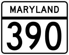
Category:Maryland Route 390
 | number: | (three ninety-) |
|---|---|---|
| State highways in Maryland: | 370 · 371 · 372 · 373 · 374 · 375 · 376 · 377 · 378 · 380 · 381 · 382 · 383 · 384 · 387 · 388 · 390 · 392 · 393 · 396 · 402 · 404 · 405 · 407 · 408 · 410 |
highway in Montgomery County, Maryland, United States | |||||
| Upload media | |||||
| Instance of | |||||
|---|---|---|---|---|---|
| Part of | |||||
| Location | Silver Spring, Montgomery County, Maryland | ||||
| Transport network | |||||
| Connects with |
| ||||
| Owned by | |||||
| Maintained by | |||||
| Inception |
| ||||
| Length |
| ||||
| Terminus |
| ||||
 | |||||
English: This category is for 16th Street in Silver Spring, Maryland.
- For 16th Street as it continues into Washington, D.C., please use 16th Street (Washington, D.C.).
Subcategories
This category has the following 2 subcategories, out of 2 total.
B
- Blair Circle (15 F)
Media in category "Maryland Route 390"
The following 7 files are in this category, out of 7 total.
-
2007 05 22 - 390@2nd@Elkhart - NB 2.JPG 2,592 × 1,944; 1.76 MB
-
2007 05 22 - 390@Spring - E leg 1.JPG 2,592 × 1,944; 1.95 MB
-
2007 05 22 - 390@Spring - E leg 3.JPG 2,592 × 1,944; 1.65 MB
-
2007 05 22 - 390@Spring - SE corner.JPG 2,592 × 1,944; 1.69 MB
-
2007 05 22 - 390@Spring - WB R-turn.JPG 2,592 × 1,944; 1.8 MB
-
Maryland Route 390 map.png 922 × 579; 19 KB
-
MD Route 390.svg 3,000 × 2,400; 12 KB


