Category:Olst-Wijhe
municipality in the Netherlands | |||||
| Upload media | |||||
| Instance of |
| ||||
|---|---|---|---|---|---|
| Location | Overijssel, Netherlands | ||||
| Inception |
| ||||
| Population |
| ||||
| Area |
| ||||
| Elevation above sea level |
| ||||
| Replaces |
| ||||
| official website | |||||
 | |||||
Subcategories
This category has the following 9 subcategories, out of 9 total.
Media in category "Olst-Wijhe"
The following 14 files are in this category, out of 14 total.
-
20140723 Buitenwaarden ten noorden van Wijhe met molen Marle.jpg 4,896 × 3,672; 1.33 MB
-
20140723 Buitenwaarden3 ten noorden van Wijhe.jpg 4,432 × 3,324; 1.72 MB
-
20140723 Buitenwaarden4 ten noorden van Wijhe.jpg 4,896 × 3,672; 1.35 MB
-
20140723 IJssel met uiterwaarden.jpg 4,912 × 1,080; 531 KB
-
20150716 Duursche waarden.jpg 4,877 × 3,658; 947 KB
-
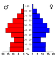
Bevolkingspiramide - Gemeente Olst-Wijhe (2007).png 350 × 370; 7 KB
-
Duursche waarden olst.JPG 2,048 × 1,536; 1.42 MB
-
Gem-Olst-Wijhe-OpenTopo.jpg 5,208 × 7,536; 5.57 MB
-
IJssel Wijhe.jpg 360 × 270; 15 KB
-
Middel 2017.jpg 3,264 × 2,448; 2.45 MB
-
Nl-Olst-Wijhe.oga 1.5 s; 27 KB
-
Nl-Olst-Wijhe.ogg 1.5 s; 18 KB
-
Olst Wijhe Buitenwaarden.jpg 3,072 × 2,304; 1.35 MB
-
Road to Ferry from Welsum to Olst, the Netherlands.jpg 3,184 × 2,388; 2.8 MB


