Category:Plans of castles in France
Subcategories
This category has the following 26 subcategories, out of 26 total.
Media in category "Plans of castles in France"
The following 154 files are in this category, out of 154 total.
-
139 of 'Élincourt-Sainte-Marguerite. Notice historique et archéologique' (11197114766).jpg 4,655 × 2,740; 2.09 MB
-
168 of 'Villeneuve-Loubet et ses seigneurs. (Illustrated.)' (11218730865).jpg 2,184 × 2,665; 609 KB
-
169 of 'Villeneuve-Loubet et ses seigneurs. (Illustrated.)' (11215523213).jpg 2,242 × 2,637; 633 KB
-
198 of 'The Historical Monuments of France' (11089971335).jpg 1,492 × 628; 159 KB
-
235 of 'Châtel-sur-Moselle avant la Révolution ... Illustrations, etc' (11292320166).jpg 1,282 × 1,697; 464 KB
-
Ancien château (Montereau-Fault-Yonne) - Plan (11091045555).jpg 1,609 × 1,162; 479 KB
-
Ancien château de Vassy-sous-Pisy - Plan (11057922884).jpg 527 × 672; 56 KB
-
Ancy-le-FrancGrundriss1576-79.jpg 2,755 × 1,355; 1.47 MB
-
Ancylefranc.jpg 1,181 × 818; 224 KB
-
Plan du château d'Andlau.jpg 4,000 × 3,000; 3.49 MB
-
Bastiments v1 (Gregg 1972 p36) - Madrid plan.jpg 6,436 × 2,710; 3.16 MB
-
Bastiments v1 (Gregg 1972 p42) - Creil plan.jpg 6,529 × 2,982; 5.59 MB
-
Bastiments v1 (Gregg 1972 p48) - Folembray plan.jpg 6,514 × 3,668; 3.28 MB
-
Bastiments v1 (Gregg 1972 p55) - Montargis plan.jpg 4,465 × 4,275; 2.64 MB
-
Bastiments v1 (Gregg 1972 p56) - St-Germain-en-Laye plan.jpg 5,247 × 3,111; 2.37 MB
-
Bastiments v1 (Gregg 1972 p57) - St-Germain-en-Laye general plan.jpg 6,472 × 4,024; 6.83 MB
-
Bastiments v1 (Gregg 1972 p66) - Vallery general plan.jpg 6,162 × 4,157; 5.08 MB
-
Bastiments v1 (Gregg 1972 p70) - Verneuil plan first design.jpg 4,001 × 3,869; 2.76 MB
-
Bastiments v1 (Gregg 1972 p71) - Verneuil plan second design.jpg 4,337 × 6,205; 4.33 MB
-
Bastiments v1 (Gregg 1972 p72) - Verneuil general plan with first design.jpg 6,446 × 4,117; 6.36 MB
-
Bastiments v1 (Gregg 1972 p79) - Ancy-le-Franc plan of the cellar.jpg 4,288 × 4,369; 5.48 MB
-
Bastiments v1 (Gregg 1972 p80) - Ancy-le-Franc general plan.jpg 6,423 × 3,047; 3.5 MB
-
BloisPiantaMedioevo.jpg 1,000 × 909; 182 KB
-
Burg Petit Marzac.jpg 3,230 × 2,153; 837 KB
-
Carte.chateau.La.Roche.Guyon.png 639 × 648; 165 KB
-
Chambois.png 4,226 × 3,345; 17.71 MB
-
ChamboisChateau.png 1,481 × 1,213; 664 KB
-
ChamboisDonjo.png 2,040 × 3,624; 4.57 MB
-
Chateau de Dampierre BM Troyes.jpg 2,444 × 1,568; 3.09 MB
-
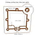
Chateau de Dourdan.svg 1,417 × 1,417; 16 KB
-
Chateau de Gaillon Le Rouge 1750.jpg 3,860 × 2,728; 6.01 MB
-
Chateau de Maison-Ponthieu Plan.jpg 3,838 × 4,461; 4.73 MB
-
Chateau de Montceaux Plan.jpg 2,544 × 1,960; 3.51 MB
-
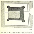
Chateau de Saint-Moré (Plan, 1870) (11058177145).jpg 768 × 752; 156 KB
-
Chateau de Tanlay - Grundrisse - Sauvageot.jpg 1,000 × 1,739; 268 KB
-
Chateau du taureau avant 1689.jpg 698 × 480; 94 KB
-
Chateau du Taureau plan.jpg 312 × 219; 23 KB
-
Chateau Estissac 1840.jpg 1,519 × 1,007; 212 KB
-
Chateau Gaillard.png 1,438 × 710; 55 KB
-
Chauvigny, Chât. de Gouzon.jpg 2,213 × 3,320; 997 KB
-
Château de Cisery (11245624974).jpg 848 × 1,291; 299 KB
-
Château de Marly-3.jpg 758 × 511; 63 KB
-
Château de Montaigne - tower - sketch of 2nd floor with library.svg 794 × 638; 64 KB
-
Château de Pisy, Yonne - Plan (1870) (11092963696).jpg 1,571 × 1,413; 829 KB
-
Château de Ragny, Savigny-en-Terre-Plaine, Yonne (11058912415).jpg 781 × 614; 73 KB
-
Château de Vault-de-Lugny (Plan, 1870) (11059205724).jpg 773 × 894; 233 KB
-
Château Franquemont.jpg 760 × 362; 114 KB
-
Châtelet de Villarnoux (11092317485).jpg 1,575 × 1,606; 604 KB
-
Clagny - btv1b53037519w (1 of 2).jpg 12,696 × 6,632; 8.76 MB
-
Description du chateau de pierrefonds Figure 01.png 1,185 × 2,028; 63 KB
-
Château de Druyes, Yonne Workaround.svg 670 × 835; 6 KB
-
Château de Druyes, Yonne.svg 670 × 835; 23 KB
-
Détail des plans de la serre et de l'orangerie d'Ettevaux - coupe sur l'orangerie.jpg 2,850 × 3,553; 4.93 MB
-
Détail du pan de la serre et de l'orangerie d'Ettevaux.jpg 4,624 × 1,996; 4.08 MB
-
Détail du plan de l'orangerie d'Ettevaux - 1913.jpg 1,626 × 730; 863 KB
-
Détail du plan de l'orangerie d'Ettevaux - vue en coupe - 1913.jpg 1,627 × 823; 1.03 MB
-
Détail du plan de la serre d'Ettevaux.jpg 2,325 × 4,483; 4.85 MB
-
Détail du plan de la serre et de l'orangerie d'Ettevaux - façade principale.jpg 3,985 × 1,717; 3.97 MB
-
Esquisse de l'ancien château de Fitz-James (Oise).jpg 15,694 × 21,069; 322.87 MB
-
F07 Ch t. Commarque 002.jpg 2,267 × 3,401; 986 KB
-
Former Castle of Girolles, Yonne (11058592405).jpg 760 × 633; 91 KB
-
FougeresGrundriss.png 1,682 × 1,246; 66 KB
-
France Brie-Comte-Robert castle annotated floor plan.svg 779 × 978; 10 KB
-
France-Guirbaden castle-Plan.svg 950 × 450; 88 KB
-
Grondplan Palais Rihour.png 1,382 × 1,102; 719 KB
-
Grundriss Burg Kaysersberg.svg 1,463 × 1,208; 59 KB
-
Grundriss Schloss Bailleul.jpg 1,273 × 1,320; 237 KB
-
Grundriss Schloss Cons-la-Grandville.jpg 1,104 × 1,407; 258 KB
-
GrundrissSchlossBalleroy.png 2,155 × 1,516; 59 KB
-
GrundrissSchlossBlois.png 3,061 × 2,615; 525 KB
-
GrundrissSchlossBloisMittelalter.png 1,522 × 1,384; 221 KB
-
GrundrissSchlossBloisMittelalterFr.png 1,522 × 1,384; 231 KB
-
GrundrissSchlossLochesGesamt.png 956 × 1,516; 109 KB
-
Burg Guedelon Plan Karte.png 1,200 × 870; 354 KB
-
Plan du château de Guédelon.svg 1,020 × 765; 65 KB
-
Harcourt.jpg 2,094 × 3,141; 787 KB
-
Isle de Ré 1749. Plan de la redoute des portes - btv1b71005159 (1 of 2).jpg 6,747 × 5,133; 2.81 MB
-
Lageplan La Bastie d'Urfé.svg 812 × 601; 1.25 MB
-
Lageplan Schloss Assier.svg 1,430 × 907; 133 KB
-
Lageplan Schloss Courances.svg 828 × 857; 74 KB
-
Lageplan Schloss Montbras.svg 1,272 × 981; 33 KB
-
Lageplan Schloss Valmer.svg 1,526 × 880; 190 KB
-
Langoiran plan - Douyn 1862.jpg 637 × 805; 153 KB
-
LeLudePlan1785.png 2,713 × 2,151; 3.86 MB
-
LochesGrundrissLogisRoyal.png 1,361 × 788; 67 KB
-
L’Architecture de la Renaissance - Fig. 46.PNG 630 × 868; 31 KB
-
L’Architecture de la Renaissance - Fig. 54 (adjusted).jpg 986 × 768; 170 KB
-
L’Architecture de la Renaissance - Fig. 54.PNG 982 × 762; 50 KB
-
Map of Puilaurens castle without description.svg 744 × 438; 154 KB
-
Map of Puilaurens castle.svg 750 × 431; 171 KB
-
Marly-Bath.jpg 551 × 885; 144 KB
-
Menou chateau 1825.JPG 1,024 × 724; 97 KB
-
Bastiments v1 (Gregg 1972 p62) - La Muette plan.jpg 4,370 × 4,600; 4.03 MB
-
Boissezon (Murat) Plan château.jpg 759 × 681; 73 KB
-
Plan château de Boissezon (Murat).jpg 3,264 × 2,239; 802 KB
-
Plan château de Canac (Murat-sur-Vèbre).jpg 366 × 387; 23 KB
-
NOR 0002-2.jpg 2,223 × 3,128; 1.71 MB
-
Palais Bourbon Hotel de Lassey Plan 1730.jpg 2,439 × 1,917; 1.92 MB
-
PiantaBloisPTerra.png 3,061 × 2,615; 531 KB
-
Plan du château de Pisy.jpg 753 × 654; 132 KB
-
Plan 1693 Chateau du taureau.jpg 2,815 × 4,205; 7.75 MB
-
Plan chateau Fere en Tardenois 08510.jpg 2,502 × 2,595; 1.88 MB
-
Plan château dourdan.gif 277 × 218; 2 KB
-
Plan csm.png 1,184 × 729; 99 KB
-
Plan d'Azay-le-rideau.jpg 1,606 × 1,130; 74 KB
-
Plan du château de Biron.JPG 3,346 × 2,223; 2.03 MB
-
Plan du château de chatillon.jpg 6,000 × 6,500; 5.24 MB
-
Plan du château de Guédelon-ru.svg 1,020 × 765; 58 KB
-
Plan du château de la Rivière à Pontgoin (Photo prise aux A.D. 28).jpg 4,226 × 3,168; 2.96 MB
-
Plan du château de la Roche (1694).jpg 8,500 × 5,428; 6.44 MB
-
Plan du château de Latsaga à Ostabat-Asme.jpg 744 × 1,052; 77 KB
-
Plan du château de Miglos - Barrière-Flavy - 1894.png 1,005 × 1,608; 55 KB
-
Plan du château de Noyers.jpg 1,632 × 2,516; 1.08 MB
-
Plan du château de Passy.jpg 431 × 459; 38 KB
-
Plan du fort-la-Latte.jpg 2,338 × 1,647; 1.06 MB
-
Plan du rez-de-chaussée du château de Renansart avant 1766.jpg 768 × 1,024; 59 KB
-
Plan général Château de Sparre.jpg 1,357 × 1,054; 281 KB
-
Plan of Maubourg Castle (Haute-Loire, France).jpg 2,848 × 2,136; 2.84 MB
-
Plan-Noyers.jpg 686 × 471; 210 KB
-
Plan.chateau.Arques.png 471 × 762; 151 KB
-
Plan.chateau.Bonaguil.png 532 × 518; 62 KB
-
Plan.chateau.Bury.png 666 × 522; 77 KB
-
Plan.chateau.Chauvigny.png 585 × 615; 57 KB
-
Plan.chateau.Falaise.2.png 447 × 414; 36 KB
-
Plan.chateau.La.Roche.Guyon.png 450 × 510; 51 KB
-
Plan.chateau.Montargis.png 685 × 642; 78 KB
-
Plan.chateau.Pierrefonds.png 663 × 1,023; 220 KB
-
Plan.Coucy.png 335 × 403; 34 KB
-
Plan.donjon.chateau.Vez.png 614 × 746; 108 KB
-
Plan.donjon.La.Roche.Guyon.png 630 × 765; 133 KB
-
Plan.tour.Montlhery.png 450 × 600; 81 KB
-
Plan.tours.Loches.et.Provins.png 663 × 369; 41 KB
-
Plans of ground floor and second floor of the Chateau Neuf.jpg 2,970 × 1,870; 2.61 MB
-
Ray-sur-Saône, Plan Bertrand, 1775.jpg 1,536 × 2,141; 1.2 MB
-
Saint-Jeanvrin Plan du château.png 845 × 1,161; 73 KB
-
Saint-Thégonnec (29) Château de Penhoat 09.JPG 1,488 × 1,984; 1.67 MB
-
SainteMere-Chateau.svg 216 × 120; 4 KB
-
Schloss La Guignardiere Trudaine-Atlas.jpg 428 × 316; 79 KB
-
SchlossBloismitParkGrundriss.png 2,208 × 1,468; 764 KB
-
Simiane-la-Rotonde, Grundriss.1.jpg 2,338 × 1,700; 755 KB
-
Simiane-la-Rotonde, Grundriss.jpg 2,338 × 1,700; 771 KB
-
Tanlay Lageplan - Sauvageot.jpg 1,713 × 976; 407 KB


