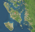
Category:Ramree Island
island in Myanmar | |||||
| Upload media | |||||
| Instance of | |||||
|---|---|---|---|---|---|
| Location | Rakhine State, British rule in Myanmar | ||||
| Located in or next to body of water | |||||
| Width |
| ||||
| Length |
| ||||
| Area |
| ||||
| Elevation above sea level |
| ||||
 | |||||
Media in category "Ramree Island"
The following 8 files are in this category, out of 8 total.
-
ISS067-E-301566 - View of Earth.jpg 5,568 × 3,712; 3.69 MB
-
Man Aung (Cheduba) Island seen from Ramree Island's west bank.jpg 3,265 × 4,898; 2.39 MB
-
Private First Class Edeleanu prints news bulletin 1945.gif 422 × 600; 91 KB
-
Ramree Island.tiff 557 × 505; 655 KB
-
Ramree Town Welcome Landmark.jpg 6,000 × 4,000; 8.29 MB
-
View of Thun Site River from Ramree Island.jpg 640 × 480; 20 KB
-
Zikha Taung Areal View seen from Man Aung Strait.jpg 2,162 × 1,440; 944 KB
-
Zikha Taung.jpg 4,898 × 3,265; 1.78 MB


