Category:Saddles (landform)
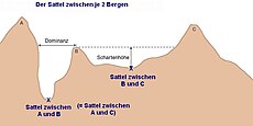
region surrounding the highest point of the lowest point on the line tracing the drainage divide (the col) connecting the peaks | |||||
| Upload media | |||||
| Instance of |
| ||||
|---|---|---|---|---|---|
| Subclass of |
| ||||
| Has part(s) | |||||
| Different from | |||||
| |||||
Subcategories
This category has the following 6 subcategories, out of 6 total.
Media in category "Saddles (landform)"
The following 5 files are in this category, out of 5 total.
-
Argonaut Peak 7818.JPG 2,848 × 4,272; 5.45 MB
-
KANGCHENJUNGA MAP by JACOT-GUILLARMOD, 1914.jpg 3,060 × 2,305; 1.06 MB
-
Mantschenhalsl.jpg 4,000 × 3,000; 3.74 MB
-
Schleimssattel.jpg 4,032 × 3,024; 4.07 MB
-
The Sphinx on the Paglia Orba.jpg 1,440 × 1,080; 617 KB


