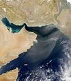
Category:Satellite pictures of Oman
Satellite pictures of Oman.
See also Category:Maps of Oman
Subcategories
This category has the following 3 subcategories, out of 3 total.
I
S
Media in category "Satellite pictures of Oman"
The following 18 files are in this category, out of 18 total.
-
Dust storm in Oman.jpg 2,445 × 2,806; 748 KB
-
Dust storm in Saudi Arabia (5579802334).jpg 6,400 × 8,400; 5.5 MB
-
Gulf of Oman (SeaWiFS).jpg 736 × 487; 41 KB
-
Masirah.jpg 996 × 1,186; 751 KB
-
Musandam Peninsula, Oman.jpg 3,108 × 4,319; 1.52 MB
-
Muscat SPOT 1089.jpg 500 × 500; 81 KB
-
Muscat, Oman (satellite view).jpg 2,048 × 1,280; 640 KB
-
Muscat, Oman Astronaut Imagery.JPG 4,288 × 2,848; 1.28 MB
-
NASA Wahiba Sands.jpg 1,024 × 768; 581 KB
-
Northeast Oman (MODIS 2024-10-15).jpg 1,643 × 1,256; 267 KB
-
Oman (MODIS 2017-10-05).jpg 3,000 × 2,480; 595 KB
-
Oman and its Dhofar mountains on the coast of the Arabian Sea (iss069e003275).jpg 5,568 × 3,712; 7.68 MB
-
Oman Landscape (51250876602).png 12,936 × 7,602; 85.33 MB
-
Persian Gulf Cable.png 789 × 720; 1.04 MB
-
Salalah.jpg 1,000 × 661; 198 KB
-
Seebintlarptnasa.jpg 888 × 892; 544 KB
-
Straße von Hormuz.jpg 800 × 738; 102 KB
-
Wahiba Sands from space.JPG 304 × 273; 35 KB


