Category:Satellite pictures of Saudi Arabia
Satellite pictures of Saudi Arabia.
Subcategories
This category has the following 6 subcategories, out of 6 total.
*
I
L
Media in category "Satellite pictures of Saudi Arabia"
The following 88 files are in this category, out of 88 total.
-
Al-hasa.png 942 × 732; 1.95 MB
-
An-Nafud Desert, Saudi Arabia (MODIS 2018-07-14).jpg 3,240 × 2,583; 730 KB
-
Arabia from space.png 1,527 × 970; 1.58 MB
-
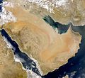
Arabian Peninsula dust SeaWiFS-2.jpg 2,504 × 2,286; 867 KB
-
Arabian Peninsula dust SeaWiFS.jpg 2,504 × 2,286; 853 KB
-
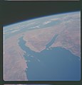
AS07-07-1774.jpg 4,150 × 4,150; 3.23 MB
-
AS07-11-2000 (21355660044).jpg 4,400 × 4,600; 1.1 MB
-
Asir arabic.png 560 × 472; 554 KB
-
Circles in the desert ESA344662.jpg 1,148 × 1,500; 1.08 MB
-
Circular irrigations in Al Jawf Region, Saudi Arabia.jpg 2,048 × 1,280; 484 KB
-
Colours of the Persian Gulf ESA353290 (cropped to Jidda Island).jpg 600 × 600; 485 KB
-
Colours of the Persian Gulf ESA353290.jpg 8,707 × 8,198; 94.68 MB
-
Crop fields in Saudi Arabia Dec 02 2012.jpg 1,840 × 3,264; 4.54 MB
-
Dust Extends from Saudi Arabia to Iran 2010-03-04 lrg.jpg 8,192 × 5,916; 4.78 MB
-
Dust Extends from Saudi Arabia to Iran 2010-03-04.jpg 720 × 480; 72 KB
-
Dust storm in Iraq and Saudi Arabia (MODIS 2017-10-31).jpg 4,000 × 5,200; 2.65 MB
-
Dust storm in Iraq, Kuwait, and Saudi Arabia (MODIS 2017-11-04).jpg 5,600 × 4,400; 2.62 MB
-
Dust storm in Saudi Arabia (5579802334).jpg 6,400 × 8,400; 5.5 MB
-
Dust storm in Saudi Arabia (MODIS 2015-04-13).jpg 5,600 × 6,200; 2.7 MB
-
Dust storm in Saudi Arabia (MODIS 2018-02-22).jpg 5,200 × 4,000; 1.8 MB
-
Dust Storm in Saudi Arabia (MODIS 2021-04-17).jpg 3,438 × 2,597; 2.04 MB
-
Dust Storm in the Middle East - NASA Earth Observatory.jpg 720 × 720; 109 KB
-
Dust storm over Iran, Iraq.jpg 2,000 × 1,836; 1.03 MB
-
Farasan and Dahlak Islands ISS042.jpg 3,280 × 4,928; 735 KB
-
Fm nasa yanbu saudi arabia - rotated.jpg 423 × 639; 161 KB
-
Fm nasa yanbu saudi arabia.jpg 3,032 × 2,008; 1.65 MB
-
Gulf of Aqaba - Gulf von Akaba.jpg 5,568 × 3,712; 4.68 MB
-
Ha'il city.jpg 410 × 414; 41 KB
-
Harrat 'Uwayrid.jpg 634 × 480; 66 KB
-
Harrat ar-Rahah.jpg 624 × 480; 56 KB
-
Harrat Ithnayn.jpg 640 × 453; 47 KB
-
Harrat Khaybar Space.jpg 3,032 × 2,005; 1.86 MB
-
Harrat Lunayyir, Saudi Arabia (ASTER).jpg 3,816 × 3,808; 2.07 MB
-
Harrat Lunayyir.jpg 583 × 480; 65 KB
-
Harrat Rahat.jpg 2,984 × 1,972; 4.14 MB
-
Irrigation systems - Bewässerungsanlagen - 43642345904.jpg 5,568 × 3,712; 4.58 MB
-
Irrigation systems - Bewässerungsanlagen - 44358481271.jpg 5,568 × 3,712; 4.44 MB
-
Irrigation systems - Bewässerungsanlagen.jpg 5,568 × 3,712; 4.16 MB
-
Jeddah, Saudi Arabia by Planet Labs.jpg 2,690 × 2,018; 1.91 MB
-
Khurais Oil Processing Facility, Saudi Arabia by Planet Labs.jpg 2,400 × 1,800; 669 KB
-
Landscape of Saudi Arabia (51254195917).png 12,240 × 7,602; 78.93 MB
-
Line Progress October 2022.png 8,192 × 1,379; 19.99 MB
-
Massive Dust Cloud over Iraq and Saudi Arabia (MODIS 2022-05-06).jpg 5,575 × 4,540; 1.77 MB
-
Medina from ISS 2017.jpg 720 × 580; 675 KB
-
NASA Sees Fields of Green Spring up in Saudi Arabia (7027523783).jpg 2,050 × 1,405; 1.65 MB
-
Near east lrg.jpg 2,987 × 3,967; 2.62 MB
-
Red Sea 37.95521E 21.41271N.jpg 1,280 × 958; 182 KB
-
Red Sea, Saudi Arabia.jpg 2,048 × 1,280; 406 KB
-
Rub' al Khali (Arabian Empty Quarter) sand dunes imaged by Terra (EOS AM-1).jpg 3,656 × 4,124; 3.05 MB
-
Rub' al Khali, Arabia (ASTER).jpg 3,656 × 4,124; 3.05 MB
-
Rub'al-Khali Desert in Saudi Arabia (MODIS 2022-03-03).jpg 1,390 × 1,019; 104 KB
-
Rub’ al Khali desert ESA14676138.jpeg 6,238 × 6,190; 6.76 MB
-
Rub’ al Khali desert ESA14676138.tiff 6,238 × 6,190; 56.79 MB
-
SA Sites.png 801 × 732; 1.03 MB
-
Sanafir.png 512 × 256; 219 KB
-
Satellite imagery of southern Qatari Peninsula Saudi Arabia Gulf of Salwa.jpg 4,288 × 2,848; 818 KB
-
Satellite photo King Khalid Military City June 2002.jpg 540 × 405; 309 KB
-
Saudi Arabia (MODIS 2019-07-07).jpg 4,520 × 3,639; 2.19 MB
-
Saudi Arabia Dunes (ASTER).jpg 2,470 × 1,828; 1.18 MB
-
Saudi Arabia ESA206327.tiff 2,746 × 2,165; 17.69 MB
-
Saudi Arabia irrigation.jpg 4,000 × 3,996; 12.64 MB
-
Saudi Arabia, Iraq, Kuwait (MODIS 2017-12-21).jpg 5,378 × 3,813; 1.68 MB
-
Saudi Arabia.jpg 2,746 × 2,165; 4 MB
-
Saudi Arabian agricultural fields.png 1,440 × 960; 2.08 MB
-
SaudiArabia.A2003086.1000.1km.jpg 1,700 × 2,200; 653 KB
-
Sharqiyya arabic.jpg 1,146 × 1,291; 771 KB
-
Shemal arabic.jpg 833 × 429; 301 KB
-
SpaceX Dragon 16 - 3.jpg 5,568 × 3,712; 3.61 MB
-
STS129-E-10292 - View of Earth.jpg 4,288 × 2,929; 836 KB
-
Tabuk SPOT 1322.jpg 500 × 500; 106 KB
-
Towns of hejaz arabic.png 625 × 730; 1.01 MB
-
Towns of nejd Arabic.png 755 × 693; 1,019 KB
-
Tragic discrepancy - tragischen Unterschied.jpg 5,568 × 3,712; 4.06 MB
-
Turquoise Swirls in the Black Sea, crop3.jpg 3,491 × 1,896; 1.84 MB
-
Underwater waves - Unterwasserwellen.jpg 5,568 × 3,712; 3.52 MB
-
Wadi Al Dawasir, Saudi Arabia (ASTER).jpg 2,034 × 3,059; 1,003 KB
-
Wadi As-Sirhan, Saudi Arabia (ASTER).jpg 2,201 × 3,900; 1.24 MB
-
Wadj Bank.jpg 3,032 × 2,007; 1.08 MB
-
الرياضFromTheISS.jpg 1,024 × 679; 361 KB
-
جدةFromTheISS.jpg 1,024 × 679; 249 KB
-
خريطة الرياض.JPG 706 × 726; 606 KB
-
خريطة الرياض.png 1,278 × 730; 2.62 MB
-
사우디아라비아 주바일항구 (아리랑 2호) (386).jpeg 3,000 × 3,100; 4.52 MB


