Category:Travel maps of France
Subcategories
This category has the following 5 subcategories, out of 5 total.
Media in category "Travel maps of France"
The following 43 files are in this category, out of 43 total.
-
Auvergne-Rhone-Alpes WV region map EN.png 2,000 × 1,505; 758 KB
-
Blondin Diop Map.png 11,200 × 6,800; 3.16 MB
-
Brittany WV region map EN.png 2,000 × 1,236; 555 KB
-
Central France WV map PNG.png 1,000 × 856; 216 KB
-
Central France WV map.svg 788 × 674; 606 KB
-
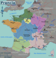
France map.png 631 × 573; 187 KB
-
France regions map (cs).png 1,875 × 1,958; 1.46 MB
-
France-regions (it).png 3,000 × 3,134; 2.42 MB
-
France-regions (ru).png 1,996 × 2,085; 1.5 MB
-
France-regions (zh-hans).png 3,917 × 4,092; 3.63 MB
-
France-regions-2017.svg 619 × 647; 1.12 MB
-
France-regions.png 1,996 × 2,085; 1.51 MB
-
France-regions.svg 619 × 647; 1.08 MB
-
France-régions (fr) proposition.png 620 × 648; 328 KB
-
France-régions (fr).svg 619 × 647; 1.15 MB
-
France-régions (it).png 1,871 × 1,955; 1.42 MB
-
Great West WV map PNG.png 769 × 519; 112 KB
-
Great West WV map.svg 744 × 1,052; 665 KB
-
Lemans map.png 1,399 × 2,651; 561 KB
-
Lemans map.svg 1,067 × 1,772; 107 KB
-
March of Edward III in 1346.jpg 1,076 × 666; 330 KB
-
Nord de la France carte wikivoyage.png 1,200 × 743; 156 KB
-
Normandy regions map (it).png 3,125 × 2,467; 772 KB
-
Normandy regions map (it).svg 750 × 625; 1.91 MB
-
Normandy regions map.png 3,125 × 2,458; 746 KB
-
Normandy regions map.svg 750 × 625; 1.91 MB
-
Northeastern France WV map SVG.png 625 × 812; 146 KB
-
Northeastern France WV map.svg 744 × 1,052; 676 KB
-
Northern France WV map PNG.png 965 × 598; 175 KB
-
Northern France WV map.svg 744 × 1,052; 675 KB
-
Nouvelle Aquitaine WV region map EN.png 2,000 × 2,651; 1.1 MB
-
Occitanie WV region map EN.png 2,000 × 1,449; 785 KB
-
Provence-Alpes-Cote d'Azur WV region map 2017 EN.png 2,000 × 1,805; 782 KB
-
Provence-map (ru).svg 704 × 635; 1.42 MB
-
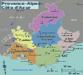
Provence-map.png 2,269 × 2,047; 895 KB
-
Provence-map.svg 704 × 635; 1.42 MB
-
Southeastern France WV map PNG.png 1,066 × 916; 251 KB
-
Southeastern France WV map.svg 744 × 1,052; 678 KB
-
Southwestern France WV map PNG.png 819 × 675; 148 KB
-
Southwestern France WV map.svg 744 × 1,052; 666 KB
-
Vallée de la Dendre.jpg 2,744 × 2,744; 1.07 MB


