File:AerialViewofTuckermanRavine.jpg
AerialViewofTuckermanRavine.jpg (575 × 357 pixels, file size: 69 KB, MIME type: image/jpeg)
File information
Structured data
Captions
Captions
Add a one-line explanation of what this file represents
Summary
edit| DescriptionAerialViewofTuckermanRavine.jpg |
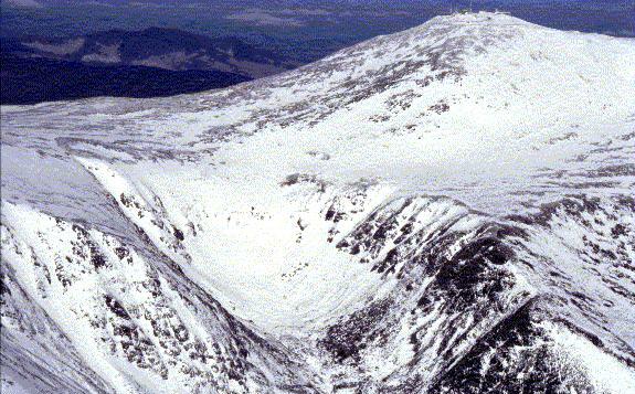
English: Aerial photo of Tuckerman Ravine with the headwall buried under snow in winter and Washington Observatory visible on the summit top right, from undated USFS monograph: AVALANCHE TERRAIN AND CONDITIONS IN THE PRESIDENTIAL RANGE, NEW HAMPSHIRE, US;
Kai-Uwe Allen, Snow Ranger, US Forest Service, White Mountain National Forest, New Hampshire, citing statistics and other sources from 1999, 2000, and earlier. |
| Source | USFS website[dead link] |
| Author | Kai-Uwe Allen, USFS Snow Ranger |
| Other versions | Additional daily USFS Snow Ranger photos. |
Licensing
edit| Public domainPublic domainfalsefalse |
This image is a work of the Forest Service of the United States Department of Agriculture. As a work of the U.S. federal government, the image is in the public domain.
|
 |
Original upload log
editThe original description page was here. All following user names refer to en.wikipedia.
- 2005-03-03 18:06 Lupinelawyer 575×375×8 (77438 bytes) Photo of Tuckerman, USFS article {{PD-USGov-USDA-FS}}
File history
Click on a date/time to view the file as it appeared at that time.
| Date/Time | Thumbnail | Dimensions | User | Comment | |
|---|---|---|---|---|---|
| current | 06:02, 26 September 2023 |  | 575 × 357 (69 KB) | Beao (talk | contribs) | Cropped 5 % vertically using CropTool with lossless mode. Removed watermark. |
| 07:35, 2 June 2007 |  | 575 × 375 (76 KB) | RedWolf (talk | contribs) | {{Information |Description=Aerial photo of Tuckerman Ravine, from undated USFS monograph: AVALANCHE TERRAIN AND CONDITIONS IN THE PRESIDENTIAL RANGE, NEW HAMPSHIRE, US; Kai-Uwe Allen, Snow Ranger, US Forest Service, White Mountain National Forest, New Ha |
You cannot overwrite this file.
File usage on Commons
The following 3 pages use this file:
File usage on other wikis
The following other wikis use this file:
- Usage on ceb.wikipedia.org
- Usage on lld.wikipedia.org
- Usage on www.wikidata.org
