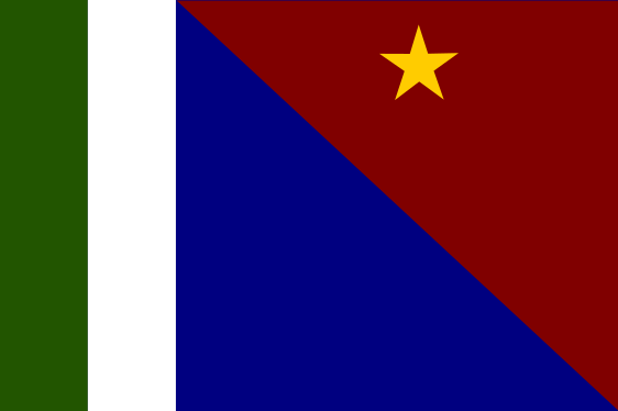
File:Flag of Milne Bay.svg

Size of this PNG preview of this SVG file: 562 × 374 pixels. Other resolutions: 320 × 213 pixels | 640 × 426 pixels | 1,024 × 681 pixels | 1,280 × 852 pixels | 2,560 × 1,704 pixels.
Original file (SVG file, nominally 562 × 374 pixels, file size: 2 KB)
File information
Structured data
Captions
Captions
Add a one-line explanation of what this file represents
| DescriptionFlag of Milne Bay.svg | Papua New Guinean Provincial Flag |
| Source | Own work |
| Author | Isaac Sutcliffe |
| Public domainPublic domainfalsefalse |
| I, the copyright holder of this work, release this work into the public domain. This applies worldwide. In some countries this may not be legally possible; if so: I grant anyone the right to use this work for any purpose, without any conditions, unless such conditions are required by law. |
File history
Click on a date/time to view the file as it appeared at that time.
| Date/Time | Thumbnail | Dimensions | User | Comment | |
|---|---|---|---|---|---|
| current | 15:44, 16 August 2022 |  | 562 × 374 (2 KB) | HapHaxion (talk | contribs) | reduce file size |
| 05:52, 18 June 2007 |  | 562 × 374 (4 KB) | Aliasd (talk | contribs) | {{Information |Description=Papua New Guinean Provincial Flag |Source=self-made |Date= |Author= Isaac Sutcliffe }} {{PD-self}} {{PD-flag}} Category:Flags of Papua New Guinea |
You cannot overwrite this file.
File usage on Commons
The following 6 pages use this file:
File usage on other wikis
The following other wikis use this file:
- Usage on af.wikipedia.org
- Usage on als.wikipedia.org
- Usage on bs.wikipedia.org
- Usage on ceb.wikipedia.org
- Usage on ckb.wikipedia.org
- Usage on cs.wikipedia.org
- Usage on de.wikipedia.org
- Usage on en.wikipedia.org
- List of flags by number of colors
- Provinces of Papua New Guinea
- Milne Bay Province
- Tagula Island
- Misima Island
- Samarai
- Rossel Island
- Template:Country data Milne Bay
- Sideia Island
- Basilaki Island
- User:Aliasd/Images/Flags
- Hemenahei Island
- Pana Tinani
- List of political and geographic subdivisions by total area from 5,000 to 20,000 square kilometers
- ISO 3166-2:PG
- List of political and geographic subdivisions by total area (all)
- List of political and geographic subdivisions by total area from 10,000 to 20,000 square kilometers
- No. 2 Strip Milne Bay
- Deboyne Islands
- User:Thecurran/Subdivisions
- Alotau District
- Esa'ala District
- Kiriwina-Goodenough District
- Samarai-Murua District
- Gili Gili
- HMAS Ladava (naval base)
- Duchateau Islands
- Auriroa Island
- Conflict Group
- Bagaman Island
- Brumer Islands
- Bonvouloir Islands
- Calvados Chain
- Daloloia Group
- Hastings Island (Papua New Guinea)
- East Island, Papua New Guinea
- Kuwanak Island
- Lunn Island
View more global usage of this file.
Metadata
This file contains additional information such as Exif metadata which may have been added by the digital camera, scanner, or software program used to create or digitize it. If the file has been modified from its original state, some details such as the timestamp may not fully reflect those of the original file. The timestamp is only as accurate as the clock in the camera, and it may be completely wrong.
| Width | 561.64484 |
|---|---|
| Height | 373.75641 |