File:Illustrations of Guarding the Yellow River WDL11387.pdf

Original file (2,593 × 3,750 pixels, file size: 4.19 MB, MIME type: application/pdf, 10 pages)
Captions
Captions
Summary
edit| Title |
Русский: Чертежи защитных сооружений на Желтой реке
Français : Illustrations sur la conservation du fleuve Jaune
English: Illustrations of Guarding the Yellow River
中文:黄河防险图
Português: Ilustrações da supervisão do Rio Amarelo
العربية: رسوم إيضاحية لكيفية حماية النهر الأصفر
Español: Ilustraciones de la supervisión del río Amarillo |
| Description |
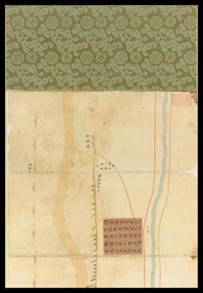
Русский: Эта книга состоит из 15 сложенных листов и прошита в форме "гармошки". На иллюстрациях показано местоположение сооружений для защиты от наводнений вдоль Желтой реки в провинции Хэнань. Здесь изображены дамбы и приподнятые берега рек в разных областях, начинающихся на западе от Ушэ Сянь и пересекающих болото Инцзэ, а также в Чжэнчжоу, Юаньу, Чжунмоу, Яну, Фэнцю, Кайфэн Фу, Чэньлю, Сянфу и в других городах. К 18 объектам прикреплены бумажные полоски с пояснениями относительно сложности задач по работе на реках в этих местах и с описаниями несчастных случаев в ходе работ, которые велись в период правления Цзяцина и Даогуана (1796–1850 гг.) из династии Цин. Этот труд содержит полезную информацию о защите от наводнений и консервации рек в Китае в данный период.
Каналы; Каналы (гидравлические сооружения); Борьба с наводнениями; Рукописные карты; Желтая река, (Китай) Français : Cet ouvrage est relié avec 15 feuilles pliées en accordéon. Les illustrations indiquent les emplacements des ouvrages de protection contre les inondations situés le long du fleuve Jaune, dans la province du Henan. Elles comprennent également les digues et les rives surélevées des différentes régions, partant du xian de Wushe à l'ouest et traversant les marais d'Yingze, ainsi que les villes de Zhengzhou, Yuanwu, Zhongmou, Yangwu, Fengqiu, Kaifeng Fu, Chenliu, Xiangfu, etc. Des morceaux de papier sont collés à 18 emplacements. Ils expliquent les difficultés rencontrées à ces endroits lors de la réalisation des ouvrages sur le fleuve, et décrivent les accidents survenus pendant les travaux durant les périodes Jiaqing et Daoguang (1796–1850) de la dynastie Qing. Cette œuvre fournit des informations utiles sur le contrôle des crues et les travaux de conservation des fleuves en Chine à cette époque.
Canaux; Canaux (génie hydraulique); Contrôle des crues; Cartes manuscrites; Fleuve Jaune (Chine) English: This work is bound in accordion pleat-like leaves, in 15 folded sheets. The illustrations show the locations of flood prevention works along the Yellow River in Henan Province. Included are dykes and raised riverbanks in different areas, beginning in the west with Wushe Xian, crossing Yingze Marsh, and in Zhengzhou, Yuanwu, Zhongmou, Yangwu, Fengqiu, Kaifeng Fu, Chenliu, Xiangfu, and other towns. A number of paper slips are attached to 18 locations, with explanations of the challenges of river work at these locations and descriptions of accidents that occurred during this work in the Jiaqing and Daoguang period (1796–1850) of the Qing dynasty. This work provides useful information on flood protection and river-conservancy work in China in this period.
Canals; Channels (Hydraulic engineering); Flood control; Manuscript maps; Yellow River (China) 中文:此图为经摺裝,凡共十五摺,包含绘制河南省境內黄河扫埧提岸工事及地点。全图描绘西起武涉县,经荥泽、郑州、原武、中牟、阳武、封邱、开封府、陈留、祥符等县境之防汎情形。图上有贴签十八处,均说明某处河工问题,以及嘉庆、道光年间 (1786-1850年)之失事处。此图提供有用材料,及可为研習河工者参考。
运河; 水道 (水利工程); 防洪; 手绘地图; 黄河(中国) Português: Esta obra está encadernada em formato de sanfona, com 15 folhas dobradas. As ilustrações mostram os locais dos trabalhos de prevenção de enchentes ao longo do Rio Amarelo na província de Henan. Estão incluídos diques e margens elevadas de rios em diferentes áreas, começando a oeste com Wushe Xian, atravessando o Pântano de Yingze, Zhengzhou, Yuanwu, Zhongmou, Yangwu, Fengqiu, Kaifeng Fu, Chenliu, Xiangfu e outras vilas. Vários pedaços de papel estão anexados em 18 locais, com explicações dos desafios dos trabalhos fluviais nestes locais e descrições de acidentes ocorridos durante estes trabalhos nos períodos Jiaqing e Daoguang (1796 a 1850) da dinastia Qing. Esta obra fornece informações úteis sobre a proteção contra enchentes e os trabalhos de conservação de rios na China deste período.
Canais; Canais (engenharia hidráulica); Controle de enchentes; Mapas manuscritos; Rio Amarelo (China) العربية: هذا العمل محزوم في أوراق مطوية في شكل ثنيات تشبه الأكورديون، في 15 صحيفة مطبوقة. تُظهر الرسوم الإيضاحية مواقع أعمال منع الفيضان على طول النهر الأصفر في مقاطعة هينان. وتشمل حواجز وضِفاف النهر التي تم رفعها في مناطق مختلفة، ابتداءً من الغرب في ووشا شيان عبورًا بينغزا مارش وفي تشنغتشو ويان وو وتشونغ ماو ويانغ وو وفونغ تشو وكايفنغ فو وتشن ليو وشيانغ فو ومدن أخرى. تم إلصاق عدد من القصاصات الورقية لـ18 موقعًا، مع شرح للتحديات التي تواجه الأعمال النهرية في تلك المواقع ووصفًا للحوادث التي وقعت خلال هذه الأعمال في فترة جياتشينغ ودوغوانغ (1796-1850) من أسرة تشينغ. يُقدم هذا العمل معلومات مفيدة عن الحماية من الفيضان وأعمال الحفاظ على الأنهار في الصين في هذه الفترة.
القنوات; قنوات (الهندسة الهيدروليكية); السيطرة على الفيضان; الخرائط المخطوطة; النهر الأصفر (الصين) Español: Esta obra consta de 15 hojas dobladas, encuadernadas con las hojas plegadas en forma de acordeón. Las ilustraciones muestran la ubicación de las obras para la prevención de inundaciones a lo largo del río Amarillo en la provincia de Henan. Contienen diques y riberas elevadas en diferentes áreas: comienzan al oeste, en Wushe Xian, atraviesan el pantano de Yingze, y Zhengzhou, Yuanwu, Zhongmou, Yangwu, Fengqiu, Kaifeng Fu, Chenliu, Xiangfu, entre otras ciudades. Hay trozos de papel pegados en 18 lugares con explicaciones sobre los desafíos para las obras en dichos puntos del río y descripciones de los accidentes ocurridos en el transcurso de la obra durante los reinados de los emperadores Jiaqing y Daoguang (1796–1850) de la dinastía Qing. Esta obra proporciona información útil acerca de las obras para la conservación del río Amarillo y la protección contra inundaciones en China durante este período.
Canales; Canales (ingeniería hidráulica); Control de inundaciones; Mapas manuscritos; Río Amarillo (China) |
| Date |
between 1644 and 1911 date QS:P571,+1500-00-00T00:00:00Z/6,P1319,+1644-00-00T00:00:00Z/9,P1326,+1911-00-00T00:00:00Z/9 |
| Medium |
Русский: Книги
Français : Livres
English: Books
中文:图书
Português: Livros
العربية: كتب
Español: Libros |
| Dimensions |
English: 1 folded volume, 21.8 x 9.8 centimeters |
| Collection |
Русский: Национальная центральная библиотека
Français : Bibliothèque centrale nationale
English: National Central Library
中文:国立中央图书馆
Português: Biblioteca Nacional Central
العربية: المكتبة المركزية الوطنية
Español: Biblioteca Nacional Central |
| Place of creation |
Русский: Китай
Français : Chine
English: China
中文:中国
Português: China
العربية: الصين
Español: China |
| Notes | Original language title: 黃河防險圖 |
| Source/Photographer |
http://dl.wdl.org/11387/service/11387.pdf
|
Licensing
edit|
This is a faithful photographic reproduction of a two-dimensional, public domain work of art. The work of art itself is in the public domain for the following reason:
The official position taken by the Wikimedia Foundation is that "faithful reproductions of two-dimensional public domain works of art are public domain".
This photographic reproduction is therefore also considered to be in the public domain in the United States. In other jurisdictions, re-use of this content may be restricted; see Reuse of PD-Art photographs for details. | |||||
File history
Click on a date/time to view the file as it appeared at that time.
| Date/Time | Thumbnail | Dimensions | User | Comment | |
|---|---|---|---|---|---|
| current | 09:35, 1 March 2014 |  | 2,593 × 3,750, 10 pages (4.19 MB) | Fæ (talk | contribs) | =={{int:filedesc}}== {{Artwork |artist = |author = |title ={{ru|1=Чертежи защитных сооружений на Желтой реке}} {{fr|1=Illustrations sur la conservation du fleuve Jaune}} {{en|1=Illustrations of Guarding the Yellow... |
You cannot overwrite this file.
File usage on Commons
The following page uses this file:
Metadata
This file contains additional information such as Exif metadata which may have been added by the digital camera, scanner, or software program used to create or digitize it. If the file has been modified from its original state, some details such as the timestamp may not fully reflect those of the original file. The timestamp is only as accurate as the clock in the camera, and it may be completely wrong.
| Image title | This document was downloaded from the World Digital Library (http://www.wdl.org). Go to http://hdl.loc.gov/loc.wdl/wdl.11387 for more information about this item. |
|---|---|
| Keywords | This document was downloaded from the World Digital Library (http://www.wdl.org). Go to http://hdl.loc.gov/loc.wdl/wdl.11387 for more information about this item. |
| Conversion program | Mac OS X 10.6.8 Quartz PDFContext |
| Encrypted | no |
| Page size |
|
| Version of PDF format | 1.3 |
