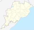
File:India Odisha location map.svg

Size of this PNG preview of this SVG file: 786 × 599 pixels. Other resolutions: 315 × 240 pixels | 630 × 480 pixels | 1,007 × 768 pixels | 1,280 × 976 pixels | 2,560 × 1,952 pixels | 1,128 × 860 pixels.
Original file (SVG file, nominally 1,128 × 860 pixels, file size: 402 KB)
File information
Structured data
Captions
Captions
Location map of Indian state Odisha
ओडिशा
ଓଡ଼ିଶା
Summary
edit| DescriptionIndia Odisha location map.svg |
Location map of Orissa Geographic limits of the map:
|
| Date | |
| Source | |
| Author |
|
Licensing
editThis file is licensed under the Creative Commons Attribution-Share Alike 3.0 Unported license.
- You are free:
- to share – to copy, distribute and transmit the work
- to remix – to adapt the work
- Under the following conditions:
- attribution – You must give appropriate credit, provide a link to the license, and indicate if changes were made. You may do so in any reasonable manner, but not in any way that suggests the licensor endorses you or your use.
- share alike – If you remix, transform, or build upon the material, you must distribute your contributions under the same or compatible license as the original.
File history
Click on a date/time to view the file as it appeared at that time.
| Date/Time | Thumbnail | Dimensions | User | Comment | |
|---|---|---|---|---|---|
| current | 05:07, 19 August 2022 |  | 1,128 × 860 (402 KB) | C1MM (talk | contribs) | Added more rivers, fixed district borders |
| 18:01, 10 January 2022 |  | 879 × 670 (363 KB) | C1MM (talk | contribs) | Fixed district borders | |
| 16:50, 1 April 2021 |  | 822 × 627 (444 KB) | C1MM (talk | contribs) | Fixed borders of districts and rivers | |
| 01:08, 1 July 2020 |  | 822 × 627 (758 KB) | C1MM (talk | contribs) | Fixed rivers | |
| 03:29, 24 April 2020 |  | 896 × 793 (368 KB) | C1MM (talk | contribs) | Added rivers | |
| 11:04, 31 May 2013 |  | 896 × 793 (287 KB) | Milenioscuro (talk | contribs) | color | |
| 10:57, 31 May 2013 |  | 896 × 793 (287 KB) | Milenioscuro (talk | contribs) | User created page with UploadWizard |
You cannot overwrite this file.
File usage on Commons
The following 41 pages use this file:
- Atlas of Odisha
- Odisha
- File:Chilika de.svg
- File:India Orissa location map.svg (file redirect)
- File:India Orissa location map with names.svg
- Category:Airports in Odisha
- Category:Archaeological sites in Odisha
- Category:Artists from Odisha
- Category:Births in Odisha
- Category:Bodies of water in Odisha
- Category:Bridges in Odisha
- Category:Buddhism in Odisha
- Category:Dams in Odisha
- Category:Engineers from Odisha
- Category:Film directors from Odisha
- Category:Flora of Odisha
- Category:Forts in Odisha
- Category:Hills of Odisha
- Category:Hindu temples in Odisha
- Category:Hospitals in Odisha
- Category:Jain temples in Odisha
- Category:Lakes of Odisha
- Category:Maps of Odisha
- Category:Mountains of Odisha
- Category:Municipal corporations in Odisha
- Category:Odisha
- Category:Palaces in Odisha
- Category:People of Odisha
- Category:Populated places in Odisha
- Category:Postcards of Odisha
- Category:Power plants in Odisha
- Category:Rail transport in Odisha
- Category:Railway stations in Odisha
- Category:Rivers of Odisha
- Category:Roads in Odisha
- Category:Shiva temples in Odisha
- Category:Temple tanks in Odisha
- Category:Transport in Odisha
- Category:Villages in Odisha
- Category:Visitor attractions in Odisha
- Category:Waterfalls in Odisha
File usage on other wikis
The following other wikis use this file:
- Usage on azb.wikipedia.org
- امراطلوع
- فولاموتی
- ساپتاساجیا
- کالابودا
- کاینیپورا
- ساینتالا
- سایلونق
- قاسیپورا
- دئوقون
- بولانواقون
- باندا کانسارا
- رموندا
- جیلوندی, قانجام
- آلاماندا, اودیشا
- رانجالی
- سیرجاپالی
- جانهیتایلا
- سیریجهولی
- جامدا, مایوربانج
- ماجورساهی
- رامسوارپور
- سیدهامولا
- ایتاماتی
- راجاموندا
- آر.ودایاجیری
- پوروسوتامپور, کئونجار
- هاتامونیقودا
- پینقوا
- پاتاپور
- پاتراپور
- اوخوندا
- پارسورا
- قوپیناتپور, اودیشا
- قوپایپالی
- پاریکود
- قولانتارا
- قودیاباندها
- قورادیا
- قاتقون
- پاناسا (هیندوستان)
- تیکیری
- قاتابانده
- قانسوارپور
- پادوا توون
- پادماپور, رایاقادا
- قاندارپور
- دئوباهال
- دوردا (هیندوستان)
- قاداساهی
- فولتا (هیندوستان)
View more global usage of this file.
Metadata
This file contains additional information such as Exif metadata which may have been added by the digital camera, scanner, or software program used to create or digitize it. If the file has been modified from its original state, some details such as the timestamp may not fully reflect those of the original file. The timestamp is only as accurate as the clock in the camera, and it may be completely wrong.
| Width | 318.43112mm |
|---|---|
| Height | 242.7738mm |