File:Kiltseva-Shubert.png

Original file (953 × 685 pixels, file size: 522 KB, MIME type: image/png)
Captions
Captions
Summary
edit| DescriptionKiltseva-Shubert.png |
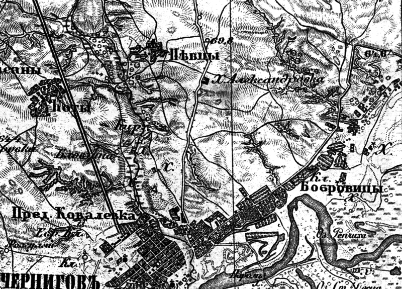
Українська: Східна місцевість Чернігова на карті 1846 року. |
||||||||||||||||||||
| Date | |||||||||||||||||||||
| Source | військово-топографічна карта Ф.Шуберта 1846-1863 р.1 | ||||||||||||||||||||
| Author |
creator QS:P170,Q49491 |
||||||||||||||||||||
Licensing
edit| Public domainPublic domainfalsefalse |
|
This work is in the public domain in its country of origin and other countries and areas where the copyright term is the author's life plus 100 years or fewer. | |
| This file has been identified as being free of known restrictions under copyright law, including all related and neighboring rights. | |
https://creativecommons.org/publicdomain/mark/1.0/PDMCreative Commons Public Domain Mark 1.0falsefalse
File history
Click on a date/time to view the file as it appeared at that time.
| Date/Time | Thumbnail | Dimensions | User | Comment | |
|---|---|---|---|---|---|
| current | 07:17, 9 January 2016 |  | 953 × 685 (522 KB) | Ukrop4ik (talk | contribs) | User created page with UploadWizard |
You cannot overwrite this file.
File usage on Commons
There are no pages that use this file.
File usage on other wikis
The following other wikis use this file:
- Usage on uk.wikipedia.org
Metadata
This file contains additional information such as Exif metadata which may have been added by the digital camera, scanner, or software program used to create or digitize it. If the file has been modified from its original state, some details such as the timestamp may not fully reflect those of the original file. The timestamp is only as accurate as the clock in the camera, and it may be completely wrong.
| File change date and time | 06:02, 9 January 2016 |
|---|
