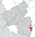
File:Rhineland-Palatinate RP.svg

Original file (SVG file, nominally 778 × 833 pixels, file size: 123 KB)
Captions
Captions
Summary
edit| DescriptionRhineland-Palatinate RP.svg | |
| Date | |
| Source | Own work based on: Locator map BIT in Rhineland-Palatinate.svg, TUBS |
| Author |
TUBS |
| SVG development InfoField | This locator map was created with Adobe Illustrator by TUBS. |
Licensing
edit
|
Permission is granted to copy, distribute and/or modify this document under the terms of the GNU Free Documentation License, Version 1.2 or any later version published by the Free Software Foundation; with no Invariant Sections, no Front-Cover Texts, and no Back-Cover Texts. A copy of the license is included in the section entitled GNU Free Documentation License.http://www.gnu.org/copyleft/fdl.htmlGFDLGNU Free Documentation Licensetruetrue |
- You are free:
- to share – to copy, distribute and transmit the work
- to remix – to adapt the work
- Under the following conditions:
- attribution – You must give appropriate credit, provide a link to the license, and indicate if changes were made. You may do so in any reasonable manner, but not in any way that suggests the licensor endorses you or your use.
- share alike – If you remix, transform, or build upon the material, you must distribute your contributions under the same or compatible license as the original.

|
I'd greatly appreciate, that you attribute this media file to Wikimedia Commons, if used outside Wikipedia or Commons. For use in publications such as books, newspapers, blogs, websites, please insert here the following line:
বাংলা ∙ Deutsch ∙ Deutsch (Sie-Form) ∙ Ελληνικά ∙ English ∙ español ∙ français ∙ Ἀρχαία ἑλληνικὴ ∙ Bahasa Indonesia ∙ 日本語 ∙ македонски ∙ Nederlands ∙ português ∙ русский ∙ Türkçe ∙ 简体中文 ∙ 繁體中文 ∙ +/− |
File history
Click on a date/time to view the file as it appeared at that time.
| Date/Time | Thumbnail | Dimensions | User | Comment | |
|---|---|---|---|---|---|
| current | 17:53, 31 May 2015 |  | 778 × 833 (123 KB) | NordNordWest (talk | contribs) | upd |
| 09:13, 6 January 2012 |  | 778 × 833 (123 KB) | WiebkeCBo (talk | contribs) | 2012-01-01: municipality "Trittenheim" joins district "Trier-Saarburg" | |
| 10:57, 18 November 2009 |  | 778 × 833 (190 KB) | TUBS (talk | contribs) | =={{int:filedesc}}== {{Information |Description= {{de|Lage von Rhein-Pfalz-Kreis in Rheinland-Pfalz, Deutschland}} {{en|Locator map of Rhein-Pfalz-Kreis in Rhineland-Palatinate, [[:e |
You cannot overwrite this file.
File usage on Commons
The following 2 pages use this file:
File usage on other wikis
The following other wikis use this file:
- Usage on cs.wikipedia.org
- Usage on de.wikipedia.org
- Liste der Landkreise in Deutschland
- Rhein-Pfalz-Kreis
- Liste der Wappen in Rheinland-Pfalz
- Wappen der deutschen Stadt- und Landkreise
- Liste der Landkreise und kreisfreien Städte in Rheinland-Pfalz
- Diskussion:Liste der Landkreise in Deutschland/Archiv/1
- Liste der Flaggen in Rheinland-Pfalz
- Benutzer:Thomas021071/Liste der Landkreise Baustelle
- Usage on eo.wikipedia.org
- Usage on fa.wikipedia.org
- Usage on fr.wikipedia.org
- Usage on gl.wikipedia.org
- Usage on id.wikipedia.org
- Usage on ie.wikipedia.org
- Usage on ja.wikipedia.org
- Usage on lld.wikipedia.org
- Usage on ms.wikipedia.org
- Usage on nl.wikipedia.org
- Usage on no.wikipedia.org
- Usage on pfl.wikipedia.org
- Usage on pl.wikipedia.org
- Usage on sk.wikipedia.org
- Usage on tr.wikipedia.org
- Usage on vi.wikipedia.org
- Usage on www.wikidata.org
- Usage on zh-min-nan.wikipedia.org
Metadata
This file contains additional information such as Exif metadata which may have been added by the digital camera, scanner, or software program used to create or digitize it. If the file has been modified from its original state, some details such as the timestamp may not fully reflect those of the original file. The timestamp is only as accurate as the clock in the camera, and it may be completely wrong.
| Width | 778px |
|---|---|
| Height | 833px |