Category:Dronning Maud Land
Norway's territorial claim in Antarctica | |||||
| Upload media | |||||
| Instance of | |||||
|---|---|---|---|---|---|
| Named after | |||||
| Location | Antarctic Treaty area | ||||
| Official language | |||||
| Currency | |||||
| Area |
| ||||
 | |||||
Subcategories
This category has the following 11 subcategories, out of 11 total.
Media in category "Dronning Maud Land"
The following 35 files are in this category, out of 35 total.
-
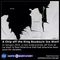
A Chip off the King Baudouin Ice Shelf (16278813147) (cropped).jpg 720 × 480; 88 KB
-
A Chip off the King Baudouin Ice Shelf (16278813147).jpg 640 × 640; 78 KB
-
A Chip off the King Baudouin Ice Shelf (full resolution).jpg 4,000 × 4,000; 3.74 MB
-
A-62 iceberg connected to Fimbul Ice Shelf at Queen Maud Land.jpg 2,400 × 2,400; 3.03 MB
-
ANT-2018-Queen Maud Land-Otter Plain 01.jpg 2,755 × 1,550; 743 KB
-
Conradgebirge Profil.png 2,984 × 1,337; 83 KB
-
Dallmann Camp.jpg 4,997 × 3,141; 2.88 MB
-
Dallmannberge.jpg 800 × 521; 130 KB
-
Dronning Maud Land satellite image.jpg 699 × 513; 46 KB
-
Emblem of the Norwegian Antarctic Expedition (1994).svg 325 × 325; 15 KB
-
Epica-dml end hg.jpg 1,404 × 2,394; 452 KB
-
Fimbul ice shelf mooring Norwegian Expedition.JPG 3,968 × 2,976; 2.28 MB
-
Flag of Norway, state.svg 1,026 × 608; 445 bytes
-
In der Schuessel.jpg 2,857 × 1,825; 782 KB
-
IncipientCharnockite.jpg 1,536 × 1,039; 311 KB
-
Jokolkyrkja.jpg 1,824 × 1,368; 145 KB
-
Koenigin-Maud-Land.jpg 1,000 × 750; 80 KB
-
Kueste-martha-ragnhild-astrid.jpg 699 × 915; 75 KB
-
Mayrkette.jpg 4,836 × 3,163; 2.1 MB
-
Mylonit1.jpg 977 × 1,400; 255 KB
-
Mylonit2.jpg 1,399 × 969; 314 KB
-
Mylonit3.jpg 1,543 × 1,034; 273 KB
-
Partial Eclipse Seen Over the Princess Ragnhild Coast, Antarctica (21231177820).jpg 7,200 × 9,400; 8.93 MB
-
Polar Queen II.jpg 4,956 × 3,157; 4.15 MB
-
Satellite image of Fimbulheimen, Antarctica (16459148353) (cropped).jpg 2,724 × 640; 990 KB
-
Satellite image of Sør Rondane Mountains, Antarctica (21231177820) (cropped).jpg 1,429 × 923; 172 KB
-
Sea Ice off the Princess Astrid Coast (16459148353).jpg 5,200 × 4,000; 16.28 MB
-
Shelf-ice edge hg.jpg 2,681 × 1,758; 527 KB
-
Signboard of ASPA-141 Yukidori Valley, Langhovde Hills.jpg 448 × 336; 56 KB
-
TerreDeLaReineMaud-ColonieManchotEmpereurBaieAtkaRadiotracking CélineLeBohec-AWI-MARE.jpg 4,608 × 3,456; 2.71 MB
-
Trønderbataljonen på hemmelig oppdrag i Antarktis (1939) (16375095884).jpg 5,152 × 3,524; 2.9 MB
-
View of the Riiser-Larsen Ice Shelf in Antarctica.jpg 800 × 566; 73 KB
-
Weddellsea-ant-iv3-28 hg.jpg 5,490 × 3,609; 2.85 MB
-
Yukidori Valley, Langhovde Hills 01.jpg 400 × 300; 52 KB
-
Yukidori Valley, Langhovde Hills 02.jpg 400 × 300; 78 KB


