Category:Geology of Pennsylvania
overview of the geology of the U.S. state of Pennsylvania | |||||
| Upload media | |||||
| Subclass of | |||||
|---|---|---|---|---|---|
| |||||
States of the United States: Alabama · Alaska · Arizona · Arkansas · California · Colorado · Connecticut · Delaware · Florida · Georgia (U.S. state) · Hawaii · Idaho · Illinois · Indiana · Iowa · Kansas · Kentucky · Louisiana · Maine · Maryland · Massachusetts · Michigan · Minnesota · Mississippi (state) · Missouri · Montana · Nebraska · Nevada · New Hampshire · New Jersey · New Mexico · New York (state) · North Carolina · North Dakota · Ohio · Oklahoma · Oregon · Pennsylvania · Rhode Island · South Carolina · South Dakota · Tennessee · Texas · Utah · Vermont · Virginia · Washington (state) · West Virginia · Wisconsin · Wyoming – the District of Columbia: Washington, D.C.
the insular areas of the United States: American Samoa · Guam · the Northern Mariana Islands · Puerto Rico · the United States Virgin Islands – the United States Minor Outlying Islands: Bajo Nuevo Bank · Baker Island · Howland Island · Jarvis Island · Johnston Atoll · Kingman Reef · Midway Atoll · Navassa Island · Palmyra Atoll · Serranilla Bank · Wake Island
the insular areas of the United States: American Samoa · Guam · the Northern Mariana Islands · Puerto Rico · the United States Virgin Islands – the United States Minor Outlying Islands: Bajo Nuevo Bank · Baker Island · Howland Island · Jarvis Island · Johnston Atoll · Kingman Reef · Midway Atoll · Navassa Island · Palmyra Atoll · Serranilla Bank · Wake Island
Subcategories
This category has the following 42 subcategories, out of 42 total.
*
+
C
D
E
F
G
L
M
N
O
P
R
S
T
W
Media in category "Geology of Pennsylvania"
The following 58 files are in this category, out of 58 total.
-
Allentown, PA, USA - panoramio.jpg 3,072 × 2,304; 2.79 MB
-
Anthracite coal (Pennsylvanian; Hazelton, Pennsylvania, USA) 19.jpg 2,217 × 1,190; 1.87 MB
-
Anthracite coalfields on 1872 PA map.jpg 471 × 488; 254 KB
-
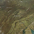
Appalachian Pennsylvania salient satfoto.jpg 720 × 720; 275 KB
-
Bald Eagle Formation 1.jpg 855 × 416; 338 KB
-
BaldEagleFm narrows.jpg 4,446 × 694; 595 KB
-
Bedford-co-rt30-warrior.jpg 2,046 × 726; 280 KB
-
Bedford-thrustfault.jpg 1,231 × 236; 131 KB
-
Blue knob massif.jpg 2,223 × 1,540; 977 KB
-
Boulder Field (HRSP).jpg 1,536 × 864; 411 KB
-
Boulder fields Loysburg gap PA.jpg 2,048 × 1,536; 1.21 MB
-
Bulletin (1910) (14597954838).jpg 3,398 × 1,018; 271 KB
-
Bulletin of the Geological Society of America (1905) (19829058023).jpg 3,712 × 2,304; 2.01 MB
-
Bulletin of the Geological Society of America (1905) (19829067473).jpg 3,488 × 2,116; 2.78 MB
-
Bulletin of the Geological Society of America (1905) (19829069163).jpg 3,360 × 2,472; 2.82 MB
-
Bulletin of the Geological Society of America (1905) (20261942818).jpg 3,744 × 2,236; 1.7 MB
-
Bulletin of the Geological Society of America (1905) (20261971478).jpg 3,512 × 2,672; 1.88 MB
-
Bulletin of the Geological Society of America (1911) (20263217779).jpg 3,328 × 2,068; 1.49 MB
-
Bulletin of the Geological Society of America (1917) (20262833029).jpg 3,284 × 1,424; 912 KB
-
Casselman Fm I-76.jpg 2,048 × 1,536; 1.06 MB
-
Chickie s Rock gap-Susquehanna.jpg 2,126 × 1,638; 973 KB
-
Conococheague I70 MM20.jpg 2,048 × 1,250; 836 KB
-
Conococheague1.jpg 869 × 785; 202 KB
-
Corriganville NewCreek pan.jpg 3,138 × 1,188; 1,005 KB
-
Deltaic 8601.jpg 2,000 × 1,333; 1.03 MB
-
Fermanagh Township cut.jpg 6,016 × 4,000; 6.1 MB
-
Foreknobs brachiopods.jpg 561 × 259; 34 KB
-
Geology of Catawissa Creek at Nescopeck Mountain.PNG 185 × 397; 50 KB
-
Geology Rocks! And Minerals - Pittsburgh, Pennsylvania Store (48171684987).jpg 7,519 × 4,906; 23.69 MB
-
Haystacks1 Loyalsock Creek Sullivan Co PA.jpg 3,072 × 2,048; 5.36 MB
-
Johnstown Rockfall 1.JPG 2,975 × 2,125; 4.01 MB
-
Juniata Formation.jpg 3,456 × 2,304; 5.59 MB
-
Keyser Formation 522.jpg 2,048 × 1,536; 1.03 MB
-
Lake Monogahela.jpg 840 × 1,211; 287 KB
-
Lehigh conglom.jpg 941 × 606; 250 KB
-
Lehigh Gap Shawangunk Formation 2.jpg 1,024 × 680; 223 KB
-
Newpariscoral.jpg 493 × 331; 69 KB
-
The oil regions of Pennsylvania - with maps and charts of Oil Creek, Allegheny River, etc (IA oilregionsofpenn01gill).pdf 816 × 1,266, 124 pages; 5.68 MB
-
Penn State Obelisk Front View.jpg 2,312 × 3,293; 1.47 MB
-
Phacops-enrolled.jpg 414 × 372; 38 KB
-
PisolitesConococheagueUpperCambrian.jpg 2,560 × 1,920; 3.15 MB
-
Prospective unit operation of oil and gas reservoirs in Pennsyvania. (IA prospectiveunito00wing).pdf 1,218 × 1,606, 102 pages; 2.94 MB
-
Reedsville Fm calc ss.jpg 825 × 433; 146 KB
-
Reedsville Formation 522.jpg 2,048 × 1,536; 1.3 MB
-
Ridgeley 522 pan.jpg 7,147 × 1,280; 2.29 MB
-
Ridgeley SS Warrior Ridge.jpg 2,592 × 1,680; 2.17 MB
-
Sinking Valley LC08 L1TP 016032 20161114 20170219 01 T1.jpg 740 × 800; 156 KB
-
Slickensides juniata.jpg 848 × 443; 111 KB
-
Snowcovered.jpg 1,794 × 867; 783 KB
-
Tuscarora Formation Diplocraterion.jpg 400 × 458; 113 KB
-
Tuscarora Formation outcrop 1.jpg 768 × 512; 79 KB
-
UpperTriassicYorkCountyPA.jpg 2,958 × 2,340; 4.66 MB
-
Weathering Limestone State College PA.jpg 1,500 × 1,000; 700 KB
-
York Haven Ferrogabbro (PYRS-84-8).jpg 4,032 × 3,024; 614 KB
-
YorkHavenDiabase1.jpg 2,174 × 2,037; 278 KB


