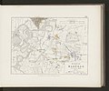
Category:Maps of the Battle of Marengo
Media in category "Maps of the Battle of Marengo"
The following 28 files are in this category, out of 28 total.
-
245 of 'The Campaign of Marengo. With comments' (11243783824).jpg 5,258 × 4,020; 3.1 MB
-
247 of 'The Campaign of Marengo. With comments' (11240033645).jpg 2,668 × 2,211; 1.05 MB
-
249 of 'The Campaign of Marengo. With comments' (11243518714).jpg 2,673 × 2,238; 904 KB
-
251 of 'The Campaign of Marengo. With comments' (11240608785).jpg 2,705 × 2,190; 942 KB
-
86 of 'The First Napoleon. A sketch political and military' (11179301424).jpg 1,337 × 2,146; 616 KB
-
Bataille de MARENGO N°4.jpg 3,986 × 2,449; 2.43 MB
-
Batalha de Marengo.jpg 1,841 × 1,099; 577 KB
-
Battle of Marengo (1800).png 368 × 293; 65 KB
-
Carte de la bataille de MARENGO 2.jpg 4,062 × 2,398; 2.25 MB
-
Carte de la bataille de MARENGO N°3.jpg 3,986 × 2,423; 2.39 MB
-
Carte de la bataille de MARENGO.jpg 4,339 × 2,524; 2.42 MB
-
EB1911 - Marengo - Map of the Battle of Marengo, June 1800.jpg 527 × 368; 105 KB
-
La Fraschetta (Galleria delle carte geografiche, Città del Vaticano).jpg 3,264 × 2,421; 3.66 MB
-
Marengo Battle map.jpg 2,017 × 1,559; 2.1 MB
-
Meyers b11 s0228 b1.png 382 × 306; 39 KB
-
Plan bataille Marengo.jpg 4,080 × 3,060; 3.81 MB
-
Plan de la bataille de Marengo gagnée par le Premier Consul, Bonaparte, le 14 Juin 1800.jpg 4,916 × 3,298; 11.55 MB
-
Relation de la Bataille de Marengo.jpg 6,670 × 3,276; 2.75 MB
-
Relazione della battaglia di Marengo (frontespizio).jpg 1,024 × 1,482; 156 KB
-
Spruner-Menke Handatlas 1880 Karte 28 Nebenkarte 2.jpg 1,644 × 1,362; 185 KB
-
The first Napoleon - a sketch, political and military (1895) (14781872502).jpg 1,663 × 2,702; 390 KB
-
VICTOIRES ET CONQUETES DES FRANCAIS. Bataille de Marengo. G.33401.jpg 5,104 × 3,191; 11.15 MB
-
Alison's history of Europe atlas 1850 (92102157).jpg 6,867 × 5,702; 4.23 MB


