Category:Margate, Kent
town in Kent, England | |||||
| Upload media | |||||
| Instance of | |||||
|---|---|---|---|---|---|
| Location | Thanet, Kent, South East England, England | ||||
| Population |
| ||||
 | |||||
Margate is a seaside town in the district of Thanet in Kent, England. Included in Margate are the conjoined areas of Cliftonville and Northdown at the east, Dane Valley at the south-east, and Westbrook and Garlinge at the west.
Subcategories
This category has the following 23 subcategories, out of 23 total.
- Dane Valley (4 F)
- Northdown (59 F)
B
- Botany Bay, Kent (55 F)
C
D
F
- Foreness Point (7 F)
G
- Graffiti in Margate (10 F)
H
- Hartsdown Park (3 F)
M
- Margate Caves (3 F)
N
S
T
W
- Westbrook Bay (27 F)
Media in category "Margate, Kent"
The following 200 files are in this category, out of 680 total.
(previous page) (next page)-
"Block Brexit" slogan, Arlington House, Margate - geograph.org.uk - 6637618.jpg 1,600 × 1,064; 262 KB
-
"Victory" memorial, Margate - geograph.org.uk - 4541971.jpg 1,000 × 668; 189 KB
-
002osd000000015u00371v00.jpg 4,000 × 3,256; 4.13 MB
-
1 Cecil Square, Margate, August 2022 02.jpg 4,032 × 3,024; 4.39 MB
-
103, High Street - geograph.org.uk - 6315956.jpg 2,448 × 3,264; 2.29 MB
-
13 - 16 The Parade, Margate - geograph.org.uk - 4874629.jpg 640 × 428; 109 KB
-
15, Dalby Road - geograph.org.uk - 6010845.jpg 2,448 × 3,264; 2.13 MB
-
2 Cecil Square, Margate, August 2022.jpg 3,024 × 4,032; 4.56 MB
-
2 High Street - geograph.org.uk - 4532129.jpg 768 × 1,024; 251 KB
-
20 ^ 21 Trinity Square - geograph.org.uk - 6312440.jpg 2,448 × 3,264; 2.4 MB
-
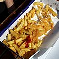
Box of fish 'n' chips Margate Kent England 1.jpg 3,000 × 2,400; 2.86 MB
-
Box of fish 'n' chips Margate Kent England 2.jpg 3,000 × 1,500; 2.44 MB
-
Box of fish and chips Margate Kent England.jpg 2,500 × 2,500; 3.91 MB
-
Bay danger mark off Margate Kent England.jpg 3,368 × 1,684; 4.34 MB
-
Armitage Shanks urinals at Margate Kent England.jpg 2,000 × 3,000; 2.91 MB
-
22-26, Crescent Road - geograph.org.uk - 6012951.jpg 2,448 × 3,264; 2.03 MB
-
32 a ^ b, Addington Street - geograph.org.uk - 6009290.jpg 2,448 × 3,264; 2.04 MB
-
38, Belgrave Road - geograph.org.uk - 6012959.jpg 3,264 × 2,448; 3.87 MB
-
44, Canterbury Road - geograph.org.uk - 6011589.jpg 2,448 × 3,264; 2.11 MB
-
47, Northdown Road - geograph.org.uk - 6010856.jpg 2,448 × 3,264; 2.16 MB
-
58 Victoria Road, Margate - geograph.org.uk - 4872412.jpg 640 × 480; 122 KB
-
64, Edgar Road - geograph.org.uk - 6010137.jpg 2,448 × 3,264; 2.09 MB
-
69, Trinity Square - geograph.org.uk - 6313487.jpg 2,448 × 2,998; 2.06 MB
-
7, Trinity Square - geograph.org.uk - 6311790.jpg 2,391 × 3,264; 2.18 MB
-
7-9, Addington Road - geograph.org.uk - 6010063.jpg 3,264 × 2,448; 1.87 MB
-
A stick of rock at Margate Kent England.jpg 1,993 × 445; 670 KB
-
Abandoned railway track on outskirts of Margate - geograph.org.uk - 5616657.jpg 2,816 × 2,112; 3.12 MB
-
Albert Terrace, Margate - geograph.org.uk - 6650764.jpg 1,600 × 1,064; 294 KB
-
Albion Rooms 76 Club.png 1,170 × 1,155; 1.69 MB
-
Ale Caesar, Margate - geograph.org.uk - 5060077.jpg 2,090 × 2,163; 934 KB
-
Alexandra Homes, North Range, Margate - geograph.org.uk - 3380934.jpg 4,288 × 3,216; 4.46 MB
-
Alexandra Homes, South Range, Margate - geograph.org.uk - 3380937.jpg 4,288 × 3,216; 4.72 MB
-
Allotments on St Peter's Footpath - geograph.org.uk - 735842.jpg 640 × 480; 232 KB
-
Amusement arcade, Margate - geograph.org.uk - 2538631.jpg 640 × 480; 103 KB
-
Arlington House - geograph.org.uk - 6922862.jpg 1,024 × 768; 161 KB
-
Arlington House from Margate station - geograph.org.uk - 3276470.jpg 1,024 × 768; 138 KB
-
Arlington House, Margate - geograph.org.uk - 5056915.jpg 2,448 × 2,615; 1.11 MB
-
Arlington House, Margate - geograph.org.uk - 5056920.jpg 2,448 × 3,264; 1.78 MB
-
Arlington House, Margate - geograph.org.uk - 5855324.jpg 851 × 1,280; 358 KB
-
Arlington House, Margate - geograph.org.uk - 6505587.jpg 3,024 × 3,502; 1.91 MB
-
Arlington House, Margate - geograph.org.uk - 6637617.jpg 1,064 × 1,600; 299 KB
-
Arlington Square, Margate - geograph.org.uk - 3334414.jpg 640 × 427; 63 KB
-
At Cliftonville Lido, Margate - geograph.org.uk - 6100380.jpg 4,946 × 3,738; 4.13 MB
-
B2052 George V Avenue, Margate - geograph.org.uk - 5674944.jpg 640 × 428; 134 KB
-
Back of bathing houses, Margate Wellcome L0010798.jpg 1,806 × 1,162; 1,016 KB
-
Balcony, The Parade, Margate - geograph.org.uk - 6651285.jpg 1,600 × 1,064; 288 KB
-
Balls and beach toys at Margate Kent England 1 (cropped).jpg 2,250 × 2,250; 4.1 MB
-
Balls and beach toys at Margate Kent England 1.jpg 3,000 × 2,250; 4.59 MB
-
Balls and beach toys at Margate Kent England 2.jpg 2,000 × 3,000; 4.83 MB
-
Base of lamp-post, Margate promenade - geograph.org.uk - 6649597.jpg 1,600 × 1,064; 184 KB
-
Bathing Pool on Margate Beach - geograph.org.uk - 6155450.jpg 1,600 × 1,200; 459 KB
-
Bay and jetty lighthouse Margate Kent England.jpg 3,000 × 2,000; 3.69 MB
-
Bay danger mark at at Margate Kent England.jpg 2,000 × 3,000; 5.58 MB
-
Bay Inspectors Office, Margate Beach - geograph.org.uk - 6155480.jpg 1,600 × 1,201; 321 KB
-
Beach Houses, Margate - geograph.org.uk - 5058816.jpg 3,264 × 2,448; 2.78 MB
-
Beach huts at Margate - geograph.org.uk - 5664627.jpg 5,202 × 3,465; 3.8 MB
-
Beach huts on The Bay sands, Margate - geograph.org.uk - 5665186.jpg 5,202 × 3,465; 2.7 MB
-
Beach Huts, Margate - geograph.org.uk - 3017246.jpg 1,600 × 1,200; 504 KB
-
Beach Huts, Margate - geograph.org.uk - 4014352.jpg 3,488 × 2,616; 2.19 MB
-
Beaches West of Margate Pier - geograph.org.uk - 3016572.jpg 1,600 × 1,200; 214 KB
-
Beachside lamp standard Margate Kent England.jpg 2,000 × 3,000; 2.23 MB
-
Bear on Wheels - geograph.org.uk - 6100385.jpg 5,010 × 3,600; 3.89 MB
-
Beer with brandy & milk at Margate Kent England.jpg 2,500 × 2,500; 3.32 MB
-
Belle Vue, Margate - geograph.org.uk - 4581300.jpg 2,272 × 1,704; 729 KB
-
Bentley State Limousine - geograph.org.uk - 2691950.jpg 640 × 480; 95 KB
-
Bentley State Limousine - geograph.org.uk - 2691968.jpg 640 × 480; 76 KB
-
Bentley State Limousine - geograph.org.uk - 2691980.jpg 640 × 480; 50 KB
-
Bentley State Limousine - geograph.org.uk - 2691989.jpg 640 × 480; 112 KB
-
Bentley State Limousine - geograph.org.uk - 2692005.jpg 640 × 480; 114 KB
-
Bentley State Limousine - geograph.org.uk - 2693084.jpg 640 × 480; 105 KB
-
Bentley State Limousine hubcab - geograph.org.uk - 2691965.jpg 640 × 640; 91 KB
-
Binoculars stationary pier mounted at Margate Kent England.jpg 2,000 × 3,000; 5.54 MB
-
Block Brexit, Arlington House, Margate - geograph.org.uk - 6155471.jpg 1,600 × 1,277; 477 KB
-
Block on Northdown Road, Margate - geograph.org.uk - 4872192.jpg 640 × 428; 123 KB
-
Boat at low tide in the harbour of Margate Kent England 1.jpg 2,000 × 3,000; 3.49 MB
-
Boat at low tide in the harbour of Margate Kent England 2.jpg 3,000 × 1,688; 4.81 MB
-
Boats at low tide in the harbour of Margate Kent England 1.jpg 3,000 × 2,000; 5.05 MB
-
Boats at low tide in the harbour of Margate Kent England 2.jpg 3,000 × 2,000; 4.7 MB
-
Boats at low tide in the harbour of Margate Kent England 3.jpg 2,000 × 3,000; 3.27 MB
-
Bouncy tiger, Margate beach - geograph.org.uk - 4530310.jpg 640 × 507; 75 KB
-
Buenos Ayres, Margate - geograph.org.uk - 1713362.jpg 3,488 × 2,616; 2.1 MB
-
Buenos Ayres, Margate - geograph.org.uk - 6638132.jpg 1,600 × 1,064; 345 KB
-
Bumpy rides - geograph.org.uk - 4542596.jpg 1,000 × 668; 162 KB
-
Buoy and Oyster, Marine Drive, Margate - geograph.org.uk - 5665230.jpg 640 × 548; 112 KB
-
Bus on Ramsgate Road - geograph.org.uk - 1821747.jpg 1,024 × 683; 206 KB
-
Cafe G, High St, Margate - geograph.org.uk - 5665232.jpg 5,202 × 3,465; 3.45 MB
-
Cafes on the Royal Crescent Promenade, Margate - geograph.org.uk - 5521152.jpg 4,608 × 3,456; 3.51 MB
-
Camper Numero Uno (Unsplash).jpg 2,560 × 1,707; 2.76 MB
-
Canterbury Road (A28) approaching Margate - geograph.org.uk - 3672978.jpg 1,101 × 800; 210 KB
-
Canterbury Road lamp post Margate Kent England.jpg 2,250 × 3,000; 2.55 MB
-
Capturing Reculver (29777750880).jpg 1,692 × 1,212; 323 KB
-
Car parking area near Northdown Park - geograph.org.uk - 734215.jpg 640 × 480; 236 KB
-
Cecil Square Baptist Church, Margate - geograph.org.uk - 4873487.jpg 640 × 480; 121 KB
-
Chara trip to the seaside - geograph.org.uk - 82207.jpg 640 × 442; 62 KB
-
Children's Rides, Margate Beach - geograph.org.uk - 3467473.jpg 640 × 481; 429 KB
-
Cinema De Luxe, Margate - geograph.org.uk - 3380978.jpg 4,288 × 3,216; 5.01 MB
-
Cinque Ports restaurant, Margate - geograph.org.uk - 5665184.jpg 5,202 × 3,465; 4.62 MB
-
Classic Rover P6, Sweyn Road, Margate - geograph.org.uk - 5347451.jpg 3,264 × 2,448; 2.03 MB
-
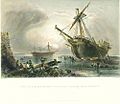
Claudine and Westminster on shore at Ramsgate 1840.jpg 1,000 × 867; 276 KB
-
Cleaner's sign, King Street, Margate - geograph.org.uk - 6656717.jpg 1,064 × 1,600; 223 KB
-
Cliftonville , cliff lift, Walpole Bay - geograph.org.uk - 6210867.jpg 652 × 1,024; 539 KB
-
Cliftonville Lido, Margate - geograph.org.uk - 4911109.jpg 468 × 640; 37 KB
-
Clock Tower, Margate - geograph.org.uk - 5521098.jpg 3,000 × 4,000; 1.47 MB
-
Clock Tower, Margate - geograph.org.uk - 5916197.jpg 1,024 × 768; 145 KB
-
Colonnade on The Parade, Margate - geograph.org.uk - 5665229.jpg 5,202 × 3,465; 3.92 MB
-
Colourful houses on The Parade, Margate - geograph.org.uk - 6162521.jpg 1,600 × 1,064; 295 KB
-
Cottages, Alkali Row, Margate - geograph.org.uk - 4873850.jpg 640 × 480; 139 KB
-
Crowds waiting for the Queen - geograph.org.uk - 2692059.jpg 640 × 480; 82 KB
-
Cycle shelter, Margate Station - geograph.org.uk - 6921236.jpg 1,600 × 1,187; 506 KB
-
Daffs - Flickr - Graham Ó Síodhacháin.jpg 2,919 × 1,778; 964 KB
-
Deckchair hire, Margate Beach, Kent - geograph.org.uk - 5090578.jpg 5,472 × 3,648; 1.64 MB
-
Derelict building, Market Street - geograph.org.uk - 6314407.jpg 2,448 × 3,264; 2.21 MB
-
Derelict building, Union Crescent - geograph.org.uk - 6009282.jpg 2,448 × 3,264; 2.09 MB
-
Derelict chapel, Canterbury Road - geograph.org.uk - 6012878.jpg 3,183 × 2,448; 1.71 MB
-
Dereliction at the Lido, Margate - geograph.org.uk - 6358498.jpg 3,869 × 2,901; 1.45 MB
-
Devil's in the detail - Flickr - Graham Ó Síodhacháin.jpg 2,126 × 3,286; 731 KB
-
Dog ^ Duck, Margate - geograph.org.uk - 4189726.jpg 3,488 × 2,616; 2.21 MB
-
Don't forget your Margate rock - geograph.org.uk - 4591449.jpg 640 × 486; 125 KB
-
Don't look at the sun - Flickr - Graham Ó Síodhacháin.jpg 1,686 × 2,153; 375 KB
-
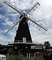
Drapers Windmill, Margate - geograph.org.uk - 5916250.jpg 768 × 1,024; 151 KB
-
Drapers Windmill, St Peter's Footpath, Margate - geograph.org.uk - 5063566.jpg 4,561 × 5,280; 7.08 MB
-
Dreamland - geograph.org.uk - 5860135.jpg 851 × 1,280; 305 KB
-
Dreamland ferris wheel, Margate - geograph.org.uk - 5665227.jpg 5,202 × 3,465; 1.93 MB
-
Dreamland Welcomes You, Margate - geograph.org.uk - 5665181.jpg 5,202 × 3,465; 2.66 MB
-
Dreamland ^ Arlington House, Margate - geograph.org.uk - 3334438.jpg 401 × 640; 71 KB
-
Dreamland, Margate - geograph.org.uk - 5170034.jpg 640 × 477; 116 KB
-
Dreamland, Margate - geograph.org.uk - 5170062.jpg 640 × 480; 62 KB
-
Dreamland, Margate - geograph.org.uk - 6155465.jpg 1,600 × 1,200; 370 KB
-
Droit House, Stone Pier, Margate - geograph.org.uk - 4874316.jpg 640 × 480; 98 KB
-
Edgar Road, Margate - geograph.org.uk - 6505521.jpg 4,032 × 3,024; 3.42 MB
-
Edward VII, Margate - geograph.org.uk - 5059197.jpg 3,264 × 2,448; 1.48 MB
-
Elaborate wall by Hartsdown Road, Margate - geograph.org.uk - 5827345.jpg 2,014 × 1,490; 1.66 MB
-
En vue de Margate par Ferdinand Perrot.jpg 2,404 × 1,426; 761 KB
-
England Coast Path sign, Newgate Lower Promenade, Margate, October 2023 01.jpg 3,024 × 4,032; 6.65 MB
-
England Coast Path sign, Newgate Lower Promenade, Margate, October 2023 02.jpg 3,024 × 4,032; 3.26 MB
-
English in Margate - geograph.org.uk - 4872819.jpg 640 × 428; 111 KB
-
Entrance To Margate Crematorium - geograph.org.uk - 341080.jpg 640 × 480; 117 KB
-
Entrance to The Winter Gardens, Margate - geograph.org.uk - 3127837.jpg 721 × 538; 111 KB
-
Field by St. Peter's Road, Margate - geograph.org.uk - 5838039.jpg 2,048 × 1,536; 1.6 MB
-
Fire Over England beacon, Margate - geograph.org.uk - 4541745.jpg 1,024 × 684; 159 KB
-
First ^ Last, Vicarage Place, Margate - geograph.org.uk - 4189747.jpg 3,488 × 2,616; 2.15 MB
-
Fishing at Margate - geograph.org.uk - 6100787.jpg 4,865 × 3,630; 3 MB
-
Flush Bracket Benchmark, Margate, Railway Station - geograph.org.uk - 6918943.jpg 1,600 × 1,207; 619 KB
-
Footpath to Margate - geograph.org.uk - 2261385.jpg 3,072 × 2,304; 1.52 MB
-
Former Constitutional Club, Margate - geograph.org.uk - 4872881.jpg 640 × 480; 129 KB
-
Former general post office, Margate - geograph.org.uk - 4873503.jpg 640 × 480; 118 KB
-
Former Margate College Preparatory School - geograph.org.uk - 3599675.jpg 1,069 × 779; 172 KB
-
Former Margate College Preparatory School, 19 Hawley Square - geograph.org.uk - 4807323.jpg 2,448 × 3,264; 1.82 MB
-
Former Margate Cottage Hospital, Thanet Road - geograph.org.uk - 4545243.jpg 1,024 × 684; 210 KB
-
Former Margate Synagogue - geograph.org.uk - 2400451.jpg 3,072 × 2,304; 2.06 MB
-
Former Primark Store, Marine Drive - geograph.org.uk - 6010103.jpg 2,372 × 3,173; 2.04 MB
-
Former Thanet Press buildings, Union Crescent - geograph.org.uk - 6008537.jpg 3,264 × 2,448; 1.72 MB
-
Former Thanet Press buildings, Union Crescent - geograph.org.uk - 6315361.jpg 3,083 × 2,448; 1.47 MB
-
Former Woolworth's, High Street, Margate - geograph.org.uk - 6664791.jpg 1,064 × 1,600; 362 KB
-
Fort Crescent, Margate - geograph.org.uk - 5059232.jpg 3,264 × 2,448; 1.95 MB
-
Fort Lower Promenade, Margate - geograph.org.uk - 3646165.jpg 3,488 × 2,616; 1.96 MB
-
Fort Terrace, Margate - geograph.org.uk - 4541696.jpg 1,024 × 684; 180 KB
-
FS Philippine off Margate.jpg 1,836 × 1,428; 799 KB
-
General store on St John Street, Margate - geograph.org.uk - 6097431.jpg 5,184 × 3,888; 7 MB
-
Ghost sign outside Margate station - geograph.org.uk - 5665237.jpg 5,202 × 3,465; 3.48 MB
-
Glass of rosé wine Margate Kent England.jpg 2,456 × 3,000; 3.09 MB
-
Graffiti, Lower Promenade, Margate - geograph.org.uk - 6092608.jpg 640 × 463; 102 KB
-
Grass at sunset - Margate.jpg 2,710 × 1,655; 916 KB
-
Great British Swim - Ross Edgley's support boat "Hecate".jpg 3,508 × 2,480; 3.4 MB
-
Gulls on playing field - geograph.org.uk - 735399.jpg 640 × 480; 139 KB
-
Harbour and Pier at Margate - geograph.org.uk - 6155169.jpg 1,600 × 1,199; 330 KB
-
Harbour Arms, Margate - geograph.org.uk - 3646195.jpg 3,488 × 2,616; 2.23 MB
-
Harbour scene - Margate.jpg 3,370 × 2,246; 621 KB
-
Hatfeild Road, Margate - geograph.org.uk - 4980479.jpg 640 × 480; 283 KB
-
Henrys, 52, High Street - geograph.org.uk - 6315329.jpg 2,448 × 3,264; 2 MB
-
High tide at Margate - geograph.org.uk - 873042.jpg 640 × 480; 145 KB
-
Hook a Duck, Dreamland, Margate - geograph.org.uk - 5170081.jpg 640 × 438; 66 KB
-
Hornby Factory, near Margate - geograph.org.uk - 4157561.jpg 3,488 × 2,616; 2.19 MB
-
Horse riding on the sands at Margate - geograph.org.uk - 3857458.jpg 640 × 480; 81 KB
-
House on College Road, Margate - geograph.org.uk - 5838038.jpg 2,014 × 1,490; 1.78 MB
-
Houses on Beatrice Road, Margate - geograph.org.uk - 5827364.jpg 1,960 × 1,412; 1.68 MB
-
Ingoldsby House, The Parade, Margate - geograph.org.uk - 6651557.jpg 1,064 × 1,600; 251 KB


