Category:Somerset Island
island in Nunavut, Canada | |||||
| Upload media | |||||
| Instance of | |||||
|---|---|---|---|---|---|
| Part of | |||||
| Location | Nunavut, Canada | ||||
| Located in or next to body of water | |||||
| Time of discovery or invention |
| ||||
| Width |
| ||||
| Length |
| ||||
| Population |
| ||||
| Area |
| ||||
 | |||||
Subcategories
This category has the following 2 subcategories, out of 2 total.
S
Media in category "Somerset Island"
The following 14 files are in this category, out of 14 total.
-
Appearance of the Sky at Port Leopold.jpg 2,337 × 1,454; 823 KB
-
Bellot Strait, September 1858.png 446 × 580; 550 KB
-
Cornwallis and devon island.jpg 572 × 386; 39 KB
-
Fort Ross 2011 (AXW 0279).jpg 680 × 451; 94 KB
-
Fury Bay Beach & Debris Nunuvut Canada.jpg 5,184 × 3,888; 6.51 MB
-
Inuit child and dog at Fort Ross, Nunavut.jpg 600 × 400; 86 KB
-
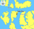
Map indicating Batty Bay, Somerset Island, Nunavut, Canada.png 425 × 360; 47 KB
-
Map indicating Fort Ross, Somerset Island, Nunavut, Canada.png 428 × 380; 50 KB
-
Map indicating Port Leopold, Somerset Island, Nunavut, Canada.png 428 × 345; 39 KB
-
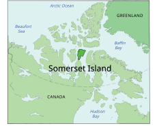
Map indicating Somerset Island, Nunavut, Canada.png 420 × 320; 59 KB
-
Noon in mid-winter (Pt Leopold) NYR 2017.jpg 3,200 × 2,389; 393 KB
-
Somerset Island.svg 668 × 536; 534 KB
-
The Bivouac NYR 2017.jpg 2,204 × 3,200; 543 KB
-
Острво Самерсет.svg 668 × 536; 534 KB


