Category:Triangulation
determining the location of a point by forming triangles to it from known points | |||||
| Upload media | |||||
| Instance of |
| ||||
|---|---|---|---|---|---|
| Subclass of |
| ||||
| Different from | |||||
| |||||
Subcategories
This category has the following 10 subcategories, out of 10 total.
A
B
G
P
T
Media in category "Triangulation"
The following 160 files are in this category, out of 160 total.
-
1843 Blackwell Map of Niagara Falls, New York - Geographicus - NiagaraFalls-haines-1843.jpg 4,000 × 2,348; 3.12 MB
-
1847 Plan of Great Arc between Seronj and Dehra Dun by Everest.jpg 3,422 × 19,346; 2.81 MB
-
1848 U.S. Coast Survey Map of New England - Geographicus - NewEngland-uscs-1848.jpg 3,000 × 4,552; 2.15 MB
-
1870 Index Chart to GTS India-1.jpg 7,308 × 7,006; 25.55 MB
-
2008.06.30.KleinePyramide.SignalimFestpunktfeld.BezirksmuseumFloridsdorfA.JPG 1,861 × 1,396; 489 KB
-
A 3D triangulation coverage heatmap.jpg 4,500 × 3,000; 3.01 MB
-
Alexander Jamieson Celestial Atlas-Plate 29.jpg 2,750 × 2,293; 518 KB
-
AMH-2484-NA Map of Cape of Good Hope.jpg 2,400 × 1,601; 601 KB
-
AMH-2501-NA Map of Table Bay.jpg 2,400 × 1,720; 837 KB
-
AMH-2503-NA Small map of Dassen Island.jpg 2,400 × 1,564; 515 KB
-
AMH-2510-NA Map of part of Mozambique.jpg 1,367 × 2,400; 511 KB
-
AMH-2524-NA Map of the north coast of Java with neighbouring islands.jpg 2,400 × 895; 372 KB
-
AMH-2529-NA Map of the islands of Onrust, Kuyper and Purmerent.jpg 2,400 × 1,709; 606 KB
-
AMH-2530-NA Chart of Table Bay.jpg 2,400 × 2,027; 1.16 MB
-
Anglo-French survey of 1784-1790.jpg 6,729 × 3,457; 6.05 MB
-
Austro-Hungarian trigonometrical pyramid at Kevi, Vojvodina, Serbia.JPG 2,562 × 1,678; 456 KB
-
BaryzKoord2.png 500 × 300; 5 KB
-
CD006-Triangulation 16th century.png 2,425 × 1,800; 192 KB
-
Cislo popisne.JPG 2,112 × 2,816; 1.12 MB
-
Clarke figure of the Earth 1860.jpg 4,500 × 5,900; 5.5 MB
-
Clarke principal triangulation of Britain 1860.jpg 4,700 × 6,460; 5.51 MB
-
Conceptual diagram of political triangulation.png 583 × 727; 30 KB
-
Corp1003 - Flickr - NOAA Photo Library.jpg 1,736 × 1,152; 1.15 MB
-
Delauney triangulation 2 Flip.png 462 × 169; 8 KB
-
Distance by triangulation AB.svg 720 × 400; 10 KB
-
Distance by triangulation.png 662 × 284; 12 KB
-
Distance by triangulation.svg 720 × 400; 11 KB
-
ETRS89CZ-NULRAD+DOPNUL-geodetická síť Česká republika.svg 3,189 × 1,826; 1,018 KB
-
First Triangular Surveying of Sasago Pass.jpg 4,120 × 2,728; 2.8 MB
-
G-F triangulation.jpg 272 × 400; 21 KB
-
Gemma Frisius - Driehoeksmeting.jpg 701 × 921; 158 KB
-
General Roys Baseline.jpg 909 × 742; 325 KB
-
Geodesy Figure 50 cu31924004129650 0267.jpg 1,234 × 2,036; 580 KB
-
Geodetische Basis van Lommel Schema.jpg 774 × 839; 54 KB
-
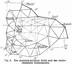
Gerling Kurhessen Triangulation 1837.jpg 803 × 1,336; 260 KB
-
Gerling Milseburg Triangulation 1837.jpg 764 × 1,350; 223 KB
-
HansenPblm1.png 466 × 357; 14 KB
-
HansenPblm1.svg 466 × 357; 3 KB
-
Heliotrope.jpg 908 × 1,380; 320 KB
-
Heliotrope2-2.jpg 780 × 495; 149 KB
-
Heliotrope2.jpg 1,376 × 900; 344 KB
-
Heliotrope3.jpg 2,243 × 1,645; 476 KB
-
Klippa vid havet.png 1,179 × 592; 45 KB
-
Kprprlks.jpg 1,024 × 768; 80 KB
-
Köprü.jpg 380 × 400; 36 KB
-
L-Triangulierung.png 1,256 × 1,123; 84 KB
-
Lawrence Cussen at the trig station, Maraetaua, Waitomo County, New Zealand.jpg 1,080 × 1,651; 142 KB
-
Level (instrument).jpg 3,264 × 1,836; 251 KB
-
Maupertuis 1768 Carte de l'arc du Meridien mesuré au Cercle Polaire b30529700 0003 0188.jpg 2,041 × 3,685; 1.61 MB
-
Mechanical drawing for trade schools (1909) (14579184858).jpg 3,375 × 2,490; 398 KB
-
Merdian Arc Survey Svalbard 1902.jpg 1,406 × 1,648; 774 KB
-
Mountain height by triangulation.png 483 × 203; 9 KB
-
Mountain height by triangulation.svg 578 × 264; 18 KB
-
Mudge 1803 Plate 15 philosophicaltra9318roya 0581.jpg 2,321 × 4,054; 604 KB
-
OTDOA Sq.png 650 × 557; 64 KB
-
Palestine Exploration Fund Map - Triangulation network 1.jpg 1,599 × 2,648; 415 KB
-
Parallaxe diurne.png 1,300 × 300; 18 KB
-
Parsec.GIF 175 × 175; 2 KB
-
Picard 1740 Figure de la Terre 199.jpg 2,454 × 3,686; 1.03 MB
-
PiramidaTales-grafik.svg 740 × 359; 3 KB
-
Plan of Hounslow Heath Baseline Roy 1785 Plate 16.jpg 15,806 × 6,002; 30.09 MB
-
Post0037 - Flickr - NOAA Photo Library.jpg 2,848 × 2,136; 2.93 MB
-
Roy 1777 Plate 18 Triangulation of Snowdon and Moel Eilio philosophicaltra6717roya 0847.jpg 4,130 × 3,170; 1.82 MB
-
Roy 1777 Triangulation of Snowdon and Moel Eilio 00907249 0159-0164.jpg 9,410 × 7,383; 26.6 MB
-
Roy 1790 Plate 08 Stations in the Series of Triangles.jpg 11,838 × 6,170; 16.78 MB
-
Roy 1790 Plate 09 Triangles for Distance between Greenwich and Paris.jpg 15,793 × 8,024; 40.92 MB
-
Roy map of proposed triangulation between London and Paris, Published 1787.png 12,238 × 6,077; 28.5 MB
-
SAM PC 1 - Surveyor with Hildebrand theodolite diorama.jpg 3,636 × 4,980; 2.29 MB
-
SeaSurveys Edgell 1965 0024 07.jpg 3,764 × 2,796; 1,016 KB
-
Second Triangular Surveying of Sasago Pass.jpg 4,108 × 2,768; 2.79 MB
-
Snellius baseline bw.png 1,064 × 364; 1.11 MB
-
Snellius baseline r.png 1,064 × 364; 1.11 MB
-
Telemetre parallaxe principe.svg 380 × 287; 15 KB
-
The country survey-book- or, land meter's vade-mecum Fleuron T083325-10.png 1,041 × 595; 22 KB
-
Theb0703 - Flickr - NOAA Photo Library.jpg 1,380 × 892; 619 KB
-
Theb0713 - Flickr - NOAA Photo Library.jpg 1,296 × 812; 809 KB
-
Theb0731 - Flickr - NOAA Photo Library.jpg 924 × 1,392; 704 KB
-
Theb0733 - Flickr - NOAA Photo Library.jpg 1,388 × 904; 667 KB
-
Theb0734 - Flickr - NOAA Photo Library.jpg 908 × 1,376; 659 KB
-
Theb0749 - Flickr - NOAA Photo Library.jpg 916 × 1,376; 727 KB
-
Theb0771 - Flickr - NOAA Photo Library.jpg 900 × 1,372; 645 KB
-
Theb0800 - Flickr - NOAA Photo Library.jpg 1,376 × 908; 800 KB
-
Theb0802 - Flickr - NOAA Photo Library.jpg 1,380 × 900; 776 KB
-
Theb1568 - Flickr - NOAA Photo Library.jpg 1,388 × 896; 725 KB
-
Theb1576 - Flickr - NOAA Photo Library.jpg 1,380 × 892; 237 KB
-
Theb1577 - Flickr - NOAA Photo Library.jpg 916 × 1,364; 821 KB
-
Theb1581 - Flickr - NOAA Photo Library.jpg 908 × 1,376; 332 KB
-
Theb1604 - Flickr - NOAA Photo Library.jpg 908 × 1,364; 247 KB
-
Theb1618 - Flickr - NOAA Photo Library.jpg 776 × 1,388; 327 KB
-
Theb1636 - Flickr - NOAA Photo Library.jpg 1,384 × 904; 253 KB
-
Theb1638 - Flickr - NOAA Photo Library.jpg 892 × 1,380; 205 KB
-
Theb1856 - Flickr - NOAA Photo Library.jpg 1,084 × 1,636; 496 KB
-
Theb1934 - Flickr - NOAA Photo Library.jpg 1,656 × 1,064; 587 KB
-
Theb1950 - Flickr - NOAA Photo Library.jpg 1,636 × 1,080; 1.46 MB
-
Theb2467 - Flickr - NOAA Photo Library.jpg 1,056 × 1,336; 269 KB
-
Theb2488 - Flickr - NOAA Photo Library.jpg 1,048 × 1,612; 247 KB
-
Theb2528 - Flickr - NOAA Photo Library.jpg 1,068 × 1,640; 457 KB
-
Theb2546 - Flickr - NOAA Photo Library.jpg 900 × 1,620; 147 KB
-
Theb2559 - Flickr - NOAA Photo Library.jpg 1,620 × 1,036; 733 KB
-
Title page of report on theExtension of the Principle Triangulation to Belgium 1863.pdf 1,239 × 1,754; 492 KB
-
Title page of the Principal Triangulation 1858.pdf 1,239 × 1,754; 2.09 MB
-
TP Vahrendorf (Nr. 4-2525) auf dem Kiekeberg Ost-Ansicht.jpg 1,809 × 2,689; 2.49 MB
-
TP Vahrendorf (Nr. 4-2525) auf dem Kiekeberg SW-Ansicht.jpg 1,804 × 2,681; 2.43 MB
-
Triangle fan.svg 281 × 203; 5 KB
-
Triangle Group vector.svg 462 × 272; 2 KB
-
TriangleGroup.pdf 389 × 237; 3 KB
-
Triangulacion.jpg 304 × 310; 32 KB
-
Triangulació dels Paisos Catalans.jpg 442 × 502; 120 KB
-
Triangulación dinámica causal.jpg 500 × 203; 146 KB
-
LL-Q150 (fra)-WikiLucas00-triangulation.wav 1.2 s; 115 KB
-
Triangulation (1600).jpg 800 × 1,067; 159 KB
-
Triangulation (2).jpg 800 × 600; 116 KB
-
Triangulation (3).jpg 800 × 600; 134 KB
-
Triangulation (4).jpg 800 × 600; 137 KB
-
Triangulation astro.svg 524 × 372; 12 KB
-
Triangulation method.png 215 × 238; 3 KB
-
Triangulation network.jpg 1,406 × 949; 272 KB
-
Triangulation of polygon.png 440 × 339; 20 KB
-
Triangulation scheme.svg 943 × 360; 106 KB
-
Triangulation Sheet 7 - Oregon, California, Nevada - DPLA - c033f0dc4654e90825627135e8b5673b.jpg 12,946 × 9,844; 15.64 MB
-
Triangulation.GIF 211 × 285; 3 KB
-
Triangulation.jpg 799 × 600; 59 KB
-
Triangulation.png 336 × 342; 3 KB
-
Triangulation.svg 202 × 326; 3 KB
-
Triangulation142857.jpg 441 × 518; 15 KB
-
Triangulation2d.png 2,658 × 2,242; 145 KB
-
Trigonometric pyramid near Pecesor, Vojvodina (at distance).jpg 2,594 × 1,662; 1.28 MB
-
Trigpole Orom, Serbia (at distance).jpg 3,001 × 1,998; 946 KB
-
Trigpole Orom, Serbia (view up).jpg 799 × 1,200; 322 KB
-
Trigpole Orom, Serbia 2.jpg 1,500 × 999; 153 KB
-
Trigpole Orom, Serbia.jpg 1,618 × 1,066; 259 KB
-
Trilateration.svg 326 × 352; 12 KB
-
Trilateration3.png 332 × 352; 16 KB
-
Trofimov triangulation.jpg 800 × 510; 68 KB
-
USGS Idaho Montana 1900 Survey Control Diagram of Triangulation from Spokane.jpg 935 × 1,362; 256 KB
-
VermessungEbene.svg 261 × 344; 16 KB
-
VermessungEbene2.svg 261 × 344; 16 KB
-
VermessungHoch.svg 268 × 344; 18 KB
-
Williams 1795 Plate 46 philosophicaltra8517roya 0733.jpg 5,308 × 2,899; 1.11 MB
-
Übersicht der Stationen.PNG 550 × 311; 174 KB
-
Здвоєний ряд тріангуляції.JPG 500 × 352; 20 KB
-
Найвигідніша форма трикутників.JPG 318 × 416; 12 KB
-
Суцільна мережа тріангуляції.jpg 1,570 × 850; 191 KB
-
נ.ט. הר מצפה הימים אמירים.jpg 4,032 × 3,016; 5.76 MB
-
단열 삼각망.png 1,034 × 418; 18 KB
-
단열삼각망 예제1.png 714 × 385; 15 KB
-
단열삼각망 예제2.png 918 × 533; 32 KB
-
사변형 망.png 643 × 457; 11 KB
-
유심다각망 예제1.png 1,009 × 699; 81 KB
-
편심 보정.png 889 × 513; 41 KB
-
편심 보정1.png 1,215 × 584; 36 KB
