Category:Wortley, West Yorkshire
area in Leeds, West Yorkshire, UK | |||||
| Upload media | |||||
| Instance of | |||||
|---|---|---|---|---|---|
| Location | Leeds, West Yorkshire, Yorkshire and the Humber, England | ||||
 | |||||
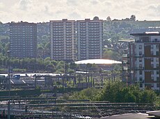
Images of Wortley in Leeds, West Yorkshire.
Subcategories
This category has the following 15 subcategories, out of 15 total.
C
H
N
- New Wortley Cemetery (3 F)
O
S
- Spring Garden Lock (19 F)
U
W
- Western Flatts Cliff Park (25 F)
- Wortley Beck (13 F)
- Wortley Recreation Ground (17 F)
Media in category "Wortley, West Yorkshire"
The following 52 files are in this category, out of 52 total.
-
26 Malmesbury Place, Wortley - geograph.org.uk - 868252.jpg 640 × 480; 50 KB
-
A footpath off Green Hill Lane - geograph.org.uk - 2712560.jpg 800 × 600; 302 KB
-
Abandoned workshop on Branch Place - geograph.org.uk - 6693847.jpg 1,024 × 768; 187 KB
-
An interesting way to repair a fence - geograph.org.uk - 5718810.jpg 1,024 × 683; 377 KB
-
Armley and Wortley aerial photograph.jpg 500 × 375; 161 KB
-
Specification of James Newton - consuming smoke and economizing fuel (IA b30756443).pdf 1,539 × 2,522, 14 pages; 953 KB
-
Bridge over disused railway line - geograph.org.uk - 5708039.jpg 1,024 × 683; 225 KB
-
Bus Turning Circle - Green Hill Lane - geograph.org.uk - 2685094.jpg 640 × 480; 72 KB
-
Cliff & Sons.jpeg 3,648 × 2,056; 3.15 MB
-
Dead-end back alley off Green Hill Croft - geograph.org.uk - 6732680.jpg 1,024 × 768; 202 KB
-
Downhill into Upper Worthley, Leeds - geograph.org.uk - 2712565.jpg 800 × 600; 286 KB
-
Factory to let, Wortley - geograph.org.uk - 4940213.jpg 1,024 × 768; 172 KB
-
Farnley & Wortley railway station (site), Yorkshire (geograph 3772969).jpg 1,024 × 768; 191 KB
-
Farnley Wood (25583746928).jpg 6,000 × 4,000; 8.06 MB
-
Farnley Wood (25584455278).jpg 6,000 × 4,000; 7.72 MB
-
Farnley Wood (39423889952).jpg 6,000 × 4,000; 8.37 MB
-
Farnley Wood (39454849061).jpg 6,000 × 4,000; 7.82 MB
-
Footbridge over the railway off Whitehall Road - geograph.org.uk - 6525239.jpg 768 × 1,024; 226 KB
-
Footbridge over Wortley South Junction - geograph.org.uk - 4940219.jpg 1,024 × 768; 254 KB
-
George V Postbox, Green Hill Lane - geograph.org.uk - 5417513.jpg 683 × 1,024; 404 KB
-
Gudgeon Hole Lane Stream - geograph.org.uk - 791909.jpg 640 × 480; 104 KB
-
Ingham & Sons Wortley (6014453867).jpg 3,649 × 4,123; 7.19 MB
-
Leeds Views (26209588519).jpg 3,990 × 2,451; 3.06 MB
-
Leeds Views (37932598896).jpg 6,000 × 4,000; 15.72 MB
-
Leeds Views (37955438672).jpg 6,000 × 4,000; 12.49 MB
-
Leeds Views (37985505591).jpg 6,000 × 4,000; 12.45 MB
-
Malmesbury Place, Wortley - geograph.org.uk - 630514.jpg 640 × 480; 62 KB
-
Netto in Wortley.jpg 1,600 × 1,200; 493 KB
-
New Wortley Gasholder Flickr 2007.jpg 2,986 × 1,414; 2.7 MB
-
Old Railway Bridge - geograph.org.uk - 77537.jpg 640 × 480; 109 KB
-
Quadruple Track - geograph.org.uk - 2108252.jpg 800 × 531; 116 KB
-
Railway at Wortley - geograph.org.uk - 2164660.jpg 640 × 480; 69 KB
-
RS Components - Leeds trade counter.jpg 1,600 × 1,200; 330 KB
-
South Leeds aerial photograph.jpg 1,600 × 1,200; 576 KB
-
Swallowhillhighfront.JPG 200 × 150; 22 KB
-
The highest phonebox in Britain^ - geograph.org.uk - 33241.jpg 640 × 480; 77 KB
-
Voyager on the Wakefield line - geograph.org.uk - 4937823.jpg 1,024 × 768; 320 KB
-
Wakefield line at Wortley South Junction - geograph.org.uk - 4937833.jpg 1,024 × 768; 335 KB
-
Wakefield line looking towards Leeds - geograph.org.uk - 4937834.jpg 1,024 × 768; 219 KB
-
Walker's Avenue - geograph.org.uk - 622150.jpg 640 × 397; 24 KB
-
Westleedsdecon.jpg 640 × 281; 47 KB
-
Wortley FireClay Company.jpeg 3,660 × 4,130; 9.16 MB
-
Wortley Reservoir - geograph.org.uk - 387329.jpg 640 × 428; 115 KB
-
Wortley Reservoir - geograph.org.uk - 622127.jpg 640 × 422; 17 KB
-
Wortley2.jpg 1,600 × 1,200; 504 KB


