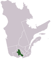
File:LocationLaurentides.png

Original file (2,000 × 2,437 pixels, file size: 1.31 MB, MIME type: image/png)
Captions
Captions
- Originally created for Spanish Wikipedia by George McFinnigan.
| Public domainPublic domainfalsefalse |
| |
This work has been released into the public domain by its author, George McFinnigan, at the Spanish Wikipedia project. This applies worldwide. In case this is not legally possible: |
derivative works
editDerivative works of this file: Provinces naturelles quebec.PNG
File history
Click on a date/time to view the file as it appeared at that time.
| Date/Time | Thumbnail | Dimensions | User | Comment | |
|---|---|---|---|---|---|
| current | 21:02, 10 January 2012 |  | 2,000 × 2,437 (1.31 MB) | Orbitale~commonswiki (talk | contribs) | Carte plus précise |
| 22:37, 19 March 2011 |  | 440 × 524 (31 KB) | Jeangagnon (talk | contribs) | image tournée de 18 degrés | |
| 12:11, 21 May 2006 |  | 419 × 483 (11 KB) | George McFinnigan (talk | contribs) |
You cannot overwrite this file.
File usage on Commons
The following page uses this file:
File usage on other wikis
The following other wikis use this file:
- Usage on de.wikipedia.org
- Usage on el.wikipedia.org
- Usage on es.wikipedia.org
- Usage on et.wikipedia.org
- Usage on fa.wikipedia.org
- Usage on fi.wikipedia.org
- Usage on it.wikipedia.org
- Usage on ja.wikipedia.org
- Usage on la.wikipedia.org
- Usage on oc.wikipedia.org
- Usage on pl.wikipedia.org
- Usage on pt.wikipedia.org
- Usage on ru.wikipedia.org
- Usage on uk.wikipedia.org
Metadata
This file contains additional information such as Exif metadata which may have been added by the digital camera, scanner, or software program used to create or digitize it. If the file has been modified from its original state, some details such as the timestamp may not fully reflect those of the original file. The timestamp is only as accurate as the clock in the camera, and it may be completely wrong.
| Horizontal resolution | 28.35 dpc |
|---|---|
| Vertical resolution | 28.35 dpc |