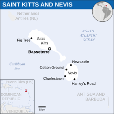
Nevis
island and state in the Caribbean Sea
located in the administrative territorial entity Saint Kitts and Nevis
-
On the western coastal plain, looking south-southwest towards Charlestown
-
The new seawall at Charlestown, Nevis, in 2005. Saint Kitts is seen in the background across the channel known as The Narrows; the museum of Nevis history is visible in the mid distance
-
Pool of hot water on the island of Nevis resulting from geothermal activity
-
part of the west coast of Nevis, including the location of Nelson's Spring
island and state in the Caribbean Sea | |||||
| Upload media | |||||
| Instance of | |||||
|---|---|---|---|---|---|
| Part of | |||||
| Named after | |||||
| Location | Saint Kitts and Nevis | ||||
| Located in or next to body of water | |||||
| Capital | |||||
| Highest point |
| ||||
| Population |
| ||||
| Area |
| ||||
| Different from | |||||
| official website | |||||
 | |||||
Animals
edit-
A sponge crab (Moreiradromia antillensis)
-
spotted trunkfish
Geography
edit-
Nevis and neighbouring Leeward Islands during the 2002 volcanic eruption in Montserrat (centre). Top to bottom on left are: St. Eustatius, Saint Kitts, Nevis. On the right are: Barbuda, Antigua, Guadeloupe
-
view of Nevis from the southeastern peninsula of Saint Kitts in 2005
-
east coast, partially protected by coral reefs with Long Haul Bay visible in the foreground
-
Gingerland
-
Gallows Bay
-
west coast
-
Nevis Peak
History
edit-
Illustration of French slave trade from the 1876 book The 18th century: Its Institutions, Customs, and Costumes: France, 1700–1789
-
Charlestown Methodist Chapel in 1802. Pro-slavery mobs set the chapel ablaze in 1797, but the building was saved
-
Slave owner and sugar merchant John Pinney of Mountravers Plantation
Human settlements
editCharlestown
editMain category: Charlestown, Nevis
-
Main Street in Charlestown, capital of Nevis
-
Charlestown
-
Christena memorial in Charlestown
Transport
edit-
The view looking inland from the Nevis airport in 2008
See also: Atlas of Nevis.


